|
<><><><> <><><><>
<><><><> <><><><>
<><><><> <><><><>
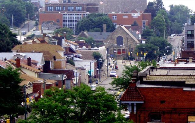
Random Brookline Street Scenes
♦ Aidyl Avenue to Freedom Avenue ♦ Gallion Avenue to Woodward Avenue ♦
♦ Brookline Boulevard ♦ Saw Mill Run Boulevard ♦ West Liberty Avenue (1909-1913) ♦
♦ West Liberty Avenue (1915) ♦ West Liberty Avenue (1916-1965) ♦
Brookline Connection Feature Presentation:
♦ 301 Vintage Brookline Photos In Living
Color ♦
<><><><> <><><><>
<><><><> <><><><>
<><><><> <><><><>
Orvilla, Beechwood and Beechview
When West Liberty Borough was annexed into
the City of Pittsburgh, the former borough was divided into two distinct communities,
Beechwood and Brookline. There was no mention at the time of Beechview. How and when
did Beechwood become Beechview? The following page attempts to answer that
question.
♦ Beechview or Beechwood? Why not Orvilla?
(The Untold Story) ♦
<><><><> <><><><>
<><><><> <><><><>
<><><><> <><><><>
Railroads That Operated In Brookline
Learn the history of the Pittsburgh And Castle Shannon Railroad (1871-1912), the Wabash Pittsburgh Terminal Railway (1904-1916), the Pittsburgh and West Virginia Railroad (1916-1988) and the current Wheeling and Lake Erie Railroad (1990-present). These railroads have operated the freight trains
that run along Saw Mill Run and Library Road.
♦ Walk the W&LERR Route Through Brookline ♦
West Liberty Avenue to Jacob Street
♦ History of the West Side Belt Railroad ♦
<><><><> <><><><>
<><><><> <><><><>
<><><><> <><><><>

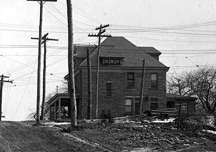
This estate home, shown here near the turn
of the 20th century, stood at the corner of Pioneer and
West Liberty Avenue. The home was torn down to build the Bell Telephone
building.
 
Two businesses, the Tunnel View Hotel
and Twin-Tube Auto Repair and Blacksmith Shop, both located
at the intersection of Saw Mill Run Boulevard and West Liberty Avenue in
1925.

Fordham Avenue, looking towards
the intersection with Queensboro Avenue, in 1921.
 
The home on the left once stood at the
corner of Whited Street (Oak Street) and Saw Mill Run Creek.
On the right is a view of Berkshire Avenue from Queensboro Avenue in
1925.

Myer's Gas Station, with Miller Tires, Atlantic
Gas and Pennzoil products, in 1933.
<><><><> <><><><>
<><><><> <><><><>
<><><><> <><><><>
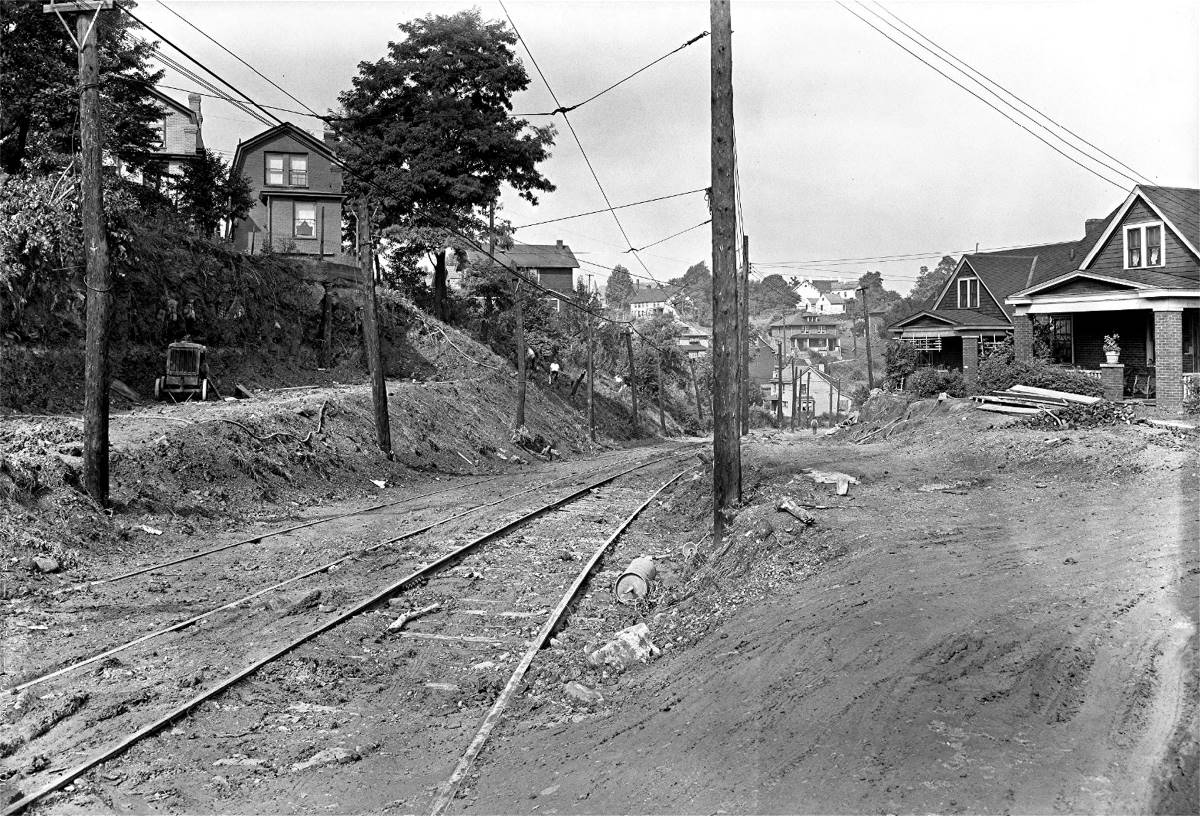
The trolley right-of-way at the intersection
with Shawhan Avenue, looking towards Kenilworth Avenue, in July 1935.
 
A street scene at the intersection of
West Liberty Avenue and Pioneer Avenue in 1915 (left);
Kilgore's Used Car Sales at 1545 West Liberty Avenue in 1950.

A customer pulling out of Ed Seebacher's Sunoco
service station, located at the Brookline Junction, in 1936.
 
West Liberty Avenue near the
intersection with Pauline Avenue in 1951 (left) and the original
Eat'n Park restaurant,
pictured in 1949, located on Saw Mill Run Boulevard in Overbrook.

The 3100 block of Pioneer Avenue, shown here
in 1935, looking from the corner of West Liberty Avenue.
 
A South Hills Coal Company truck makes a
left turn off McNeilly Road onto Library Road (left)
and a young man walks towards the McNeilly Road intersection on September 8,
1934.
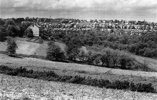
The Anderson Farm,
shown here in 1936, was operated by the Anderson family from 1874 to
1947. The farm fields and
the distant homes show the contrast between 19th century rural Brookline
and the 20th century urban neighborhood.
<><><><> <><><><>
<><><><> <><><><>
<><><><> <><><><>
531 Brookline Boulevard - 1970
These photos show the house that once
stood at 531 Brookline Boulevard, at the corner of Wedgemere Avenue, across
from the United Methodist Church. The pictures were taken in 1970, shortly before
the home was razed. They show the house from several angles, and what a fine
old structure it was.


This grand home was one of the original
houses built along the Boulevard, and throughout the years was the location of
a doctor and dentist's office. For nearly two decades before being torn down, it
was the location of Dr. William Kluber MD and Dr. Charles J. Hoover DDS.
After the house was removed, Dr. Kluber
and Dr. Hoover moved their office to the 700 block of Brookline Boulevard, next
to the old Carnegie Library location. The two doctors had a long-standing
relationship with the Brookline community and continued their practice for
several years. A 1956 listing of Boulevard merchants lists Dr. Kluber and Dr.
Hoover at the old home at 531 Brookline Boulevard.

In addition to the corner home, the house
next door was also demolished to clear enough space to build the convenience store
and Sunoco gas station that has stood now for over thirty years.
* Thanks to Rich Cummings for
providing photos and information on 531 Brookline Boulevard *
<><><><> <><><><>
<><><><> <><><><>
<><><><> <><><><>
Do You Have Any Old Photos?
If anyone has any old photos
of Brookline that they would would like to share with us and
have presented here, please contact us via our guestbook located on the homepage.
You can also post a message to our Brookline Connection Facebook Page.

Queensboro Avenue, shown in 1933, looking from
Woodbourne Avenue up the hill to Bay Ridge Avenue and beyond.
A home at the intersection of Brookline
Boulevard and Pioneer Avenue (left), shown in 1909. The home was moved
to the corner of Berkshire and Pioneer in 1935. It was razed in 1999;
Homes along Glenarm Avenue in 1930.

A Pittsburgh and West Virginia Railroad train
passes over the Whited Street tressel at Jacob Street in 1957.
 
The Brookline Junction in March 1915 (left)
and the intersection of West Liberty and Capital in June 1916.

This is the Boron gas station that stood
at the corner of Capital Avenue and West Liberty Avenue
in the 1970s. A British Petroleum (BP) gas station currently occupies
this spot.
<><><><> <><><><>
<><><><> <><><><>
<><><><> <><><><>
Fast-Food Restaurants
West Liberty Avenue has the dubious
distinction of being the Auto Dealership Capital of Pittsburgh. It also
is the scene of the local fast-food franchise wars. Wendy's opened across
the street from Belle Isle Avenue, in 1974, and McDonalds followed at the
corner of Wenzell Avenue in 1981.
Although both restaurants are located
on the Beechview side of West Liberty Avenue, the fast-food giants have been
doing battle for the hearts and pallates of Brookliners for over thirty years.
Aside from a Hardees that had a brief run along Saw Mill Run Boulevard in the
1970s, Wendys and McDonalds have been the only two national fast-food burger
joints within walking distance of Brookliners.
 
A Double with Cheese, Fries and a Frosty ... or
a Quarter Pounder with Fries and a Coke?
To the disdain of some and the delight
of others, the community of Brookline has never fallen prey to the franchise
wars, unless you consider the inordinate amount of Wendy's and McDonalds paper
trash that persistently litters our streets. If you want a good burger right
here in Brookline, try the Moonlite Cafe or the Boulevard Lounge.
That's the ticket!
<><><><> <><><><>
<><><><> <><><><>
<><><><> <><><><>

|