|
If you lived in Castle Shannon,
Fairhaven or West Liberty in the late-19th century and needed to
travel to downtown Pittsburgh, one way to get there, without access
to a horse and buggy, was to ride the Pittsburgh and Castle
Shannon Railroad.
A short trip on the P&CSRR, including
a dark ride through Mount Washington's first train tunnel, was followed by a
slow descent along the 850-foot Pittsburgh and Castle Shannon Plane, a coal incline built in 1864. Passengers
exited onto Carson Street near the Smithfield Street Bridge. In later
years, the railroad also operated two other inclines, the Castle Shannon Incline and the Castle Shannon South. The railroad operated from 1871 to
1915.
The former railroad rights-of-way
were taken over by the Pittsburgh Railways Company. The lines were
electrified and used for the Shannon-Drake and Shannon-Library streetcar
routes. Today the PCSRR property is part of Pittsburgh's southern light-rail
system.
History
of the P&CS Railroad

Illustration entitled "On Carson Street, South
Pittsburgh, 1875" that appeared in "Fleming's Views of Old Pittsburgh,"
showing the Pittsburgh and Castle Shannon Plane a four years after the P&CS railroad took
over the line and began
passenger service. On Carson Street was a coal distribution platform and a loading
station/office building. This
drawing shows the northern portal of the old railroad coal tunnel and the upper
coal depot/passenger station.
The Old Coal
Railroad
The Pittsburgh & Castle Shannon
Railroad was a narrow gauge line from Pittsburgh to Castle Shannon.
The P&CSRR began as the Coal Hill Coal Railroad, established in 1861 by the Pittsburgh Coal
Company. It ran from the north face of Mount Washington through a Mount
Washington tunnel and extended a further one and a half miles along
Warrington Avenue to the Oak Mine in West Liberty Borough.
The tunnel was a converted
coal mine, started in 1825 by Jacob Beltzhoover, that eventually extended
through Coal Hill.
Measuring 1,741 feet in length, the northern tunnel portal was located
below Bailey Street and the southern portal stood on the hillside above
the present-day South Hills Junction and Port Authority transit tunnel entrance.
Milton D.
Hayes
Milton D. Hays was born in 1844. His
family settled in the South Bank area of Fairhaven in the home at 1766 Ballinger Street (now 1900 Whited Street). His father was Jacob Hays, a former railroad
man and prominent landowner who operated a lumber business on the South Side.
At the age of 22, Milton Hays was elected director of the Farmers and Mechanics
Bank, and later was named Vice-President.
Hays dreamed of getting involved
in the growing railroad and coal mining industry. He envisioned acquiring
property rights and building a railroad through Fairhaven and on to the
south. This way he could exploit the riches of the Pittsburgh Coal Seam
and bring passenger service to the mining towns that would grow along
the route.
In 1866 he began holding meetings in
Finleyville and Monongahela to drum up support for the new railroad. The
first official stockholder was Fairhaven land owner Jacob Horning, who
operated a farm along the proposed route of the railroad. He acquired
his two shares as compensation for two bales of hay.

An 1895 representation of a P&CSRR
train passing Jacob Horning's Fairhaven farm on its way
towards Castle Shannon. This is the location of the present-day
St. Norbert's Church.
By August of 1871 Milton Hays and
his stockholders had acquired the necessary investment capital to begin the
process of creating the Pittsburgh and Castle Shannon Railroad.
The Birth Of The
P. & C. S. R. R.
The Pittsburgh and Castle Shannon Railroad
Company was incorporated on September 21, 1871. The company articles stated that
the railroad was to be constructed a distance of seventeen miles from Pittsburgh
to Washington County. The railroad received it's charter on October 9, 1871.
Twenty-seven year old Milton D. Hays was named President.
The Coal Hill Coal Railroad was purchased
by the Pittsburgh and Castle Shannon Railroad in November 1871 for $225,000, plus
the assumption of $50,000 in debt owed by James Bailey on prior land acquisitions.
The property acquired in the transaction included:

All railroad buildings, fixtures and
machinery, sidings, check houses, oil houses, steam pumps and pump house,
water station and tanks, three locomotives, 280 coal cars, six
horses and harness, five tunnel mules, fourteen pit mules, four two-horse
coal wagons, three stables, eight coke ovens with furnishings, the Coal
Company's mineral rights and the coal business, which included a coal yard
at the corner of present-day East Carson Street and Arlington
Avenue.
Separate from the transaction, the
company also obtained the remaining forty-year lease between the Coal
Company and the Bailey family.
The lease included rights to a 275-foot
parcel of land along the south side of Carson Street that included a
loading dock and office building, the existing Coal Incline and the Coal
Tunnel, the Horseshoe Curve on the south side of the tunnel and the
remaining mile of existing of railroad tracks along Warrington
Avenue.
The P&CSRR Company was required
to pay a yearly royalty of one-tenth cent per bushel of coal transported
and cover the cost of all required city improvements.


The company also acquired rights
to a second Mount Washington tunnel which began near the coal incline,
on the north face, and ran to the west under Grandview Avenue. This
1,766 foot tunnel was used to transport coal from active mines located
under Mount Washington. It was abandoned a few years later when the mines
ceased operation.
At this time, the coal incline
was renamed the Pittsburgh and Castle Shannon
Plane. The Mount Washington Coal Tunnel was redesignated the Pittsburgh and Castle Shannon
Tunnel. The tunnel
was soon enlarged from 5.5 feet high to a height of 12.5 feet to accomodate
larger locomotives and rail cars. Passengers and freight could now pass through
the natural divide of Coal Hill directly to Pittsburgh.

The Pittsburgh and Castle Shannon Plane, shown here along the slope of Coal Hill in 1888, was a
low guage inclined plane used to transport coal mined in the South Hills to
industries located
along the Monongahela riverfront. The old coal incline was built in 1864.
Railroad Line
Extended To Castle Shannon
When purchased, the Coal Railroad
line extended along the eastern side of the Saw Mill Run Valley to a terminus
in West Liberty Borough, behind present-day Moore Park in Brookline. When the
railroad reached the present-day McKinley Bridge, in Bon Air (which was part
of West Liberty Borough at that time), it veered to the right across the
broad expanse and creek, over another wooden high-level bridge*, to the Oak
Mine on the Brookline on the western side of the valley.
The Pittsburgh and Castle Shannon
Railroad, although primarily focused on the growing coal mining industry
in the South Hills, was also interested in becoming a common carrier,
adding freight and passenger service. In 1872, the company acquired options
on 2000 acres of land in Fairhaven (present-day Overbrook) and Castle
Shannon, with the intention of both mining and developing the land.
 
The P&CSRR McKinley Bridge on August 24,
1902 (left) and the Reflectorville Viaduct at Edgebrook Avenue.
Both bridges were replaced in 1929 and remained in service with the Port Authority
until 1993.
These bridges have since been replaced to accomodate modern
light rail traffic.
In 1872, the company began upgrading and
extending the line from McKinley, in Bon Air, south along Saw Mill Run to
Reflectorville, a small community located between Edgebrook Avenue and Whited
Street. The original Coal Railroad terminus in West Liberty became an active spur
line until that portion of the vast Oak Mine was closed around
1890.
This required the construction
of three bridges. The McKinley Bridge (over Bausman Street) and the
Reflectorville Viaduct (over Edgebrook Avenue) were on the northern embankment
of the valley. The third bridge was the Oak Viaduct across from Oak Street
(now called Whited Street). It brought the line across the valley to the south
bank of Saw Mill Run near the Oak Station. Here, another short spur line
extended into the valley to an active Oak Mine shaft.

The P&CSRR Maintenance and Repair Shop in
Castle between Willow Avenue and Castle Shannon Boulevard.
From Oak Station, the main
line continued on to mine shafts located along both sides of the Saw
Mill Run Valley. A third spur line, near present-day Overbrook School,
branched off to the Fairhaven mine in the valley behind present-day
Brookline Park.
The tracks followed Saw Mill Run
Creek and, at Library Road, turned towards the west. Further mines entrances
were located along Library Road. Eventually, the main line came to an
end at Arlington Station in Castle Shannon, a total distance of six miles
from the Mount Washington tunnel.

The Arlington Station marked the end
of the line, the southern terminus of the P&CSRR.
* NOTE: The original high-level bridge
at McKinley which crossed the valley to the mines behind Moore Park was
dismantled in the late-1880s when that section of the Oak Mine was
closed.
Bridges, Stations and
the Horseshoe Curve
The P&CSRR maintained four major
bridges along its route with a total length of 1,530 feet. In addition
to the three built in 1872, this included a bridge over Warrington Avenue
acquired in the original lease agreement. The railroad also operated
fourteen passenger and loading stations along the length of the
line.
The stations were, from north to south,
P&CSRR Station (incline), Warrington Station, Boggs Station, Bell Station,
High Bridge Station, Reflectorville Station, Smith's Station, Oak Station,
Fairhaven Station, Elwynn Station, Cooley Station, Grove Station, Castle
Shannon Station and Arlington Station.
 
A railroad crossing sign at Fairhaven Road
(present-day Glenbury Street), The West Liberty Belt Railroad
Tunnel stands in the distance; and the P&CSRR Fairhaven freight
and passenger station.
Castle Shannon station, the next to
last stop on the P&CSRR line, was located on Willow Avenue. The main service
yard, locomotive shop and car barn were located in Castle Shannon at the
corner of Willow Avenue and Castle Shannon Boulevard.
The rail yard extended to a spot
near the present-day Lebanon Shops along Mount Lebanon Boulevard. This
was the location of the Arlington Station, the final stop along the line.
The trains then looped around the rail yard for the return trip to
Pittsburgh.
The Castle Shannon Station at Willow
Avenue. A box car sits idle on the side rails.
Aside from the scenic route
through the rolling, wooded landscape of the rural South Hills, one of
the most striking features of the Pittsburgh and Castle Shannon Railroad
was the Horseshoe Curve. It was located on the south face of Mount Washington,
near the southern portal of the Coal Tunnel.
Inbound trains would approach the
curve, which began along Warrington Avenue near Boggs. Here, there was a
sharp horseshoe-like turn, first to the right and then around to the left.
Once on the hillside leading to the tunnel, there was a final turn to the
right before reaching the entrance.

A 1910 map showing the P&CSRR
Horseshoe Curve.
In 1892, when passenger and freight
traffic through the tunnel ended, an expanded loading station was built along
the horseshoe curve. From this station, passengers and cargo were transfered
to the Castle Shannon Inclines for the trip over Mount Washington. Coal
continued to be transported through the tunnel until 1912.
The Fairhaven and
Castle Shannon Suburbs
The Pittsburgh and Castle Shannon
Railroad Company immediately began advertising home lots in Fairhaven,
the first of their planned suburbs. On April 17, 1872, they offered
sixty parcels of the former Briggs Farm. The terms of sale were ten
percent down and five dollars per month with interest.

The town of Fairhaven (present-day Overbrook),
shown here in 1895, was developed along the route of the railroad.
This view shows Fairhaven Road (Glenbury Street) and the P&CSRR boarding
station to the lower left.
The company encouraged railroad
workers and miners to take advantage of this opportunity to live close
to the new mines. An additional advertised benefit was the convenience
of a fifteen minute commute to the city.
 
The Fairhaven Hotel on Library Road was
a popular resting spot for passengers on the Pittsburgh and
Castle Shannon Railroad. Train schedules (right) were available at the
hotel.
A year later, in 1873, lots were
offered in Castle Shannon. Advertisements described large lots four to
five times the size of average city lots and a timely forty-five minute
trip to the city. Although the Fairhaven suburb thrived, the Castle
Shannon subdivision initially struggled with a lack of interest
in buyers.

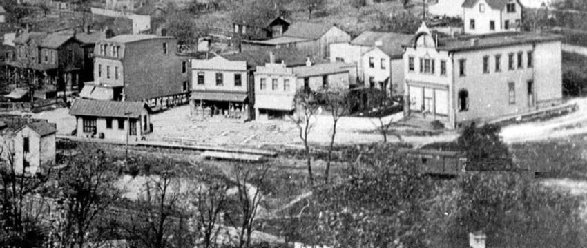
Castle Shannon, shown here in 1890,
was another community that grew along the railroad line.
Between 1873 and 1876, in an
effort to increase interest in the Castle Shannon development, the
railroad opened a zoological garden, picnic groves, and a Protestant
Methodist church camp meeting ground along the rural route. Linden Grove,
still a popular stop along Library Road, was built at this
time.
The Zoological Gardens, located
at Arch Street and Poplar Avenue, drew between 2000 and 3000 people to
its grand opening in May 1876. The zoo featured over 100 varieties of
birds and animals, and contained a museum that housed a variety of
curiosities. The Castle Shannon Camp Meeting Grounds, later called the
Arlington Camp Meeting Grounds, included twenty-one cottages, a hotel,
a boardwalk and a pavilion.
 
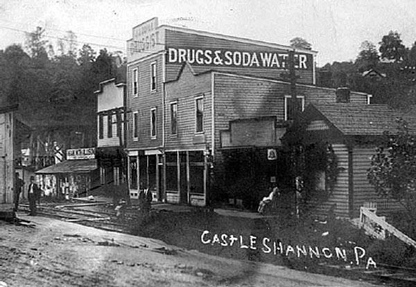
The intersection of Willow Avenue and Castle
Shannon Boulevard (left) and the Castle Shannon Hotel (right),
another popular stop for P&CSRR passengers. A the railroad crossing sign stands
in the foreground.
These efforts did much to
increase ridership, but did not attract the large-scale migration
the company had in mind. Although miners and rail workers began
settling in Castle Shannon, city dwellers from Pittsburgh continued
to shy away from buying land, perhaps because of the six-mile distance
from the city and the reliance on the train.
Railroad tracks along Willow Avenue,
1910, and a P&CS RR train passing the Castle Shannon
Hotel, 1912.
In 1874 the P&CSRR claimed
ownership of five locomotives, two first-class passenger cars, five
second-class cars (converted box cars), one freight car and 320 coal
cars. The value of real estate owned by the company totaled
$292,000.

According to 1877 reports, the
P&CSRR Company owned two South Hills mines along the railroad line.
The first, the Oak Mine in West Liberty, had three drift openings
and produced some of the finest coal on the market. The second mine,
located in Fairhaven, produced 68,500 short tons of coal that year
and employed 134 persons.
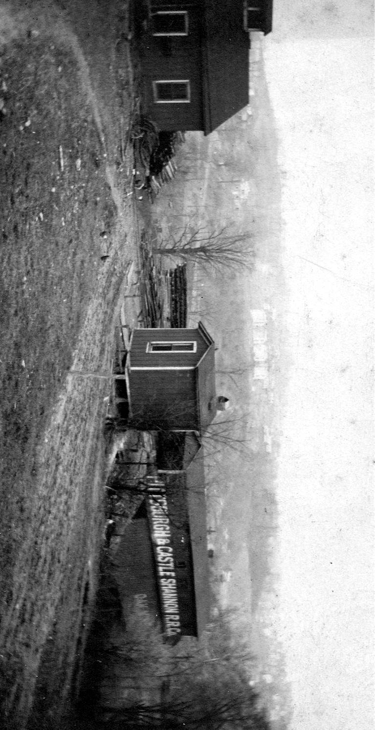
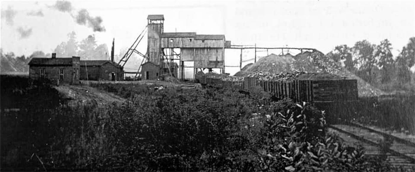
Undated photo showing the office,
blacksmith shop and tipple at
the Pittsburgh & Castle Shannon RR Company's Oak Mine.
The Pittsburgh
Southern Railroad
P&CSRR President Milton Hays
became involved in the promotion of a new railroad in 1876, which was
to travel south to Washington, Pennsylvania. It became known as the
Pittsburgh, Castle Shannon and Washington Railroad, and Hays assumed
the presidency of the new company.
Hays considered this new railroad
company, which operated thirty miles of track between Castle Shannon and
Washington, as an extension of the Pittsburgh and Castle Shannon Railroad.
The expanded railroad was projected to haul coal, petroleum, iron, stone,
lime, agricultural products, livestock and lumber between Washington and
Pittsburgh.
Two years later, Hays formed
the Pittsburgh Southern Railway
Company in a merger
with the Washington Railroad Company, extending his southern rail line
a further six miles.
The Pittsburgh Southern also used
the same forty-inch guage track as the Pittsburgh and Castle Shannon Railroad.
Since there was no way to obtain locomotives or rolling stock of that
guage, Hays arranged a one-year lease agreement between the two railroads.
The Pittsburgh Southern was now equipped with P&CSRR motive power and
equipment.
For a short while this arrangement
worked just fine. The Pittsburgh Southern enjoyed financial success as
farmers shipped their goods to the city and ordered manufactured goods
and machinery. These items used the six miles of the Pittsburgh and
Castle Shannon Railroad to reach downtown Pittsburgh.
Tensions Mount
Between The Two Railroads
The Board of Directors of the
Pittsburgh and Castle Shannon Railroad did not see eye-to-eye with
Milton Hays on the purpose of the new southern railroad, nor were they
pleased with Hays' dual-presidency.
The P&CSRR Board considered the
southern railroad as a spur line of their railroad, and were envious
of the sizeable profits flowing into the pockets of their acting president
as a result of his private railroad. They were also unhappy with Hays'
lease agreement, which allowed the use of their equipment to contribute
to these profits.
The P&CSRR Board saw many
advantages in gaining control of the southern railroad, but were
powerless to act due to the influence of Hays as President of both
companies. This animosity towards Milton Hays grew until one day the
board members decided to act.
In May 1878 the directors of
the P&CSRR announced in a formal letter to Hays that their railroad
would no longer honor Pittsburgh Southern tickets and that they would
be terminating the lease of locomotives and rolling stock in thirty
days.
Cargo from Washington destined
for Pittsburgh was now unloaded at the Arlington Station and sat
idle. With no means to transport the good to Pittsburgh, the P&CSRR
board felt that Hays would be forced to sell the Pittsburgh Southern
Railroad to the P&CSRR at a bargain price.
The Castle
Shannon Railroad War
Milton Hayes was stung by the
decision, but quickly came up with a plan to outwit the now-hostile
P&CSRR board. He met with the owner of the Little Saw Mill Run Railroad, which operated a thirty-inch narrow guage
coal line along the Banksville corridor. Hays offered a tidy sum of money
to enter into a lease agreement with the Little Saw Mill Run Railroad
to use their line for his Pittsburgh Southern trains. The transaction
was kept secret from the P&CSRR board members.
With the Little Saw Mill Run Railroad's
access to Pittsburgh, Hays needed only to construct a three mile
connector to bridge the gap between the northern terminus of the
Pittsburgh Southern Railroad and the coal line to gain access to the city.
His crews went to work immediately on building this extension.
To the chagrin of his rivals,
Hays continued to use P&CSRR equipment to build his new extension.
Without knowledge of his agreement with the Saw Mill Run Railroad,
the P&CSRR board stood by and watched as he built what they
considered to be a road to nowhere.
Another problem facing Hays
was the lack of narrow-gauge locomotives and rolling stock. Once
his lease expired with the P&CSRR in thirty days, he would have
no equipment to run his railroad.
After a hasty search, he
was able to purchase a thirty-six inch guage locomotive, two passenger
cars, one baggage car and three flat cars. This news was also kept
a secret from the P&CSRR board, who were growing increasingly suspicious
of Hays' clandestine activities. The new acquisitions were immediately
emblazed with the name Pittsburgh Southern Railroad.

Rival Railroad Crews
Battle In The Streets
Only one day before the expiration
of the old lease with the P&CSRR, Pittsburgh Southern crews drove in the
last spike connecting their line to the Little Saw Mill Run Railroad. When
the P&CSRR directors saw the crews laying the third rail to accomodate the
new guage, they finally understood Hays true intentions.
The P&CSRR directors were both
amazed and furious when they realized that they had been
deceived. The day was a Sunday, and the courts did not open until Monday.
With the idea of delaying the planned junction and seeking a court
injunction the next day, P&CSRR men were mobilized in a effort to halt the
work of the Pittsburgh Southern crews.
Some of the P&CSRR men hurriedly
spiked a switch to block the Pittsburgh Southern workers while others
fired up a P&CSRR locomotive and purposely derailed it in the path of the
oncoming Pittsburgh Southern locomotive, upon which stood Milton
Hays himself. Others tore up a length of the new track to further delay
the connection.
Hays used his locomotive to
push the derailed P&CSRR engine off the tracks. It crashed down an
embankment and was seriously damaged. The P&CSRR master mechanic
then threw a hammer at Hays, hitting him with a glancing blow and
knocking him unconscious.
At this point the rival railroad
crews began to brawl. The fight lasted a few minutes until weapons were
drawn. Outnumbered by the Pittsburgh Southern crewmen, the P&CSRR gang
withdrew from the scene. Shortly afterwards, the Pittsburgh Southern
connection was completed and Hays emerged victorious in the Castle
Shannon Railroad War.
The following day Hays resigned
as president of the Pittsburgh and Castle Shannon Railroad. He continued
in his role with the Pittsburgh Southern, which remained in operation
until 1884. Hays' victory was bittersweet, as his new railroad was never
able to turn a profit. The route was sold to the Baltimore and Ohio
Railroad for $50,000. The Pittsburgh Southern Railroad was then
reorganized as the Baltimore & Ohio Short Line Railroad.
The P.& C.S.R.R.
Struggles Through Hard Times
Although, in the end, the Pittsburgh
and Castle Shannon Railroad emerged as the survivors of the short-lived
railroad war, the company itself began to suffer. Due to its use of
the odd forty-inch narrow guage rails, it was prohibited from connecting
to other railroads in the city, thus hampering its growth potential and
profitability.
After the Hays incident, the
railroad fell on hard times. Between May 1, 1879 and April 1, 1880, the
railroad was placed in receivership. Stockholders scrambled to liquidate
the company's real estate holdings to pay off accumulating debt.
Lost during receivership were
five parcels of land totaling 359 acres, including the picnic groves,
Zoological Gardens, camp grounds and unsold lots in the Castle Shannon
plan.
Transporting Coal
Brings Modest Growth
After receivership, the
railroad enjoyed a decade of modest growth. Coal continued to be the
most profitable venture, as the subdivisions of Fairhaven and Castle
Shannon did not experience a large increase in population and the
loss of the tourist attractions eliminated a large source of passenger
traffic.

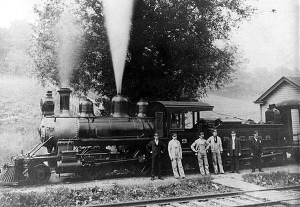
A P&CSRR locomotive at the Castle
Shannon maintenance and repair shop in 1901.
In the 1881 Annual Report,
the value of company real estate was reported as $35,000. The line
transported 18,162 passengers and 134,450 short tons of coal. The
fare rate for passengers was 2 1/2 cents per mile (5 cents if the
passenger also used the Coal Incline). Freight was transported
for 33 1/3 cents per ton, per mile.
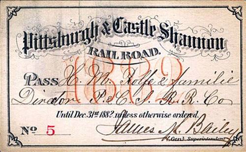
Shown here
is the six-page 1882 Annual Report:
  
  
Throughout the
1880s, while other traction companies and railroads were experimenting with
new technology, the Pittsburgh and Castle Shannon Railroad changed very
little. It continued to operate a steam railroad while others were exploring
the use of cable systems and electricity.
The Castle Shannon
and Castle Shannon South Inclines
In 1889, due to safety concerns
regarding the transporting of passengers through the Coal Tunnel, the
P&CSRR was compelled to begin making capital improvements along the line.
The first was construction of a passenger/freight incline along the north
face of Mount Washington. Pittsburgh's newest funicular was designed by
renowned engineer Samuel Diescher, following a line from Bailey Avenue atop
the hill to Carson Street.
The Castle Shannon Incline was the final
part of Pittsburgh and Castle Shannon Railroad trip from the
southern communities to Pittsburgh. The incline itself continued operating
until 1964.
Built on land leased from the
Bailey family, the funicular first known as Incline Number One, or the
Front Incline, was 1,375 feet long and rose 451 feet from the lower
platform along Carson Street. The cost of the project was $161,815.
Incline Number One opened to the public on March 7, 1891.

Incline Number One, the Coal Incline
and the northern tunnel portal are shown on this 1910 map.
Incline Number Two, or the Back Incline headed to the left from
the P&CSRR Station.
With Incline Number One in
place, passengers were no longer transported on the old coal incline.
Once through the tunnel, they went up a flight of steps to the new
incline for the ride down to Carson Street.
A postcard image circa-1912 showing the
Castle Shannon Incline (left) and the Pittsburgh and Castle
Shannon Plane (right), which was used to transport coal brought
from South Hills mines by the old
Coal Railroad, and later the Pittsburgh and Castle Shannon Railroad,
from 1864 until 1912.
To connect this plane with
the railroad, Diescher was also hired to design Incline Number Two,
or the Back Incline, along the south face of Mount Washington.
Under construction between 1890 and 1892, the second funicular
was a cable road, 2,562 feet in length, that gradually rose nearly
200 feet. The final cost of the southern incline was $58,000 and
it opened to the public on August 20, 1892.
 
Looking from Warrington Avenue up Haberman
Avenue along the route of the Castle Shannon South Incline (left)
and the P&CSRR Warrington Station and Horseshoe Curve on the lower
end of the incline.
 
Looking up from near the lower Warrington station
(left) and a view towards the Bailey Street upper station.
Once the two inclines were
in place, the tunnel was used exlusively for transporting coal to
the old coal incline, with the exception of times when the inclines
were out of service. Once both funiculars were in service, Incline
Number One was renamed the Castle Shannon Incline and Incline Number Two was designated Castle Shannon South.
Landslides and Other
Disasters
Maintenance of the Pittsburgh & Castle
Shannon Railroad locomotives and cars was a constant process carried out at their
railyard along Castle Shannon Boulevard. Keeping the tracks in working order was
another frequent undertaking, one that included not only track upkeep but responding
in a timely fashion to both natural and man-made problems.
Mechanical breakdown was always a possibility,
and crews needed to be on call to clear the rails and keep the traffic on schedule.
With the railroad operating mostly along hillsides, another potential emergency was
the threat of landslides, which cut shut down operations for a considerable time
while crews clear the debris.
 
On November 29, 1901, a collision between a
passenger and freight train at a side track in West Liberty Borough. The locomotives
and two freight cars were damaged. Both engineers were injured. The damaged cars and
their cargo were pushed over the hillside and the locomotives removed.
With little of no help of being evacuated
from the location of the disturbance, passengers were forced to walk the tracks
all the way to the incline station along Warrington Avenue. In the case of the 1901
collision, nearly 200 were compelled to make their way by foot to
Pittsburgh.
Pittsburgh
Coal Company Regains Ownership
Then, the financial Panic
of 1893 hit the nation, and the railroads suffered hard. During this
period of economic dissolution, a total of 156 operational railroads
in the State of Pennsylvania were put in receivership. Although the
Pittsburgh and Castle Shannon Railroad survived the immediate crisis,
the long-term effects were disastrous.
A P&CSRR outbound passenger train
moving through Fairhaven, present-day Overbrook, in 1902.
In 1900, the Pittsburgh Coal
Company acquired a controlling interest in the stock. They bought out
7,756 of 9,628 shares, eighty percent of the railroad. The Coal
Company assumed operation of the mines, transportation of coal to
market and the passenger service. Pittsburgh Coal had regained control
over the railroad that they had sold to Milton Hays thirty years
before.
The stock takeover did not result
in the termination of the Pittsburgh and Castle Shannon Railroad Company,
however, as it continued to exist as a real estate and coal mine
holdings company. The railroad line itself also retained the P&CSRR
designation.
The Oak Station mining offices and tipple
near the bottom of Oak (Whited) Street,
and several loaded coal cars awaiting transport (circa 1910).
The Pittsburgh
Railways Company
The popularity of horse-drawn
trolley service, cable car service and then electrified streetcars was
growing rapidly in the late-1800s. As the technology continued to evolve,
independant transit companies began a number of short neighborhood lines
throughout the city of Pittsburgh.
In the late-1890s several of
the companies began to merge and consolidate these urban transit lines.
As growth within the city limits continued, these large transit
companies began looking to the developing suburbs for the creation of
new routes.
The Pittsburgh Railways Company
was formed in 1901 as a conglomeration of numerous local traction lines.
The company immediately began a massive expansion that included
bringing streetcar service to the South Hills
communities.

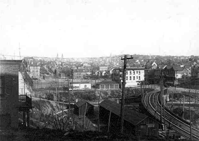
Looking down upon the Pittsburgh Railways
South Hills Junction in the spring of 1904 from the P&CSRR tracks
above.
The Pittsburgh Coal Company
operated the line from 1900 to 1905. In 1902, the Pittsburgh Railways
Company entered into a ninety-nine year lease of the railroad with plans
to convert the steam powered line into an electric interurban streetcar
route.
The terms of the lease allowed
the Pittsburgh Railways Company to use the main line and its equipment,
but reserved the mining operations and narrow-guage access along the
line for the railroad company's transportation of coal for a rental fee
of $15,000 per year.
The first major undertaking
of the Pittsburgh Railways Company was the construction of
the Mount Washington Transit
Tunnel. Excavation of the 3,492 foot tunnel
began October 6, 1902. The tunnel followed roughly the same path
as the old coal tunnel. Its southern portal was slightly below
the coal tunnel portal, and with a six percent downhill grade, the
northern portal emerged at Carson Street near the Smithfield
Street Bridge.
At that time of the lease,
the Pittsburgh and Castle Shannon Railroad inventory included three
locomotives, five passenger cars, three combinations, ten flat cars,
and 275 coal cars.

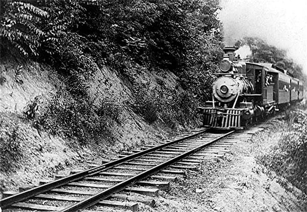
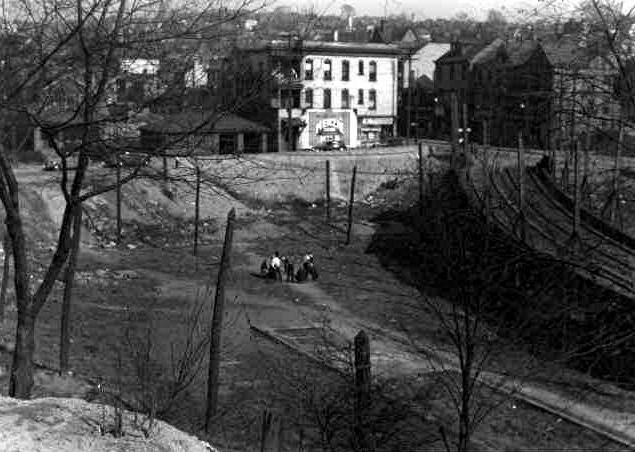
An outbound P&CS RR train in 1907
on the hillside above the South Hills Junction. After emerging
from the coal
tunnel, the train navigated the Horseshoe Curve to Warrington Avenue,
then headed south along Saw Mill Run.
Electrification
Of The P.& C.S.R.R. Line
While Pittsburgh Railways began
installing new electified routes to southern suburbs like Beechview,
Brookline and Mount Lebanon, the company began studying the feasibility
of double-tracking and electrifying the P&CSRR main line to accomodate
several projected interurban lines, including Charleroi and
Washington.
The Charleroi line, the construction
of which was funded by the Mellons, was completed in 1904, using the P&CSRR
passenger service initially to connect to the southern end of that line in
Castle Shannon. That line would remain in service until 1953.
 
P&CSRR locomotive near Fairhaven (left) and
a stretch of track near the same area.
This modernization began in
April 1909 and cost of $161,000. The work included refitting the four
remaining railroad bridges, installation of electrical equipment along
the entire line, and adding a third rail to accomodate the Pennsylvania
Broad Gauge of 60 1/2 inches. P&CSRR trains continued to run during the
project, and the refurbished dual-purpose line opened to trolley traffic
on July 15, 1909.
 
A view from both ends of the P&CSRR
McKinley Bridge after electrification.
Although the railroad played a
key part in the early development of Fairhaven and Castle Shannon, it
was the advent of streetcar service that really propelled the growth
of these two municipalities.
Pittsburgh Railways provided
cost-effective, frequent and reliable transportation. Commuters could
now travel from Castle Shannon directly across the Monongahela River
into downtown Pittsburgh in record time. This more than anything made
moving to the suburbs an attractive option for city residents.
The Pittsburgh and Castle Shannon
Railroad continued to operate its mines between 1909 and 1912, running
coal at night along the route. The lease for the horseshoe curve at
Warrington Avenue, the coal tunnel, and the coal incline was scheduled
to expire with the Bailey's in May 1912. When the lease expired, the
Pittsburgh Railways Company purchased the rights to these parcels of
land for $12,000.
The End Of The
Pittsburgh And Castle Shannon Railroad
This lease expiration signaled
the beginning of the end of the narrow-guage railroad. The Pittsburgh
Railways Company eventually removed the extra rail from the line, leaving
the third track only on bridge approaches as safety rails.
Although the coal railroad was
no longer in operation after 1912, the Pittsburgh and Castle Shannon
Railroad Company continued to exist as a land holding subsidiary for
the Pittsburgh Coal Company, collecting fees on their rented property.
The P&CSRR rights-of-way were not sold to Pittsburgh Railways for several
years after the termination of the actual railroad.
Pittsburgh Railways trolleys pass
Elwyn Street (left) and Fairhaven Road,
McNeilly Road and Glenbury Street in present-day terms.
The passenger railroad discontinued
day-to-day operations in May 1912. Limited passenger service continued until
1915. The last Pittsburgh & Castle Shannon Railroad train made a final
ceremonial run in 1919. The company remained on the books until 1950, when
its remaining obligations and assets were acquired by the Pittsburgh Railways
Company.
The Years That
Followed
In the century following the end of
Pittsburgh and Castle Shannon Railroad operations, the railway right-of-way
along the Saw Mill Run Corridor, from the South Hills Junction to Castle
Shannon, was in continuous use by the trolleys of the Pittsburgh
Railways Company, and subsequently the Port Authority of Allegheny County,
until 1993.
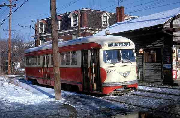
A trolley passes over the McKinley
Bridge (left) and a modern light-railcar along
Castle Shannon Boulevard, near the old P&CSRR maintenance shop.
After several years of inactivity,
the former P&CSRR line was completely rebuilt from the South Hills Junction
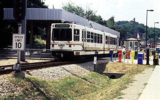
through to Library for use by the modern light-rail system. The new, refurbished rail line was returned
to service in 2004 and has performed well.
The community of Brookline, whose
commuters used the P&CSRR and the Castle Shannon years for over a century,
finally got a stop along the route in 2004 when the South Bank Station was
installed along the light rail route. It was the first time since the old
39-Brookline trolley route was discontinued that the Brookline community
had a stop along a Port Authority rail line.
 
South Bank Station is a light-rail
transit stop located within the Brookline community.
The communities of Overbrook and Castle
Shannon, as well as numerous points further south, are fortunate to have light
rail service. It is a cheap, reliable and environmentally sound alternative to
the automobile. This would not be the case without Milton D. Hays and his 1866
vision of a suburban rail line known as the Pittsburgh and Castle Shannon
Railroad.
The Castle Shannon South Incline's fate
was tied to the railroad itself. With no passengers to move, the line was
abandoned in 1914. The more successful northern incline was acquired by Pittsburgh
Railways Company and in operation until June 21, 1964. At the time of it's closing,
Castle Shannon Incline No. 1 was one of only three functioning inclines remaining in
Pittsburgh.
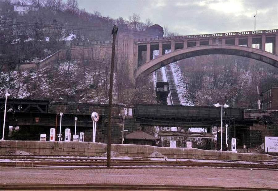
Maps Showing The P.& C.S.R.R.
Route
Through Mount Washington
 
A map of the P&CS RR route from 1886 and a
current map of Mount Washington, 2011.

Map from 1910 showing the route of the
P&CSRR along Warrington Avenue to the Horseshoe Curve, then through
the tunnel to Pittsburgh. This map shows the inclines used by the railroad
to ferry passengers and freight.
Photos of the Pittsburgh
and Castle Shannon Railroad
and the Castle Shannon Inclines
Click on images
for larger pictures
 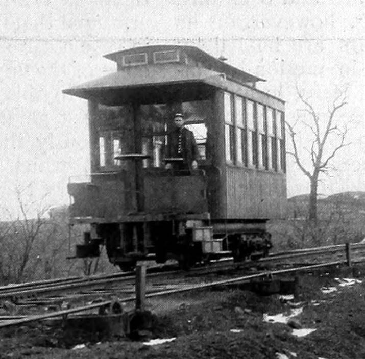
Vintage turn-of-the-century Castle Shannon
incline cars from the northern (left) and southern planes.
The P&CSRR horseshoe curve at Warrington Avenue (left),
running under the trolley ramp, in 1915
and the same location after the removal of the railroad line in the 1930s.
Looking from Warrington Avenue up Haberman
Avenue along the route of the Castle Shannon South Incline (left)
and the P&CSRR Warrington Station and Horseshoe Curve on the lower
end of the incline.

Looking up from near the lower Warrington station
(left) and looking down from near the top of the rise.

Cables along the tracks near the top of the
line (left) and a view towards the Bailey Street upper station.

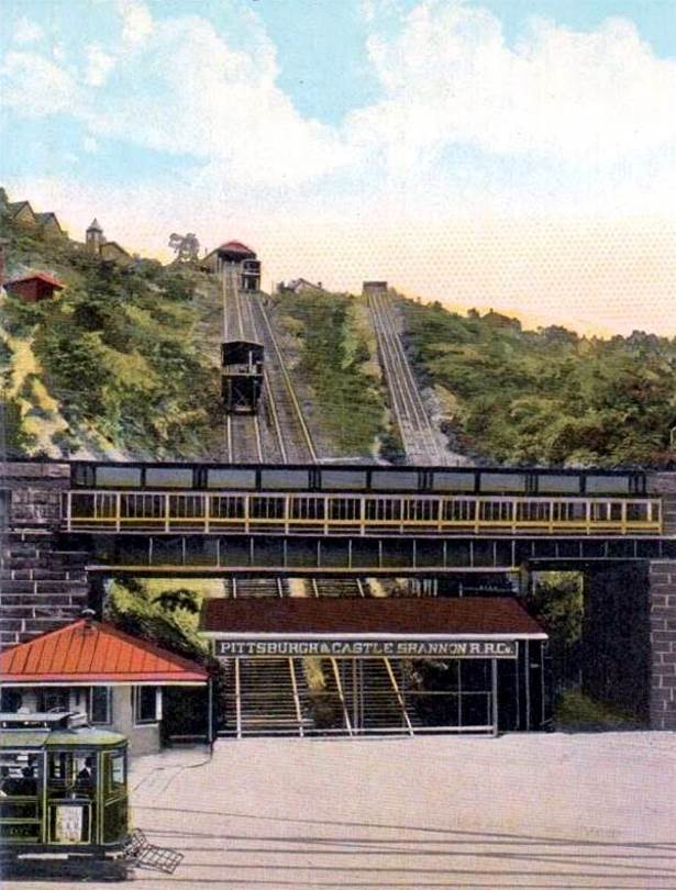
The Castle Shannon Incline and the Pittsburgh
and Castle Shannon Plane along Mount Washington in 1900.
 
The Castle Shannon Incline measured 1,350 feet
in length.
Originally steam powered, the incline was electrified in 1918.
 
Vintage Pittsburgh postcards showing the
Castle Shannon Incline.

The lower station of the Castle Shannon Incline
on Carson Street in 1921.
 
Library Road approaching Elwyn Street (McNeilly
Road) and the bridge leading to the entrance to the South Hills
Coal Company (right). The P&CSRR tracks followed the hillside, crossing the trestle
in front of the tunnel.

The P&CSRR tracks passing Castle Shannon
Boulevard, the Washington Boulevard, in 1906.

Panoramic view of the village of Castle Shannon
in 1909, showing the P&CSRR tracks, near the
bottom of the photo, approaching the West Side Belt Railroad Viaduct.

The P&CSRR tracks passing Castle Shannon
Boulevard, the Washington Boulevard, in 1910.
Photos of Pittsburgh
Railways Trolleys Along
The Old P.& C.S.R.R. Route
Click on images
for larger pictures
 
The Oak Viaduct at Whited Street
(left) and the Linden Grove car stop.
 
An inbound (left) and outbound trolley
pass along Willow Avenue in Castle Shannon.
 
The Reflectorville Viaduct (left) and
passing under the West Side Belt Viaduct in Castle Shannon.
 
An outbound trolley on the hillside
overlooking Edgebrook Avenue (left)
and another heading inbound along Saw Mill Run through Overbrook.
 
A trolley passes over the Warrington
Avenue trestle heading towards the South Hills Junction (left) and a
Library Trolley passes Fairhaven Road (Glenbury Street) and
the old P&CSRR passenger station.
 
Interurban trolleys following the
Pittsburgh Southern Railroad route to Washington, Pennsylvania.
|