|

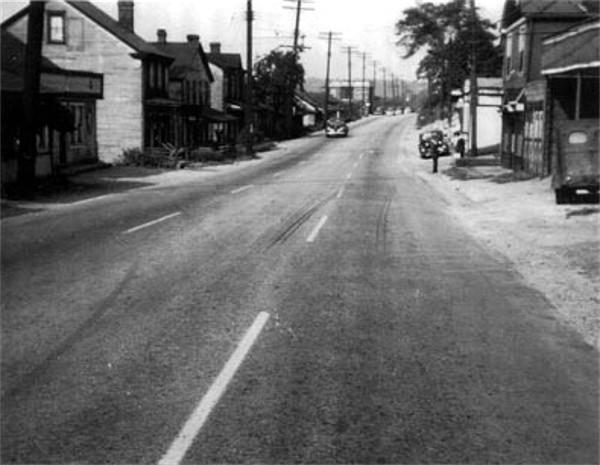
A busy intersection - Saw Mill Run
Boulevard runs left-to-right in the foreground. Hillview Avenue runs down
the hill
and across the bridge. Library Road begins here, running south along the
row of buildings to the right of the creek.
Pennsylvania State Route 88 is a 67
mile long north-south state highway located in southwestern Pennsylvania.
It is one of the oldest state highways in Pennsylvania, designated in 1927.
The southern terminus of the route is at U.S. Route 119 in Point Marion less
than 2 miles from the West Virginia border. The northern terminus is at State
Route 51 (Saw Mill Run Boulevard) in Pittsburgh. Route 88 runs parallel to the Monongahela River
for almost its whole length.
The 8.5 mile Allegheny County
stretch of Route 88 is also designated as Library Road, running through South
Park, Bethel Park, Castle Shannon, and ending in Overbrook. Library Road's
origins date back to the 1800s, servicing the communities that grew along
the path of the Pittsburgh and Castle Shannon
Railroad. For many years
from the late-19th to the mid-20th century, Library Road was dominated by
coal mining enterprises, like the South Hills and Castle Shannon Coal
companies.
These photos begin on the northern end
of Library Road, at the Saw Mill Run intersection in Overbrook, and head south
to Connor Road in Castle Shannon.
Click
on images for larger photos
 
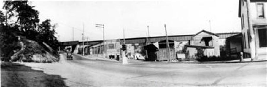
Left - Library Road in Overbrook, 1909; Right -
Construction of Rt88/Rt51 interchange, 1929.
 
Construction of interchange st Library Road
(Rt88) and Saw Mill Run Boulevard (Rt51) in 1929.
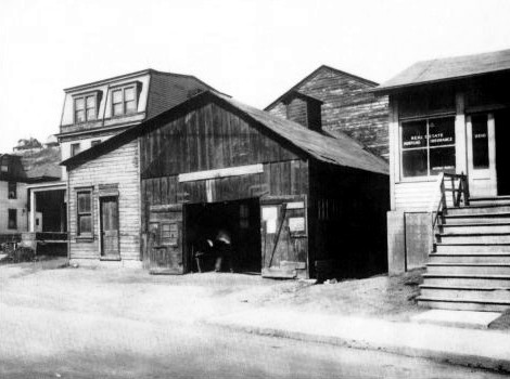 
Imblum's blacksmith shop (left) and Luffy's
Tobacco Store stood on Library Road near Saw Mill Run Boulevard for many
years. Imblum's was in business from 1885 to 1945. Luffy's was also a
real estate office, pool room and bowling alley.
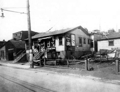
The Fairhaven Hotel, located at 2510 Library Road,
was a popular resting spot for passengers on the Pittsburgh and
Castle Shannon Railroad. Built in 1882, it stood next to Imblum's blacksmith shop.
It was operated
by Charles and Anne Dreshler Scheller until 1906, then sold to Ernest Melhorn. In 1940
the building was sold to James Kirk, and known as Kirk's Tavern.
 
Looking from Library Road towards the
railroad tunnel along McNeilly Road (left). Note the different path of the
road than exists today (see map below). The photo on the
right shows the approach to the McNeilly Bridge from the south.
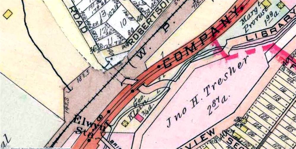
This map shows the former configuration and
path of McNeilly Road approaching Library Road. The road veered off to
the left for a short distance rather than proceeding straight through.
It illustrates the pictures shown above.

Approaching McNeilly (Elwyn) Road on September
8, 1934. To the right is the McNeilly Bridge, and on the hillside is
an inbound Pittsburgh Railways trolley about to cross the trestle. A sign
points to the South Hills Coal Company,
just beyond the railroad abutment, through the McNeilly Tunnel. On the left is
Hartz Mountain Canaries.
Hartz bred canaries since the late-1890s to be used in the numerous
local coal mines. Three dollars
could purchase guaranteed singers. The canaries were a vital part of
the mining industry.
The birds were used to help detect pockets of blackdamp and other toxic
gases.
 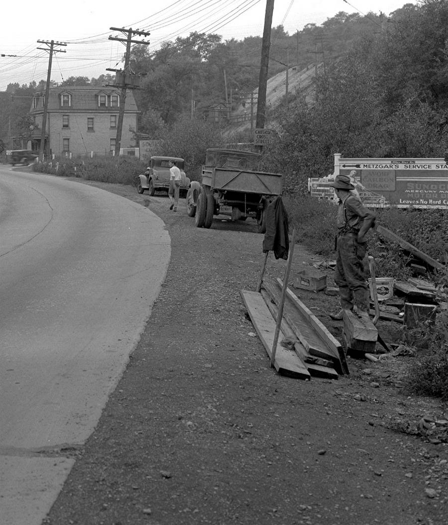
The photo to the left shows a residential
home standing next to Hartz Mountain Canaries. The men along the roadway
are checking what the photo caption read was a four inch gas line break. An
attendant from Metzger's Service Station
is walking their way. They are standing next to Saw Mill Run Creek. The photo
on the right shows
a young man walking past the scene towards the McNeilly Road
intersection.
 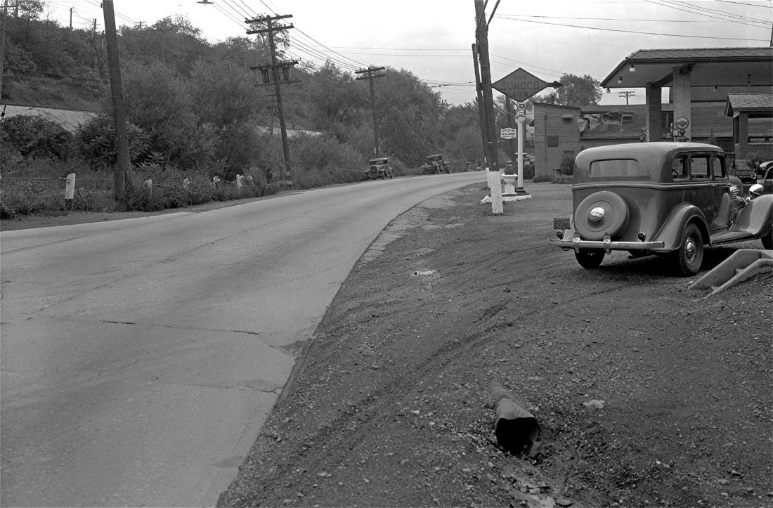
Aproaching McNeilly Road from the
north (left) and looking south from Metzger's Service Station,
which stood at the intersection. The Pittsburgh Railways trolleys and
the P&WVRR run along the abutment to the left.
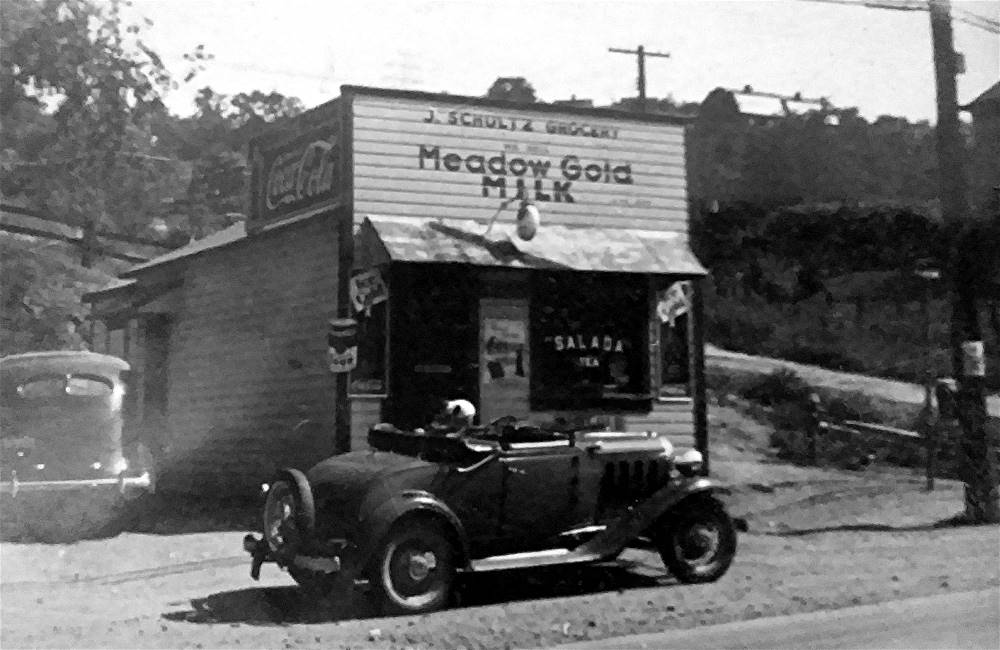
John Schultz Grocery Store at 2741
Library Road, at the corner with Elwyn Street, in 1934. Ritaann Schultz's
grandparents owned the store. Her grandmother, Anna, and Aunt Helen
ran the store,
known for it's fresh lunch meat and assortment of penny candy.
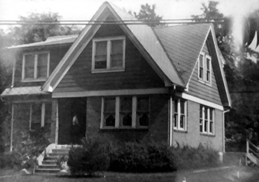 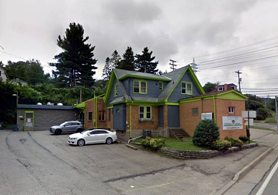
The home of John and Anna Schultz at
2739 Library Road. The Schultz's owned the grocery store next door.
John was an iron worker and the family store was run by Anna. The Schultz's
had three kids, Helen, Rita
and Albert. Today, the house still stands. Enlarged, it is now
owned by Jean-Gilles and Associates.
 
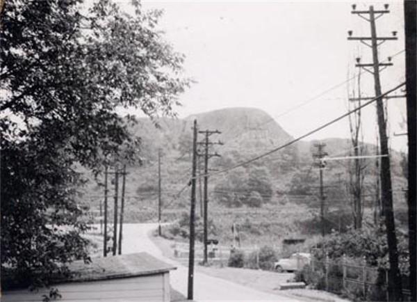
Mining homes on Library Road between Killarney
Avenue and Grove Road. The homes were razed in 1948.
 
The Castle Shannon Coal Company owned
several mines along Library Road. This one between Killarney Avenue and Grove
Road operated from 1902 until the early-1940s. The trucks made local
deliveries for residential heating.
Left - Library Road between Killarney Avenue and Grove Road
in 1940. The Castle Tavern stands in the distance.
Right - Connor Road approaching the intersection with Library Road - 1948.
The intersection of Library Road, Shady Run Avenue
and Castle Shannon Boulevard in 1930.

An inbound trolley approaches the McNeilly Station
near the intersection with Library Road in August 1964.
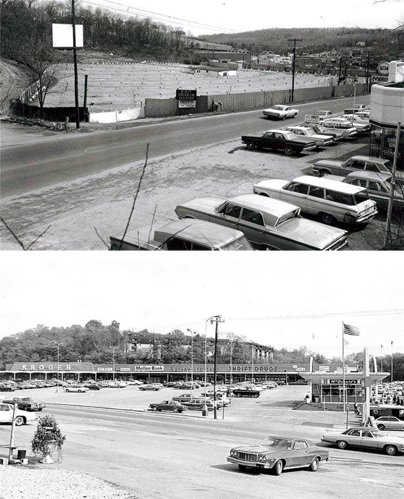
The South Park Drive In, the South Park Shopping Center and the McDonalds near Corrigan
Drive, circa 1980.
|