|

Alm's Pharmacy, Blockinger's Boys and Mens
Wear, and the Brookline Savings and Trust Company, shown here on Brookline
Boulevard, from the corner of Stebbins Avenue, on January 17, 1933.
The building with the marquee is the former
Braverman Theatre, which was bought by Warner Brothers and became the Boulevard Theatre for many years.
A visit to the website myheritage.com resulted in a free trial membership and an opportunity to sample their
DeOldify program. This application colorizes old photos and often the results are
amazing. Adding color to old black and white pictures brings warmth and feeling to
these vintage images, adding life and making them seem somehow less distant in time.
Stunning details emerge that seemed hidden in the grey scale version. This page
shows 300+ of the best classic images that were brought to life in living color.
Enjoy this visually vivid look back in time.
Click on images for
larger pictures.

Broad, tree-lined Berkshire Avenue on July
25, 1923, looking towards Stebbins Avenue and on towards Castlegate.
Brookline Boulevard

The Brookline firehouse, shown here in a 1909 postcard image, was put into service in
June 1911.

A 1912 image of Brookline Boulevard showing
a festival-like atmosphere. Up until the 1930s vehicles could travel
in any direction on either side of the street. The large field shown to the left
is where people gathered on
Independence Day evening to watch motion pictures using white sheets as a
projector screen.

The intersection of Brookline Boulevard and
Flatbush Avenue on March 1, 1916.

The crew of Engine House #57 in 1920 with their
horse-drawn combination chemical and hose wagon.

Brookline Boulevard and Chelton Avenue in 1926.
The Brookline Boulevard United Presbyterian Church
had recently been expanded and in the triangle
park stands the Freehold Real Estate office.

The Brookline Bakery, Dooley's Meat Market,
a dairy store and the firehouse stand at the Castlegate Avenue intersection in
1926.

The crew of Engine House #57 in 1929 with
their motorized American La France 750 GPM pumper truck.

The 900 block of Brookline Boulevard, as seen
from Glenarm Avenue, on January 17, 1933.

Brookline Boulevard at the Glenarm Avenue
intersection on January 17, 1933.

Brookline Boulevard at the Flatbush Avenue
intersection on January 17, 1933.

The residential side of Brookline Boulevard
at the Flatbush Avenue intersection on January 17, 1933.

Brookline Boulevard at the Castlegate Avenue
intersection on January 17, 1933.

The 500 block of Brookline Boulevard, at
the intersection with Pioneer Avenue, on January 17,1933.
These buildings were torn down in 2000 for the construction of the
present-day CVS Pharmacy.

Brookline Boulevard, looking from Flatbush
towards Stebbins Avenue, in 1933.

Looking at Brookline Boulevard from Chelton Avenue
on August 15, 1933.

From 1905 to 1935, the Brookline streetcar used an exclusive right-of-way to get from West Liberty Avenue to
Pioneer Avenue, shown
here on July 29, 1935. Later that year, Brookline Boulevard was rerouted onto this looping path, which was widened and paved.

Pioneer Avenue at Brookline Boulevard on November
21, 1935, during the Boulevard Improvement Project.

The home of David Hunter, one of the earliest Brookline residents, stands at
Pioneer Avenue and Brookline Boulevard.

The Brookline Boulevard Improvement Project
on October 22, 1935. Homes along Jillson and Shawhan Avenues are visible.

The Brookline Boulevard Improvement Project
on October 22, 1935.

The Brookline Boulevard Improvement Project
on October 22, 1935, looking towards the West Liberty Avenue intersection.

The Brookline Boulevard Improvement Project
on November 21, 1935. The retaining wall now sports the Brookline Welcome Sign.

Pioneer Avenue at Brookline Boulevard on
November 21, 1935, during the Boulevard Improvement Project.

The Brookline Boulevard Improvement Project
on November 21, 1935.

The Brookline Boulevard Improvement Project
on November 21, 1935.

Brookline Boulevard and Pioneer Avenue on June
10, 1936. That's Myer's Service Station and Brookline Pharmacy on the far
corner.

Brookline Boulevard, near the Wedgemere Avenue
intersection, on June 23, 1936. Note the Esso filling station along the
sidewalk.

The 500 block of Brookline Boulevard on
June 23, 1936. All is well, folks. A fresh supply of beer has arrived!

Brookline Boulevard in 1936, looking from
the triangle park towards Pioneer Avenue.

An outbound 39-Brookline streetcar at the
Pioneer Avenue intersection in 1965.

Brookline Boulevard in 1985.
Pioneer Avenue

Two children at play outside the estate
of Senator J.E. Fulton. The home stood on the corner of Pioneer and West Liberty
Avenues at the turn of the 20th Century. Purchased from the Fetterman estate
in 1902, the Fulton property
was sold around 1930 and the home was razed to build the Bell Telephone
building.

A loading platform, next to the West Side
Belt Railroad, at the lower end of Pioneer Avenue, in July 1915.
This platform, which was later replaced with a concrete one, was a vital
unloading area for the
vast quantities of construction supplies necessary for the growing
community.

Pioneer Avenue, looking from Berkshire
towards Woodbourne Avenue, on July 3, 1916. The gateway roadway was in the
process of
being improved and paved, an event that was touted in newspaper advertisements
as another reason to invest in Brookline.

Pioneer Avenue, looking from Jillson
Avenue towards Woodbourne Avenue to the right, on July 3, 1916.
Brookline Elementary School would be just to the right out of frame.

Pioneer Avenue, looking from near
Knowlson Avenue towards Fordham Avenue, on July 3, 1916.

Pioneer Avenue, looking towards McNeilly Road
from near Knowlson Avenue, on July 3, 1916. To the right would
be the Episcopal Church of the Advent and the homes of Ida and Lydia
Fleming.

Pioneer Avenue, looking from near Crysler
Street towards Capital Avenue and Dunster Street, on August 11, 1924.
The Paul Presbyterian Church is just up the street, to the left out of frame, at the Dunster
intersection.

Pioneer Avenue, looking from Ray towards
Bellbrook Avenue, on August 11, 1924.

Pioneer Avenue was improved, from near
Moore Park down the hill to West Liberty Avenue, in 1924. This photo from
August 11 shows a steam shovel at work near the bottom of the hill
near Cadet Avenue. A sewer line was laid and
the street paved in belgian block. It remained that way until
the mid-1980s when paved over with asphalt.

Pioneer Avenue in Dormont, near the West
Liberty Avenue intersection, looking towards Brookline, in 1935.
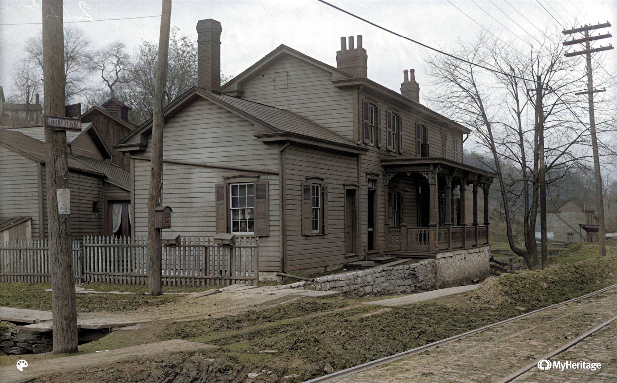
West Liberty Avenue

One of the earliest photos of a trolley on
West Liberty Avenue, showing a southbound Mt. Lebanon car passing homes
just north of Brookside Avenue, in 1904. The trolley line would be
double-tracked the following year.

West Liberty Avenue, at the junction with
Brookline Boulevard, on August 24, 1909. This lower section of
Brookline Boulevard, from here to Pioneer Avenue, was in the process of
being paved in belgian block.

Elijah Lee's blacksmith shop and Mill Building
Company, at the corner of West Liberty and Warrington Avenues, in March 1912.
Atop the hill in the distance is the home of Peter Miller, and to the far right
is the home of Catherine Lang.

The Horse Shoeing and Wagon Works of Peter
Schaffner in March 1912. Schaffner lived in the home next door.

The home of blacksmith Peter Schaffner, at
the intersection with Pioneer Avenue next to the railroad trestle, in March 1912.
Schaffner's home would be moved back a bit during an upcoming improvement project
and then stood until the 1940s.

The Brookline home of P. Parker along West
Liberty Avenue, near Brookside Avenue, in March 1912.

The Brookline home of T. Beal along West
Liberty Avenue near Brookside Avenue.
With no modern plumbing, a well and outhouse were necessities.

The property of the American Mechanics Association,
at the corner of Cape May and West Liberty Avenue, in March 1912.
This Brookline building was, for several years before 1898, the original West Liberty
Elementary School.

Brookline homes along West Liberty Avenue, just
north of Stetson Street, in March 1912.

Brookline homes along West Liberty Avenue, north
of Stetson Street, on March 18, 1912. The young lad says "Hello!"

William G. Dooley's Central Meat Market
at the corner of West Liberty Avenue and Stetson Street in March 1912. Up the
to the left was the Paul Mining Company, with a shaft dug
just to the left of Stetson and Woodward Avenue.
Just up the street from Dooley's is the property of T. Harley, including
a wood shed,
home and a laundry at the corner of Capital Avenue.

West Liberty Avenue, looking north at a
Beechview townhouse across from Stetson Street, in March 1912.

J. L. O'Donnell's Wholesale Liquor store, at
the Curran Hill intersection across from Capital Avenue, in March 1912.
The sign advertises homes in Beechview's Curran-Algeo Plan just up the hill
to the left.

Beltzhoover's Pool Room, on West Liberty Avenue
near the intersection with Capital Avenue, in March 1912.

The Brookline residence of Mary Beltzhoover, on
West Liberty Avenue between Ray and Capital Avenues. During the West Liberty
Borough days, prior to 1908, Mary was the postmaster for the Fetterman PO, with the
office at her home.

Clothes hang on the line at the Beechview home of
Estella Flanders, across from Ray Avenue, in March 1912. There
were several more homes along that side of the street all the way to
Curran Hill Avenue, properties owned
by the Whyel, Rosefelt, Welch, Miller and Piroth estates. The
final building was the St. Clair House.

Another Beechview home owned by Estella Flanders,
north of Pauline Avenue, in March 1912.

Estella Flander's Stables and General Store,
located north of Pauline Avenue in Beechview, in March 1912.

The Beechview home of William Abbott, just north
of Pauline Avenue, in March 1912.
The Beechview home of George C. Becker, at
the Pauline Avenue intersection, in March 1912.

J. Claude Grocers and two new Brookline homes,
near the Pauline Avenue intersection, in March 1912.

The Brookline home of J. Harley on West Liberty
Avenue, just north of Belle Isle Avenue, in March 1912.

The Beechview home of J. B. Knowlson, near
Belle Isle Avenue, in March 1912. The stream passing in front of the home is
Plummer's Run Creek. The water flow was diverted into the sewer system
in 1915 during an improvement project.

Wenzell Avenue, at the West Liberty Avenue
intersection, in April 1913. Visible are the stables for Beinhauer's Funeral
Home.

Surveyors working at the Brookline Junction
on March 18, 1915. The upcoming West Liberty Avenue Improvement Project, contracted
to Booth and Flinn, Ltd. cost $385,000 and completely transformed
the rural road into a broad, urban Main Street.

Looking south along West Liberty Avenue from
Warrington Avenue on March 18, 1915.

The rear of the Joseph Bandi home, at the
corner of West Liberty Avenue and Warrington Avenue, on March 18, 1915.
The small stream flowing to the left is Plummer's Run. Originating in Dormont near
Potomac Avenue, the stream is
named after early pioneer Nathaniel Plummer. West Liberty Avenue was
originally called Plummer's Run.

A wagon loaded with goods heading south along
West Liberty Avenue, approaching Ray Avenue, on March 18, 1915.

A wagon and an inbound 39-Brookline streetcar
approaching the Cape May Car Stop along West Liberty Avenue on
March 18, 1915. Looks like the slow-moving wagon may have to yield to the
fast-moving electrified trolley.

Two boys sit on a stack of wood outside the Oyer home,
watching construction work at the Brookline Junction, in April 1915.

The West Liberty sewer line running past the home
of Peter Schaffner, next to Pioneer Avenue, in April 1915.
Schaffner's home was lifted several feet and moved about ten yards back out of the
construction path.
A new brick foundation was built under the home and it remained there until
the 1940s.
The Bandi home straight on in the distance was also moved out of the way.

West Liberty Avenue at Wenzell Avenue in May 1915.
Visible are Harley's Express Moving and General Hauling,
the West Liberty Methodist Church and the Oyer estate, along with a few
other Brookline homes in
the Fleming Place Plan. Atop the hill to the left is the home at 2809 Pioneer
Avenue.

Digging the sewer trench along West Liberty
Avenue, outside of Dooley's Meat Market at Stetson Street, in June 1915.

A service trolley and a Kaufmann's Delivery
Wagon, outside the West Liberty Hotel near Warrington Avenue, in June 1915.

Installing the double track streetcar lines
at the Brookline Junction in July 1915.

A man and his three sons riding the rails
in their horse-drawn wagon, heading southbound near Stetson Street, on August 5,
1915.

A Marion steam shovel dumping a load of earth
and rock into an empty wagon, near Pioneer Avenue, on August 5, 1915.
To the left are homes in the Sauter Place Plan and a Pioneer Avenue home along
the hillside.
Behind to the workers are the Brookline homes of J. Vallor and J.A.
Talbert.

A brick mason and his apprentice working
on the West Liberty Avenue sewer on August 5, 1915.

A woman and her six children, dressed in their
Sunday finest, waiting for the inbound trolley at Capital Avenue on August 5,
1915.

A gentleman waiting for the outbound trolley
at the Curran Hill Car Stop along West Liberty Avenue on August 5, 1915.
Behind him is the West Liberty Market, formerly the Wholesale Liquor Store, at
the intersection.

Two 39-Brookline trolleys heading inbound,
approaching the Capital Avenue Car Stop, on September 2, 1915. To the right
is activity at Zehfuss' St. Clair House and ivy grows on the porch
of E. Piroth's Beechview home.

Workers digging the sewer trench along West
Liberty Avenue, just south of Capital Avenue, on September 2, 1915.

A wagon from James A. McAteer and Sons, Inc.
Wholesale Grocers stands at the Cape May intersection on October 11, 1915.

West Liberty Avenue, heading north approaching
Pioneer Avenue, in December 1915. Much has changed in the previous eight
months.
A layer of dirt was placed on the belgian block roadway. In time the dirt would
fill the spaces between the stones
and the excess would wash away. A few months later the street would be clean.

George Kerr's Horseshoeing and Wagon Repair shop,
at the corner of Wenzell and West Liberty Avenue, in December 1915.

West Liberty Avenue, looking north towards the
Brookline Junction from near the Pittsburgh/Dormont border.
The West Liberty School can be seen atop the hill in the distance.

The Brookline Junction in June 1916, looking
south towards the city line and Dormont Borough.

West Liberty Avenue, looking north from the
Brookline Junction towards Belle Isle Avenue, in June 1916.

West Liberty Avenue, looking north approaching
Pauline Avenue, in June 1916. The layer of dirt is gone, revealing the new granite
block boulevard. Those dark piles along the street are not dirt. They are
the by-products of horse-drawn transportation.

West Liberty Avenue, looking north from
Ray Avenue towards Capital Avenue, in June 1916.

A woman and her child walking along West Liberty
Avenue, approaching Capital Avenue, in June 1916.

West Liberty Avenue, looking north from
Capital Avenue towards Stetson Street, in 1916. The building
to the right is T. Harley's Laundry. Harley's residence is the next home
down the street.

West Liberty Avenue, looking north from Stetson
Street towards Cape May Avenue, in June 1916.

Looking down from the Pittsburgh Railways
Beechview line at the West Liberty/Warrington crossroads in 1918.

Looking down from the West Side Belt railroad trestle
at the intersection of West Liberty and Warrington Avenues in 1918.

Warrington Avenue (later Saw Mill Run Boulevard)
looking towards the West Liberty Avenue intersection in 1919.

Buildings along West Liberty Avenue at
the corner of Saranac Avenue, shown here on April 20, 1922.
On the opposite hillside, the two large homes to the right belong to
the Hughey family.

West Liberty Avenue in Dormont, looking north
from near Mississippi towards Potomac Avenue, in 1925.

Sewer line construction at the West Liberty
Avenue/Saw Mill Run Boulevard intersection on June 25, 1925. The homes
on the hillside to the right stand along Rapello Street. It is interesting
to note that before the 1909 upgrade
of the West Side Belt Railroad line, Pioneer Avenue came straight down between
the first two homes
rather than making the left turn at the tracks and heading down to West Liberty
Avenue.

Sewer line construction at the West Liberty
Avenue/Saw Mill Run Boulevard intersection on June 25, 1925.
Visible in the distance is the Palm Garden Dance Hall atop the hill in
Mount Washington.

Road improvements along West Liberty Avenue
in Dormont, near Biltmore Avenue, in 1926.
The Bethany Lutheran Church, at Park Boulevard, is in the distance to the
left.

The Gulf service station at the corner
of Saw Mill Run Boulevard and West Liberty Avenue on March 26, 1931. The man and child
on the sidewalk are passing J.E. Harris Confectionery, which was in
business from 1916 through the 1960s.

West Liberty Avenue, approaching the Liberty Tunnels, on November 1, 1932. The lack of traffic signals makes
for
some challenging defensive driving. In July 1930, the Pittsburgh Press listed this
South Hills
crossroads as one of the Ten Deadliest Intersections in Pittsburgh.

Digging back the hillside during the West Liberty Avenue Trolley Ramp project on January 23, 1939.

Construction of the retaining wall during
the West Liberty Avenue Trolley Ramp project on April 24, 1939.

The West Liberty Avenue Trolley Ramp on June 10, 1939. To the left is the West Liberty
Tire Company,
John's Lumber Company and the original Matthews Bronze Brookline office.

The West Liberty Avenue Trolley Ramp on August 9, 1939.

The West Liberty Avenue Trolley Ramp opened to traffic on August 15, 1939. This was the
first streetcar to pass through.

Downtown Pontiac, shown here in the 1950s, was
located near the corner of Capital Avenue, at 2001 West Liberty Avenue.
The popular local dealership was in business until the mid-1980s.

West Liberty Avenue on November 30, 1950. The
National Guard troops were called in to maintain order after
the Thanksgiving Day Blizzard that dumped over thirty inches of snow on
the Pittsburgh area.
School Days

The West Liberty School, built in 1898 and shown here in 1909, was
known locally as the "Little Red Schoolhouse." The school
building, located along Pioneer Avenue, was in operation, as a grade school
from 1898 to 1939, and then as Elizabeth Seton
High School from 1941 to 1971. The bell tower was removed in 1942 after the bell
was scrapped during World War II.

Resurrection Church in 1910. The church/school building would
see three expansions before completed in 1928.
The church was located on the lower level until a new sanctuary was built
in 1939.

There are plenty of smiling faces at a
fundraiser for the construction of the Resurrection School building in 1911.

The upper grades in the first group of
students at Resurrection School in 1912.

The Brookline School Garden, located in the open land bordered by
Rossmore, Gallion and Pioneer Avenues, shown here in 1916.
When the original land was sold to developers, the school garden was moved
to an open lot next to the school.
The very successful Pittsburgh Public School program began at Brookline
School in 1909.

The Oak Elementary School, located along
Ballinger Avenue, on February 12, 1930. The school was built in 1908,
replacing an older schoolhouse dating to the early-1890s. The school was in
service until 1943.

Overbrook Elementary School, along Saw Mill Run Boulevard,
on June 20, 1934. Built in 1928,
the school was enlarged twice and remained was in service until 2003.

A first grade class at Resurrection Elementary during the 1935/1936 school year.

Fairview Elementary School, on Hillview
Avenue in Overbrook, on March 11, 1940. Built in 1907 and
originally called Overbrook School #1, it was in service until 1974 and razed
two years later.

A Defense Stamp drive at Brookline School
on June 2, 1942. Neighborhood children were very active in the war effort at
home.

Brookline School was the #1 Pittsburgh
Public School in the sale of Defense Stamps in 1942.

A travel and geography class at Brookline
School in 1945.

A music class at Brookline School in
1945.

A journalism class at Brookline School
in 1945.

The graduating class at Brookline
School in the spring of 1945. The young man in the front row, fifth from
the left,
is Robert Sallin, who went on to a successful career as
a Hollywood film producer,
including one of the feature length Star Trek movies.

The graduating class at Brookline
School in the spring of 1950.

The West Liberty School garden in
1951.

The Resurrection School football team at
Moore Park in 1952. The team competed in the Diocesan League.

The graduating class at Brookline
School in the spring of 1953.

A new addition to Resurrection School was opened in 1957. The annex contained
six new classrooms.

A classroom at Resurrection School in 1957.

A classroom at Resurrection School in 1957.

Every day at Resurrection School, Creedmoor Avenue was blocked off from
Oakridge to Brookline Boulevard during lunch hours
so the students could have a place to play. For a couple hours each day the
street was alive with hundreds of students.
Despite the objections of some
residents, this policy was officially recognized by the city on October
22, 1933.

Students gather for the May Crowning
at Resurrection School in 1957.

The courtyard at Resurrection School in 1957. During recess this area was alive
with activity.

One of the Resurrection graduating classes from the 1956/1957 school
year.

digitaries and parishioners gather for the
groundbreaking of Our Lady of Loreto church/school on March 28, 1961.
This wooded section of Brookline, next to Moore Park, was referred to locally as
"Our Enchanted Forest."

Father Arthur Garbin
and other dignitaries at the groundbreaking for Our Lady of Loreto church/school on March 28, 1961.

Clearing the land for the construction
of Our Lady of Loreto church/school in April 1961.

Our Lady of Loreto church/school under construction in September 1961.

Our Lady of Loreto church/school is nearing completion in July 1962.

A Brentwood Motor Coach bus drops students off along Pioneer Avenue at Elizabeth
Seton High School in 1962.

The Resurrection Activities Building under construction in December 1964. The final addition to the school
would include
a garage, gymnasium, lockers, banquet hall, library and several additional
classroom. Resurrection Church/School was
built on the highest ground in Brookline, and from the church window the view of
the community was magnificent.

The Resurrection Activities Building under construction in January 1965. It was completed for the 1965/66
school year.
Moore Park

The parking lot and entrance to Moore Park on May 25, 1938. It would be two years before park construction was
completed.

Moore Park pool and bath house construction
as of October 31, 1939.

Moore Park pool and bath house construction
as of January 9, 1940.

Moore Park pool and bath house construction
as of June 3, 1940.

Moore Park pool and bath house construction
as of July 3, 1940.

The front entrance to the Moore Park pool and bath house on August 2, 1940. The grand opening would
be held seven days later.

Fans gather for the first Brookline Pony League playoff game hosted at Moore Park in 1952.

Football practice at Moore Park in the fall of
1961. Our Lady of Loreto Church/School is under construction to the
right.
Creedmoor Avenue

Creedmoor Avenue, at the Clippert Street
intersection, looking downhill towards Brookline Boulevard, on May 28, 1919.
Resurrection Church and School stands to the left. Creedmoor is being
resurfaced in paving bricks and belgian block.
You can see homes along Bellaire Avenue and Brookline Boulevard, with
the iconic firehouse tower, in the distance.

Homes along Creedmoor Avenue on May 28, 1919.
These homes stand across the street from Resurrection Church and School.
From 1912 to 1957 the first two homes served as Convent for the
Sisters of Charity that taught at the school.

Creedmoor Avenue on May 28, 1919, looking
towards Oakridge Avenue and beyond to Resurrection Church and School.

This home at 1201 Creedmoor Avenue was built
in 1912 to serve as Resurrection Church rectory and home to Pastor James Quinn
and the other priests. Shown here on May 28, 1919, the home served in that
capacity until 1939.

Homes along Creedmoor Avenue on May
28, 1919.

Homes along Creedmoor Avenue on May
28, 1919.

Homes along Creedmoor Avenue on May
28, 1919.
People And Places

The 1898 wedding of Barbara Hufnagel
and Philip Fisher, who owned a seventeen acre farm along Edgebrook Avenue.
Many of the local citizenry are in attendance. The man with the bucket
is showering the crowd in blessings.

Local farmer Philip Fisher outside his home along Edgebrook Avenue in 1902.

The home of local blacksmith George Kerr, built in 1898 at the corner of Wenzell and West Liberty Avenues
and shown here in 1909.

The dairy farm owned by John Schafer and
S. Jacobs along Timberland Avenue, shown here on October 14, 1909.

Homes along Cadet and Linial Avenues in
the Boggs Place Plan, shown here on October 14, 1909.

Looking down at the West Side Belt Railroad line
on October 14, 1909. The busy freight line was being upgraded for heavier
traffic. This resulted in the construction of the tunnels at Crane Avenue, Overbrook
School, Glenbury Avenue, McNeilly
Road and so on down the line, the West Liberty and Edgebrook Avenue bridges and the
Castle Shannon viaduct.
Homes along Timberland Avenue, and the Saw Mill Run Valley, can be seen below and
beyond the tracks.

This is one of the Pittsburgh Coal Company power
stations and ventilation shafts for the Oak Mine. This station stood from
1905 to 1915 and was located at the Brookline Junction with West Liberty
Avenue.

This image represents all of the coal mining
ventures around the Brookline area that took place between 1870 and 1941.
The Oak Mine was rich in black gold, and 95% of the Brookline and
surrounding area has been undermined.

The Timberland Avenue Bridge, designated City
Bridge D-315, connects Cadet Avenue (to the left) and Timberland Avenue.
Built in 1909, the bridge and passes over the Belt Railroad tracks. It was
the only link for homes in the Boggs Place Plan
to get off the hill to the main roads. The bridge stood until 1925 when Cadet
Avenue was extended to Pioneer Avenue.

The view of the Saw Mill Run valley from the
Timberland Avenue Bridge on August 1, 1918.
That is the Pittsburgh Railways McKinley High Bridge in the distance.

The tracks of the West Side Belt Railroad pass
under the Timberland Avenue Bridge on August 1, 1918.

Homes along Fordham Avenue, near the Ardsley
Avenue intersection, on March 15, 1921.

A home at the corner of Fordham and Stebbins
Avenue on March 15, 1921.

Two homes along Fordham Avenue on March
15, 1921. That is the Queensboro Avenue intersection in the distance.

Fordham Avenue, looking from Castlegate
towards Midland Avenue, on March 15, 1921.

A new sewer pipe being installed along
Sussex Avenue on June 10, 1921.

A view of the Fleming Place Plan in Brookline
from Vodelli Avenue in Beechview in 1922. Homes along Jillson, Shawhan and
Aidly Avenue are visible. Brookline School can be seen atop the hill along
Pioneer Avenue.

The five Fisher sisters in 1923. They have a
combined age of 350 years. Seated: Mary Fisher Anderson (69)
and Margaretha Fisher Fieck (63). Standing: Elizabeth Fisher Stumme (73),
Catherine Fisher Friday (75)
and Helena Fisher Edwards (70). Their other two sisters, Eva and Caroline
Fisher had already passed.

A wagon loaded with coal makes the turn off
Merrick Avenue onto Freedom Avenue on October 7, 1924.

Two cars parked along Freedom Avenue on October
7, 1924. A new home is being built along Wareman Avenue.

Homes along Bay Ridge Avenue on October 9,
1924.

Two women talking along Rossmore Avenue. The view
is looking from Wedgemere uphill towards Pioneer Avenue, on May 25, 1925.

Rossmore Avenue, looking from Wedgemere Avenue
uphill towards Flatbush Avenue, on May 25, 1925. The tree has to go!

Homes along Timberland Avenue (left) and Cadet
Avenue (hilltop), seperated by the Timberland Avenue Bridge, in June 1925.

Three children, two on tricycles and one on
a wagon, look to be having some fun on the Wedgemere Avenue hill,
between Bellaire and Rossmore Avenues, on August 21, 1925. Another kid stands
on a nearby porch looking
as if he'd like to join in the fun, while a woman looks out the side window of
the home next door.

Street improvement work along Wedgemere Avenue,
at the Rossmore intersection, on August 21, 1925. The children on tricycles
look to be keeping a keen eye on things. A note of interest is that where the homes
stand on the left, between Rossmore
and Gallion Avenues, was from 1914 to 1922, the community baseball park, playground
and festival location.

The Bob O Link Golf Driving Range, located along Pioneer where Moore Park now stands. The range, shown here in 1930,
was a popular attraction from the mid-1920s until 1931, when the land was
purchased by the city to build a park.

A garage along Glenarm Avenue. The view is
towards the Berwin Avenue intersection on June 24, 1930.

The 2400 block of Glenarm Avenue, near
the Berwin Avenue intersection, on June 24, 1930.

The South Hills Coal Company, located
along McNeilly Road (Elwynn), next to the Wabash railroad tunnel. The company
was in operation here from the early-1900s until the early-1940s,
when mining in the Brookline area ceased.
The South Hills Coal Company was one of the main suppliers of local home heating
coal.

The old Hayes Mansion at 1900 Whited Street (1766 Ballinger). Built in the 1850s and
home to wealthy landowner Jacob Hayes
and his son, Milton, president of the Pittsburgh & Castle Shannon Railroad. The building is the oldest building
in Brookline,
and some say that it is haunted. From 1984 to 2014 this was the location of
Larry's Roadhouse bar and restaurant.

One of the rooms inside the Hayes Mansion at 1900 Whited Street (1766 Ballinger) circa 1900.

One of the rooms inside the Hayes Mansion at 1900 Whited Street (1766 Ballinger) circa 1900.

Viaduct Way, the alley between Norwich (left)
and Fordham Avenues, as seen from Queensboro Avenue on June 17, 1931.

A stepped board walkway along Woodward
Avenue, looking to the Capital Avenue intersection, in 1932. Homes along
Plainview Avenue stand along the hillside. The West Liberty
schoolhouse is barely visible in the upper left.

The home at the corner of Fordham
and Sussex Avenue, as seen on April 4, 1933.

A group of men gather at a garage along
Tariff Way, at Sussex Avenue, on April 4, 1933. Laundry hangs on
the clothes line and the youngster walking away looks to have had enough
of the conversation at hand.

Lariat Way, the alley behind Woodbourne
Avenue, as seen from Sussex and Bay Ridge Avenue, on April 4, 1933.

The rear of homes along Woodbourne Avenue,
as seen from Sussex Avenue on April 4, 1933.

Queensboro Avenue, looking down from Chelton
Avenue, on August 15, 1933. Sewer work is being done at the bottom
of the hill, at the Berkshire intersection. Queensboro would be paved
to Norwich Avenue later that summer.

The city steps along Stebbins Avenue,
looking up towards Woodbourne Avenue, in 1933.

The city steps along Belle Isle Avenue, looking
up from Plainview Avenue, on September 18, 1934.

Shawhan Avenue in November 1935, looking
towards Bodkin Street (then still designated as Brookline Boulevard).
The home straight ahead with the dual porch was the original St. Mark Lutheran Church.

The Anderson Farm, which stood between Breining Street and Brookline Boulevard,
in 1936. This is now the location of
Brookline Memorial Park. Homes along Milan Avenue, Bellaire
Place and the boulevard can be seen in the distance.

The Women's Bible Class at the Brookline Boulevard United Presbyterian Church, sitting in the lawn next to the old
Stone Chapel
in 1939. The space where they rest became the ground for the Children's
Education Center in 1953.

The family of Josef and Amalia Kapsch, two of Brookline's earliest homebuyers, moving into their
home at 1114 Milan Avenue in 1906.

Kids having a snowball battle in the front
yard at 2414 Beaufort Avenue in 1940.

New home construction along Seaton Avenue
and Creedmoor Place in 1941.

This is the home at 2306 Whited Street, the
third house up from Marloff Place. Shown here in 1941, the house
was constructed in 1939. It was the first home built along this section of Whited.
The plot of land
was purchased from the Marloff family, who owned the farm house in the distance
to the right.
Other homes followed as the Marloffs sold off lots for development.

The Stengel brothers, James Gillespie and
other members of James Cowan's Boy Scout Troop collecting
scrap goods and other items for the war effort along Norwich Avenue in
1945.

The expansion to Altmar Street from Bellaire Avenue in underway in 1946.

The laying of the second cornerstone on
the United Presbyterian Church Children's Education Center in 1953. The minister
is Reverend Stillman Foster, who headed mission 1951 to 1959. On the right hand
side of the platform in the
back row is Samuel McClelland, and to his right is Nettie McClelland. The McClelland
family had been
members of the Brookline United Presbyterian Mission since February 1913.

Children at play in the front yard at
1322 Bellaire Place in the summer of 1953.

Pittsburgh & West Virginia Railroad locomotives
pass over Whited Street, at the Jacob Street intersection, in 1957.

Players get instructions from mom during a
1958 football practice in the yard at 1501 Brookline Boulevard.

Northcrest Avenue, looking towards the
intersection with Pioneer Avenue, in 1960.

Looking uphill at the Y-intersection of
Berkshire Avenue (to the left) and Chelton Avenue, in 1960 during a street
resurfacing project. Berkshire Avenue, from Freedom Avenue to Woodbourne Avenue,
is paved in concrete.

Another image of Berkshire Avenue during
a street improvement project in 1960. The Chelton Avenue intersection
is just ahead, and in the distance are homes along Creedmoor Avenue.

The wedding of Patricia McGibbeny and Gerald
Burton at Resurrection Church on November 19, 1960.

A crowd gathers outside Resurrection Church
after the wedding of Patricia McGibbeny and Gerald Burton on November 19,
1960.

The Community Center baseball field in 1969.
The field was first used in 1952 for Brookline's first Little League season.
On the
plateau above the field is the old Anderson farmhouse,
which acted as the Recreation Activities Building from 1947 until 1971.

Masons working on the Brookline Recreation Center building in 1970. The gentleman in the foreground is Rudy Lopez, a basketball
enthusiast who made the most of his efforts, becoming a regular Recreation Center
patron until his passing in March 2018.

Groundbreaking for the Brookline Recreation
Center was in July 1969. This image shows masons erecting the concrete block walls
for the lower level. The building was dedicated in May 1971 and staffed by the
city Department of Parks and Recreation.

Brookline Area Community Council members
Alice Doran and Elva McGibbeny (both sitting), Marge Labawy and Vi Nolla in 1982.
These energetic ladies helped bring some remarkable changes to Brookline, including
the expansion of Brookline Park.

The inside of Kribel's Bakery in 2004. The
family-run business was in operation on the boulevard for over 65 years.
In 2015 the establishment changed ownership and is now called DeLuca's
Bakery.
Saw Mill Run

Locomotive #9 of the Pittsburgh & Castle Shannon Railroad at the Lebanon station in Mount
Lebanon in 1901. The narrow gauge
railroad operated along the Saw Mill Run corridor from Pittsburgh to Mount
Lebanon from 1872 to 1912,
offering passenger and freight traffic to South Hills residents, along with
coal traffic.

An outbound Pittsburgh & Castle Shannon Railroad passenger train passes through the
Overbrook area around the turn of the century.

Construction of a traffic culvert along the
township road that ran through the Saw Mill Run valley, on July, 9, 1909.
This is at present-day Bausman Street, and the small stream flows to Saw Mill Run
Creek.

The Franum Street footbridge across Saw
Mill Run Creek on October 17, 1919.

Saw Mill Run Bridge #4, along the approach
to the intersection with West Liberty Avenue, in 1929.

A tractor and steam shovel level a path during
the first phase of the construction of Saw Mill Run Boulevard on April 30, 1929.

On May 24, 1929, the Borough of Overbrook
held a parade to celebrate the opening of their new municipal building
and firehouse, located at the intersection of Saw Mill Run Boulevard and
Maytide Street.

Engineers doing test bores on March 14, 1930,
before beginning to excavate the cut between Crane Avenue and Woodruff Street.

The 135 foot deep cut for the boulevard,
approaching Woodruff Street. Over 500,000 cubic yards of earth and rock
was removed.

Cars parked at the Woodruff Street terminus
of Saw Mill Run Boulevard on September 9, 1930. This was dedication
day for the second phase of the Saw Mill Run project, which now stretched from
Stewart Avenue to Woodruff Street.

R. Stauffer's Overbrook Market on Saw Mill
Run Boulevard, near Overbrook School, on June 20, 1934.

A service station along Saw Mill Run
Boulevard, across the street from the Overbrook Market, in 1934.

Saw Mill Run Boulevard at Maytide Street, on
June 21, 1934. The Overbrook firehouse and municipal building is to the
left.

The Dairy Del Delicatessen, at Overbrook and
Saw Mill Run Boulevards, on December 11, 1935.

Saw Mill Run Boulevard, looking from the
Overbrook Boulevard intersection towards Library Road, on May 23, 1936.

Saw Mill Run Boulevard, approaching Overbrook
Boulevard, on May 23, 1936.

Clement's Amoco Service Station at 1700
Saw Mill Run Boulevard in 1945. The stately home had stood for decades when the
boulevard was built in 1929. The once spacial front yard was taken
and the road ran just feet from the front door.
Not long after, the gas station was installed on the corner. Today this is
the location of Jack Maggs Agency.

The original Eat'n Park Restaurant, at 2209 Saw Mill Run Boulevard in Overbrook. The
store opened on June 5, 1949,
and on that day car customers received a 25 cent ice cream sundae for free with any
purchase.

The Banksville Traffic Circle in 1949. The circle was located on the site of
the present-day Fort Pitt Tunnel south interchange.

The Bansksville Traffic Circle in 1950 during
the construction of the West End Bypass. Visible to the left is Woodville Avenue.

A Schneiders Dairy Truck driving through a
flood along Saw Mill Run Boulevard, near Library Road, in 1950.

Clement's Auto Service, at 1700 Saw Mill
Run Boulevard, in 1950. To the right is the old Hayes Mansion.

During the West End Bypass construction project, from 1949 to 1951, one million cubic yards
of earth and rock were
removed from the Mount Washington hillside in order to make room for the four-lane
highway.

Clement's Mobil service station, at the corner of
Whited Street and Saw Mill Run Boulevard, in 1952.

Approaching the Oak Station Bridge at Whited
Street in 1960.

State Route 51, approaching Stewart Avenue,
on July 21, 1964. Stewart is the official boundary between Saw Mill Run and Clairton
Boulevards. At the Gulf station, Gultane was selling for .23, Good Gulf for .26
and No Nox was an even thirty cents per gallon.

The intersection of Saw Mill Run Boulevard and
Warrington Avenue on October 26, 1970. The Palm Garden Bridge,
built in 1903 to carry trolley traffic on the Beechview route, crosses over the
boulevard. In 1939
the Brookline, Dormont and Mount Lebanon lines were re-routed onto the
bridge.
Library Road

Metzgar's Sunoco station at the intersection
with Library Road and McNeilly Avenue on September 8, 1934.

Looking at the Library Road/McNeilly
Road intersection on September 8, 1934. An inbound streetcar
is about to cross the McNeilly trestle on the Pittsburgh Railways line to the
right.

Library Road, approaching the McNeilly Road
intersection, on September 8, 1934. Hartz Mountain Canaries
had a thriving business with all of the mining in the area. Guaranteed Singers
cost $3 apiece.

A residential home along Library Road,
near the McNeilly Road intersection, on September 8, 1934.
Liberty Tunnels

The south portals of the Liberty Tunnels in April 1921. Construction began in 1919 and the tunnels
opened in January 1924.
The Twin Tubes were instrumental in bringing further investment to the growing
South Hills communities.

A work crew inside the Liberty Tunnels in April 1921.

Workers standing by the shovel used to clear
the debris and do the bench working inside the Liberty Tunnels in April 1921.

A Booth and Flinn locomotive hauling debris
from the Liberty Tunnels construction area in April 1921.
The earth and rock were used to form Bausman Street and lower McKinley
Park.

The south portals of the Liberty Tunnels in 1954.
Liberty Bridge

Construction of the Liberty Bridge on March 16, 1927.

Construction of the Liberty Bridge on March 16, 1927.

The two ends of the Liberty Bridge were joined on June 15 1927.

The massive Liberty Bridge built along the northern approach to the Liberty Bridge.

The Liberty Bridge in 1936. The Coca Cola Clock stands next to the McArdle Roadway bridge.

The new Liberty Bridge and Mount Washington Roadway in August 1928.

The Liberty Bridge on April 30, 1937.

Workers pouring new concrete paving
along the Liberty Bridge on June 5, 1942.

The evening rush on the Liberty Bridge in 1950.

The Liberty Bridge northern approach began at Forbes Avenue, shown here in
1951.

A traffic policeman stands outside the
northern portals of the Liberty Tunnels during rush hour.

A welder working on one of the expansion
joints of the Liberty Bridge on June5, 1956.
Community of Beechview

A streetcar along Broadway Avenue in
1909.

Broadway and Beechview Avenues in 1909.
This was the year that Borough of Beechview (to the left) and
the city community of Beechwood (to the right) were merged and renamed
Beechview.

Rutherford Avenue, from the corner with Sebring
(South Sharon) Avenue, looking towards Hampshire Avenue in August 1909.

A stately home stands at the intersection
of Crosby and Belasco Avenues in 1911.

Hampshire Avenue in 1912, looking west
from Rockland Avenue.

Hampshire Avenue, looking towards Rockland
and Westfield Avenues, in 1912.

Masons installing the granite block curbs
along Rockland Avenue in 1913.

Beechwood School, along Rockland Avenue,
in 1913. Beechwood was the original name of the
Beechview community.

Beechview School, along Sebring (South Sharon)
Avenue, in 1916. The former borough school opened in 1907.

The Beechwood School Garden in 1916.
The Pittsburgh Public School's gardening program began in neighboring Brookline.

Hampshire Avenue in 1919, looking up towards
Broadway Avenue, in 1919. The Beechview United Methodist Church,
to the right, served as Beechview Borough's first school building from 1905 through
the end of 1906.

Storefronts along Broadway Avenue, at the
Hampshire Avenue intersection, on February 18, 1930.

The Broadway Realty Company at 1557 Broadway
Avenue on February 18, 1930.

Stores along Beechview Avenue, near Broadway
Avenue, in October 17, 1945.
City Of Pittsburgh

The Smithfield Street Bridge in 1894. This is an artist's colorized rendition of a
vintage photo. Originally called the
Monongahela Bridge, until the building of the Liberty
Bridge in 1924, this was the main gateway to downtown
Pittsburgh for South Hills commuters. The Brookline streetcar
route used the bridge from 1905 to 1965.

Smithfield Street in 1905, with Kaufmann's
Department Store in the distance to the right.

The grand entrance to Luna Park in 1905,
with the Shoot the Chutes plunge standing tall in the distance.

Luna Park in 1905. Located in Oakland at
the intersection of Craig Street and Baum Boulevard, the park was in
operation for only four short years, but it's legacy lives on in the Lost
Kennywood section of Kennywood Park.
Ironically, it was competition with other trolley parks like Kennywood that
brought on Luna Park's closure.

A wagon loaded with Heinz products leaves
the North Side plant in 1903.

A Kaufmann's Department Store delivery wagon in
1915.

A trolley, a wagon and an automobile make an
interesting traffic mix along Sixth Avenue downtown in 1917.

Billboards along the Bluff below Duquesne
University on May 28, 1920. The Pennsylvania Railroad's Try Street Terminal
freight yard stands at the foot of the hill. Most of this hillside was cut away
a few years later
during the construction of the Liberty Bridge northern approach to Forbes
Avenue.

The Armstrong Tunnels south portals, along Second Avenue, under construction on
December 31, 1926.

The Armstrong Tunnels south portals, along Second Avenue, on September 27, 1927. Today this
view of the decorative tunnel facade is obscurred by the Parkway East
viaduct.

The Mount Washington Transit Tunnel was opened in 1904 and was the primary catalyst in the development of
the South Hills
communities, bringing quick, reliable access to downtown Pittsburgh. Now 115 years
old, the tunnel is still a vital link
to downtown Pittsburgh as part of the South Hills light rail and busway
system.

The home at 2556 Bigelow Boulevard in 1935. This was near the Brereton Road intersection, today
the location of Frank Curto Park.

A New York Central locomotive pulls a train
through the Pittsburgh & Lake Erie Railroad complex at Station Square in
1966.
|

