|
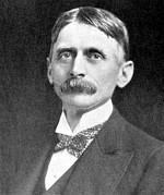
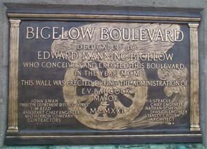
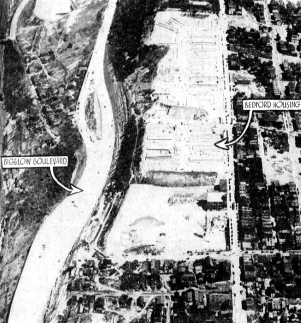
Bigelow Boulevard, originally known as Grant Boulevard, is a three and a half mile "rapid transit" roadway carved into Bedford Hill that connects downtown Pittsburgh with Schenley Park in Oakland. It is a lasting tribute to the city's most famous urban planner, Edward Manning Bigelow, known as the "Father of Pittsburgh Parks." The Boulevard, conceived by Bigelow in 1891, was the beginning of a twelve mile drive, which included Beechwood and Washington Boulevards, in a transit route that connected both Schenley and Highland Parks. Bigelow had an overwhelming desire to establish large scenic parks near the city and make them accessible to the everyday factory workers and their families, a privilege often reserved for the upper class. Edward Bigelow was appointed City Engineer in 1880 and in 1888 became Director of Public Works, a position he held for three terms, the last ending in 1906. During his tenure in office, Bigelow forged major improvements in the City's urban boulevards, waterworks, and parks.
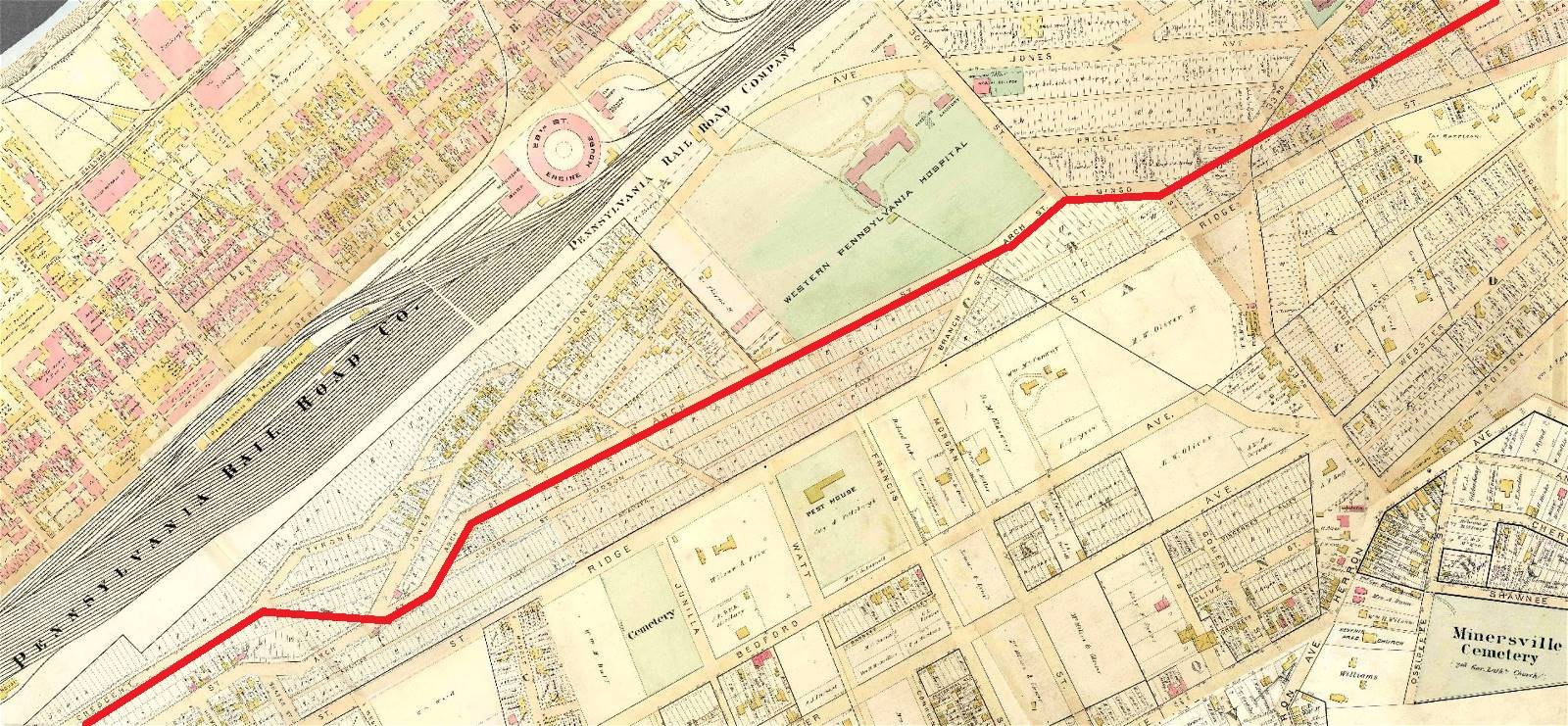
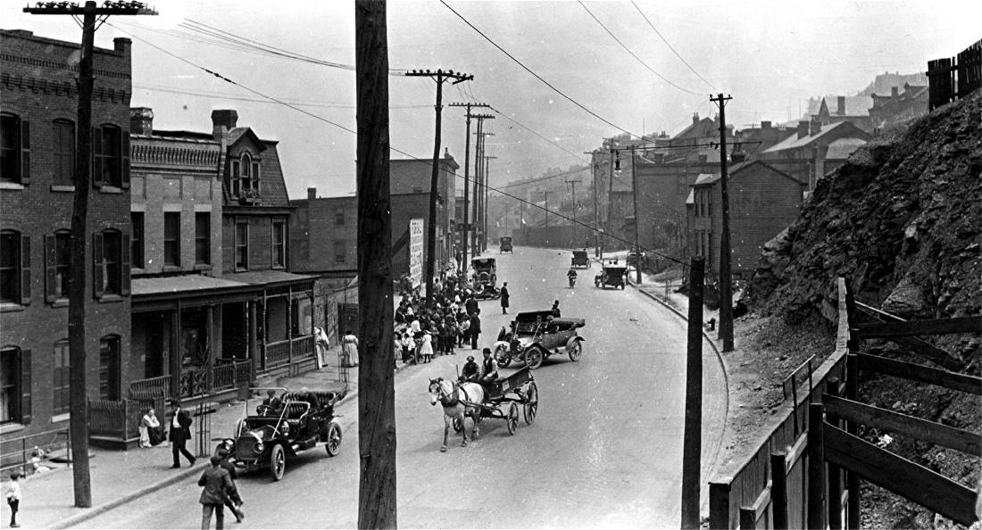
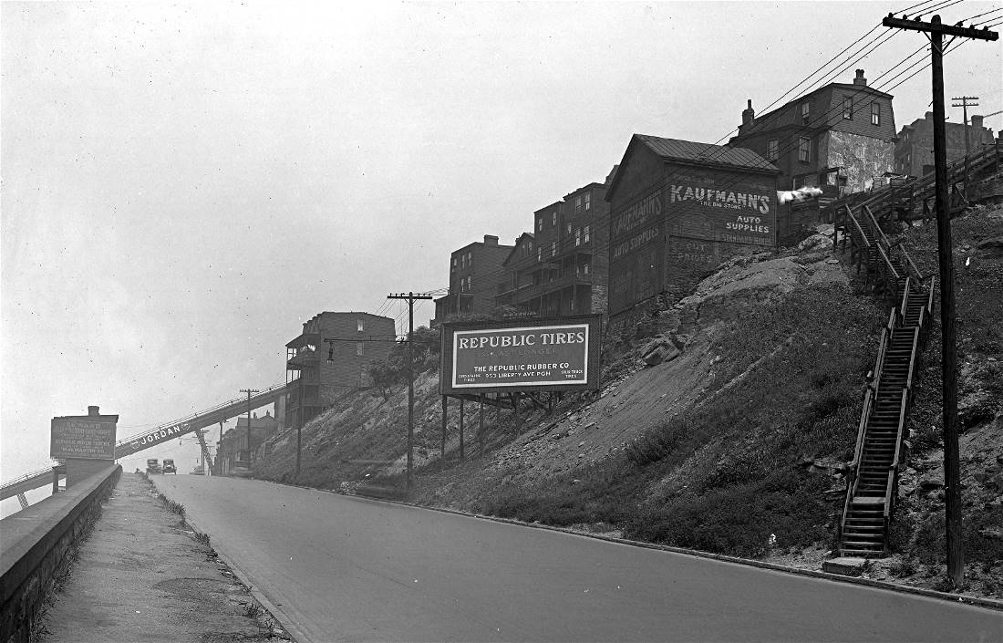
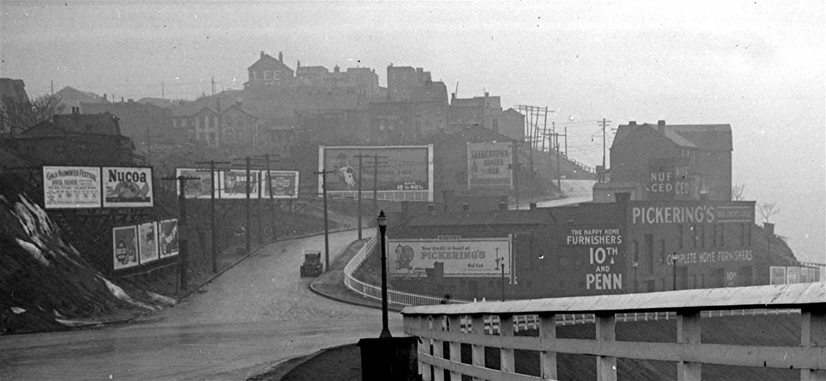
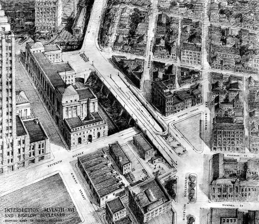
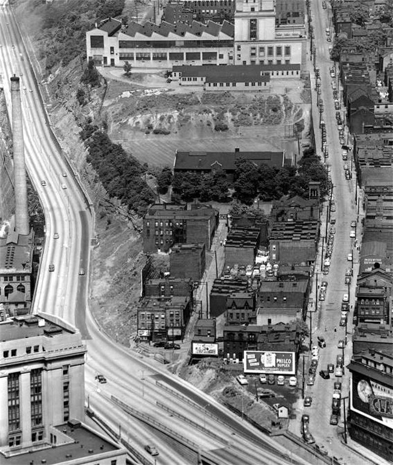
When Bigelow took office, the only public park in the city was a block-long area along Second Avenue between Grant and Ross Streets, now the ramp of the Blvd of the Allies. Soon after, he quietly began acquiring land in various parts of the city for public park use. In 1889, these parcels became Schenley and Highland Parks. In an 1895 city bond issue, $500,000 was appropriated for the construction of two boulevards. Construction of Grant Boulevard started in 1897. Beginning at Seventh Avenue in downtown Pittsburgh, the boulevard extended along a cut in the face of Bedford Hill eastward to Forbes Avenue in Oakland. Some of the roadway existed in one form or another already and just needed improving. Other sections required a massive undertaking for the times. At the top of the rise, near the Seventeenth Street (Penn) Incline, the course of the boulevard ran along Crescent Street, then Arch Street to Polish Hill. A short part of Mingo Street and a cut through the hill below Ridge Street led to Oscar Alley. It followed the alley to Craig Street then veered off onto open land owned by the Herron, Aspinwall, Davidson, Schenley and Frick estates until reaching Forbes and Fifth Avenues in Oakland.
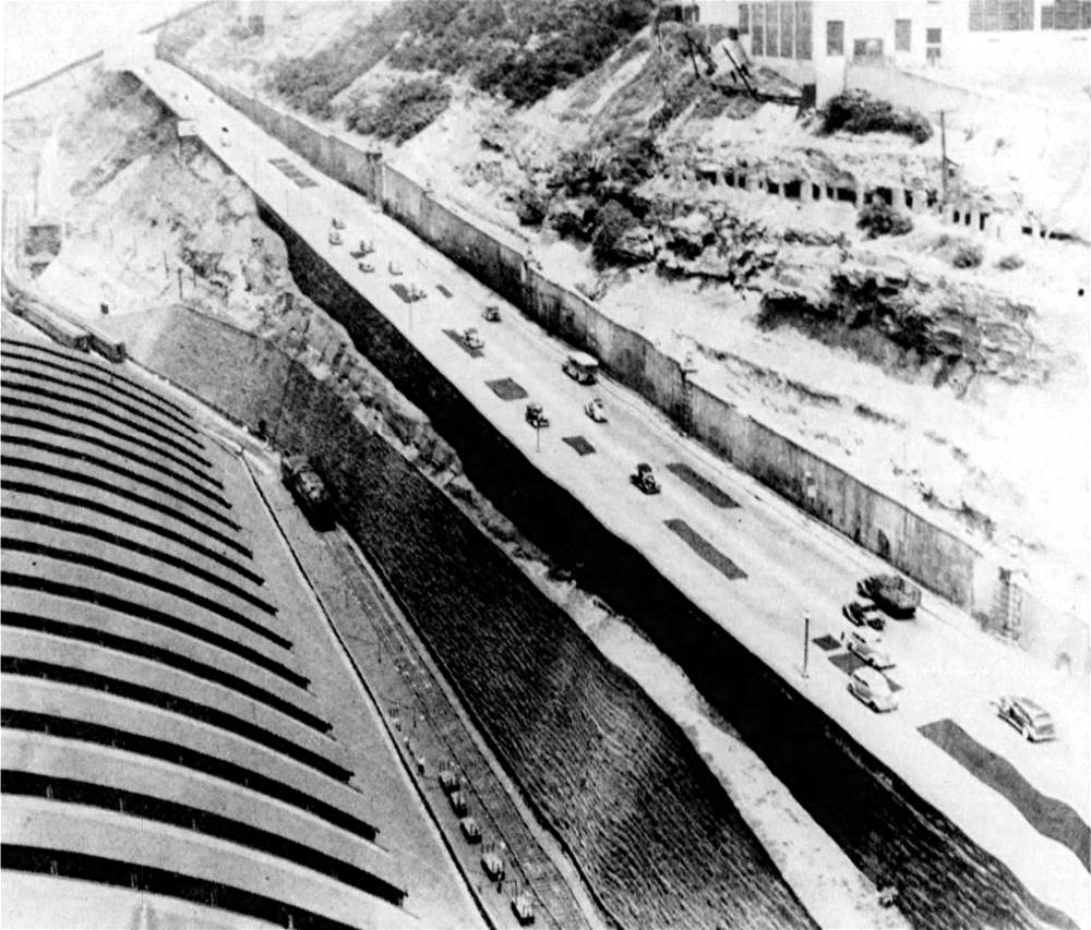
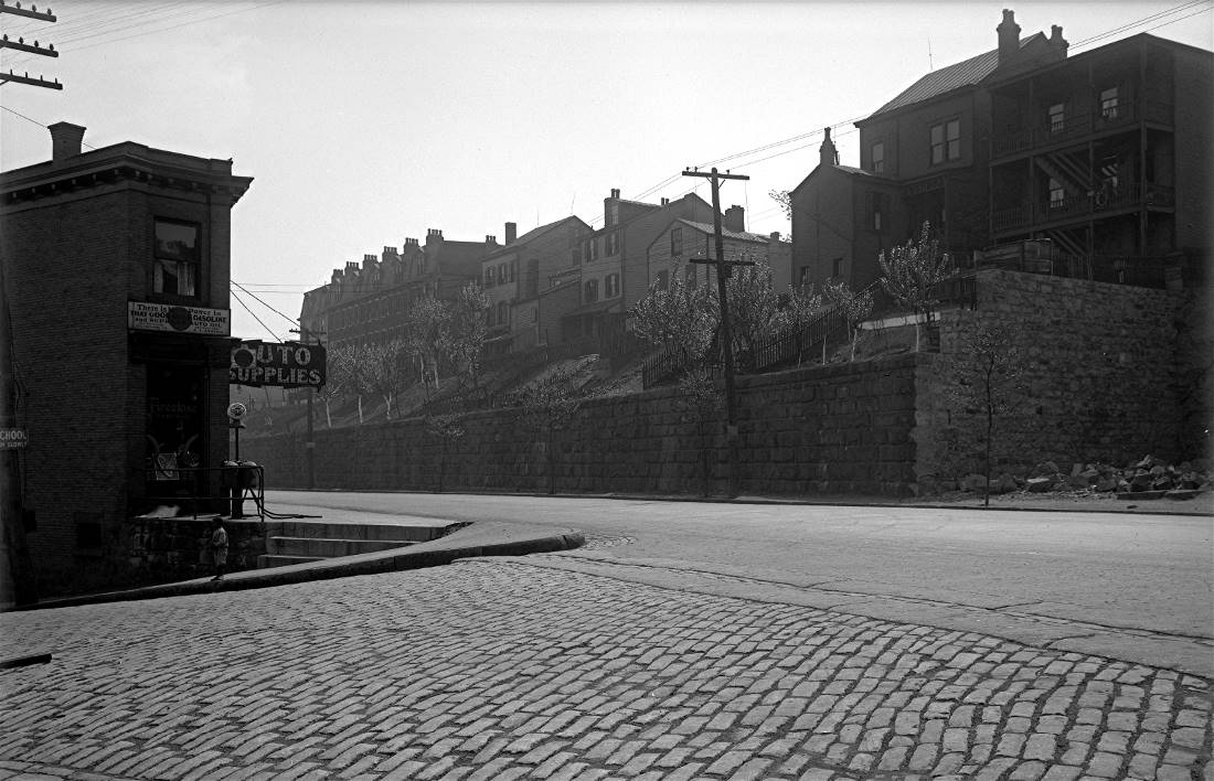
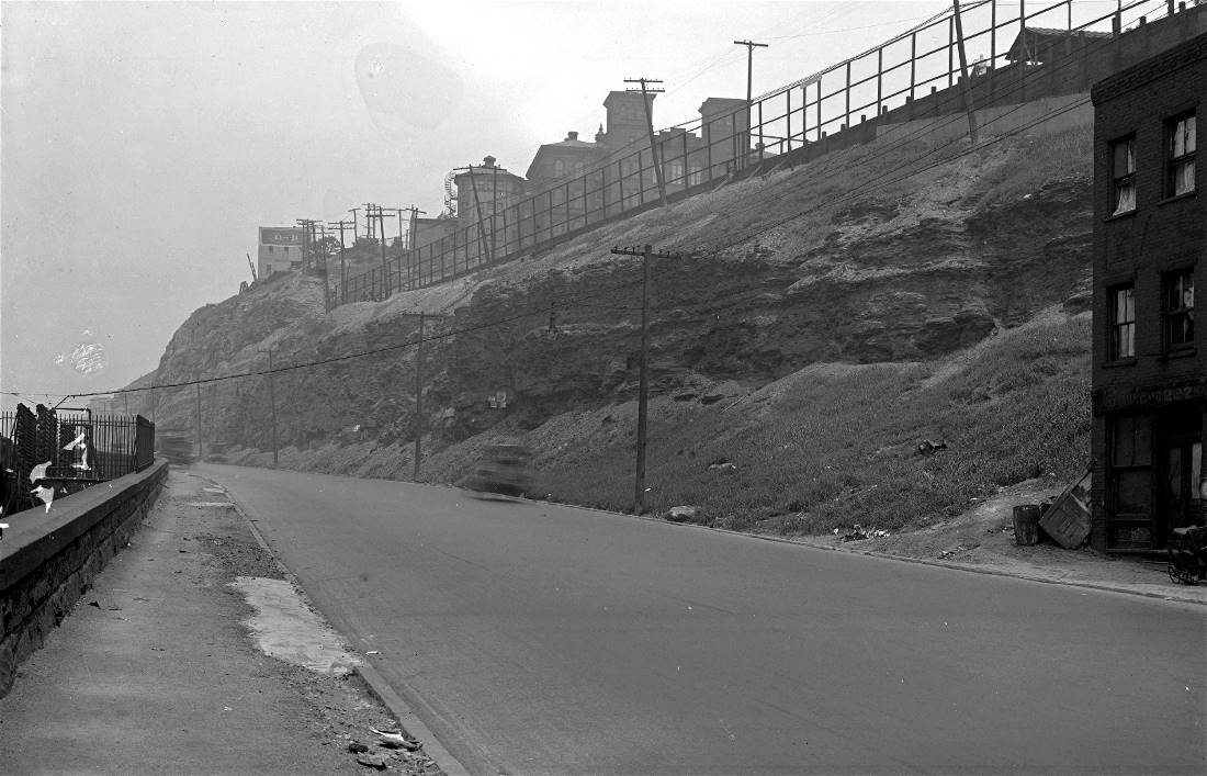
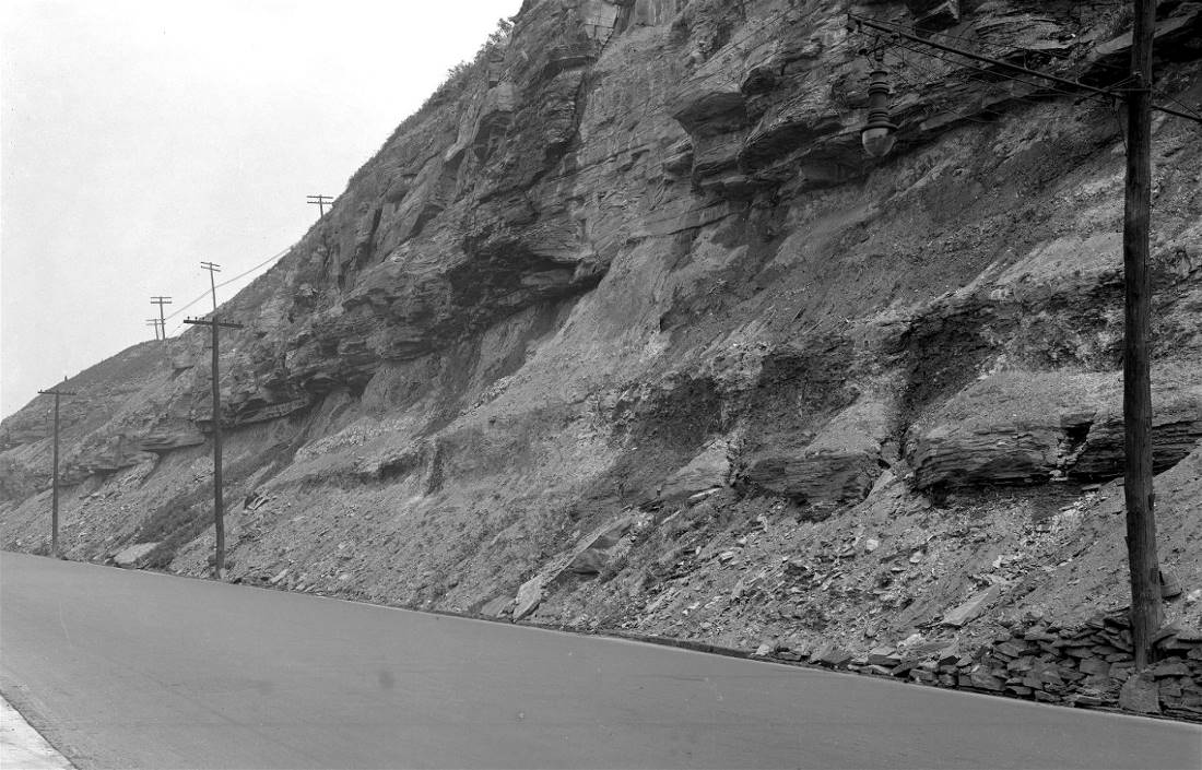
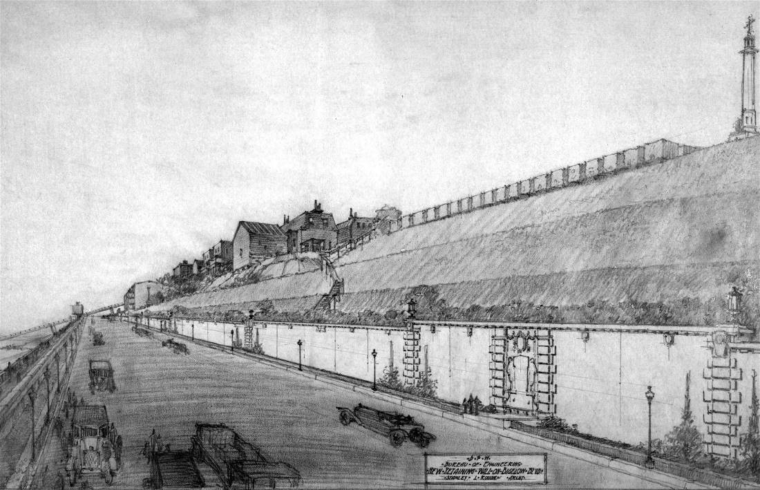
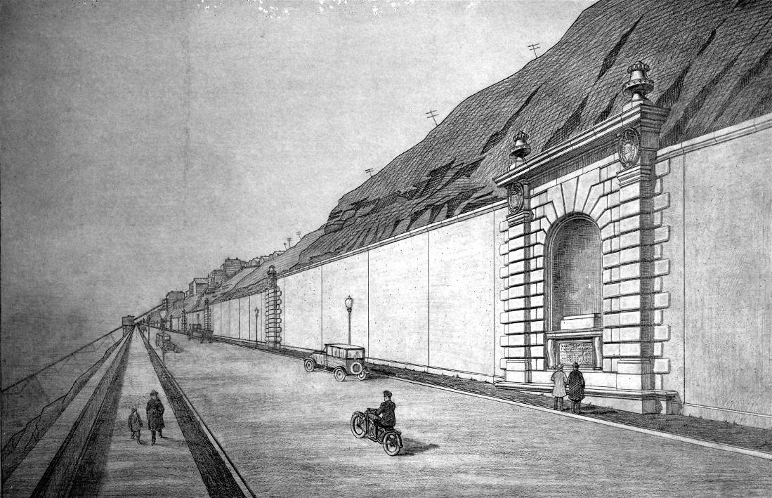
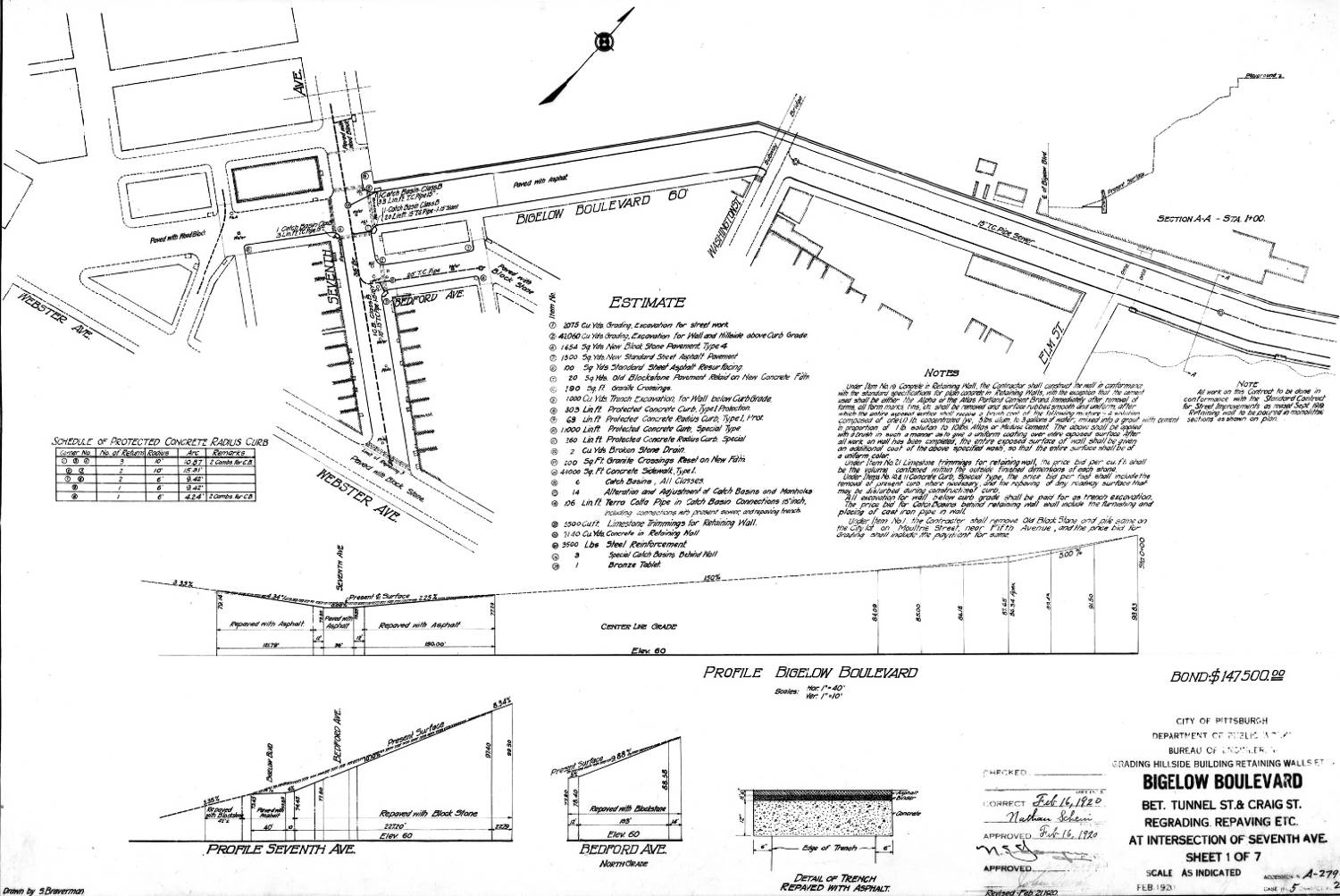
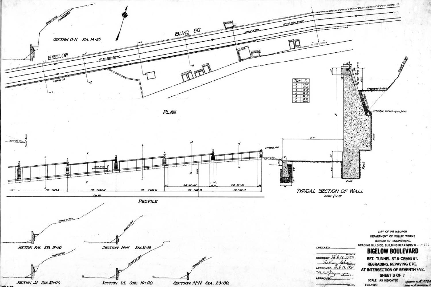
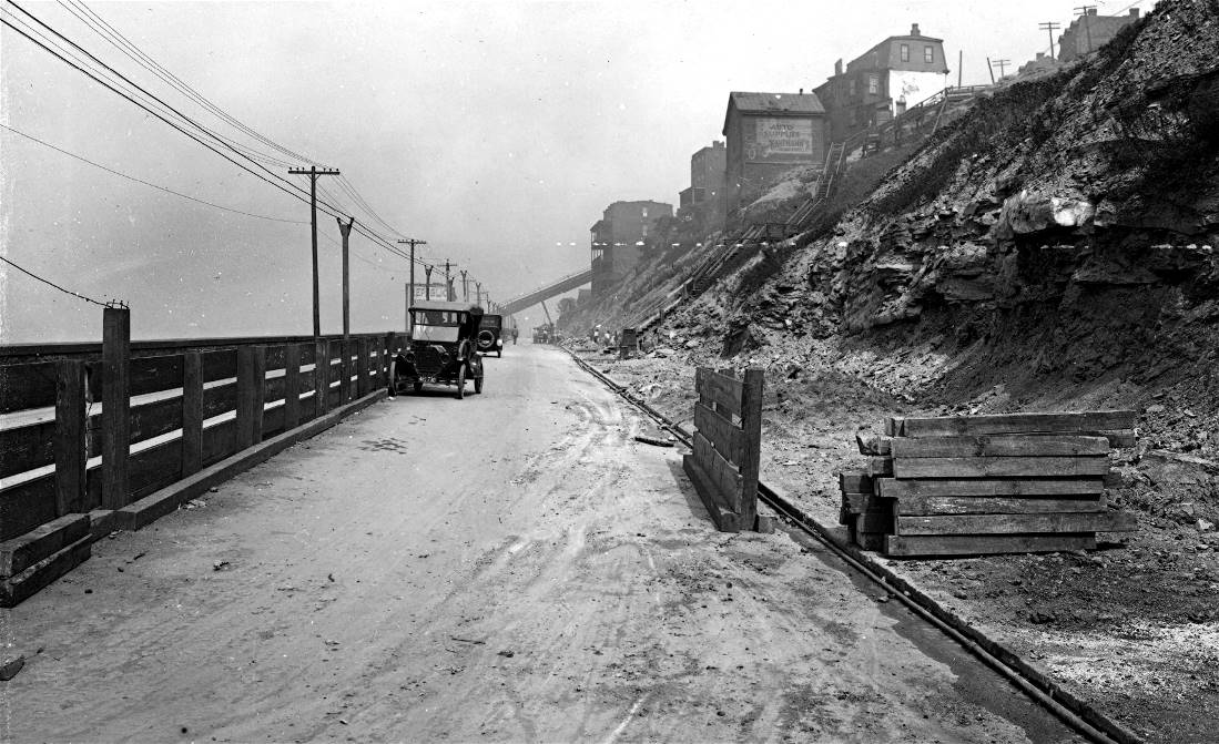
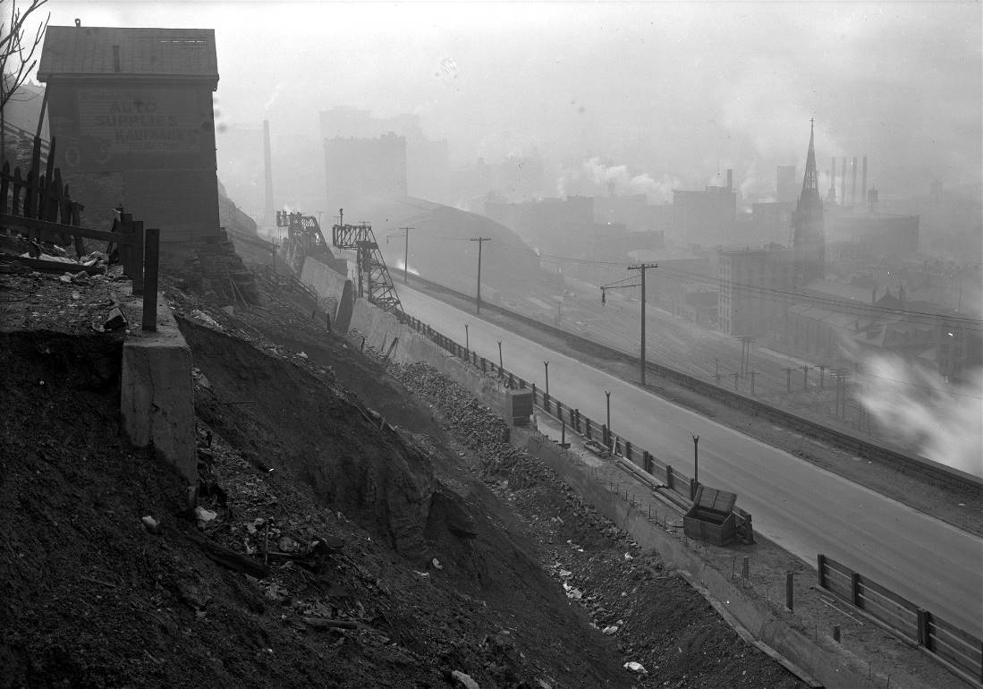
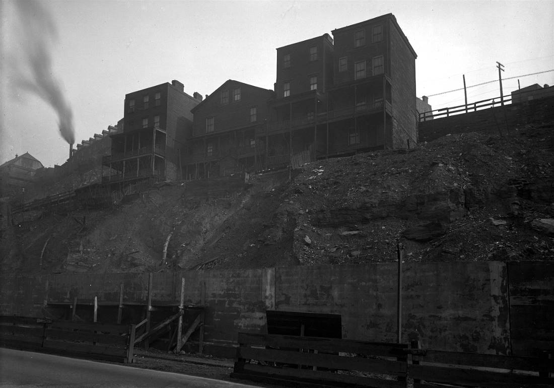
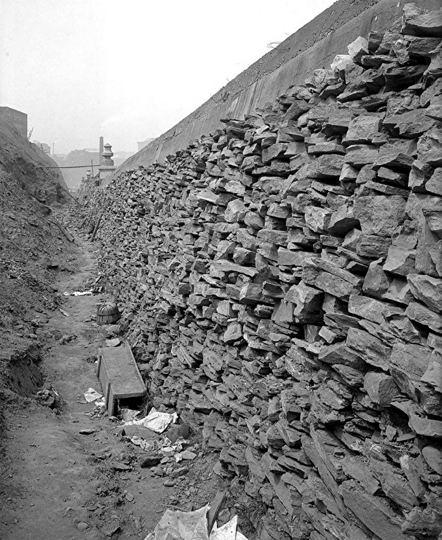
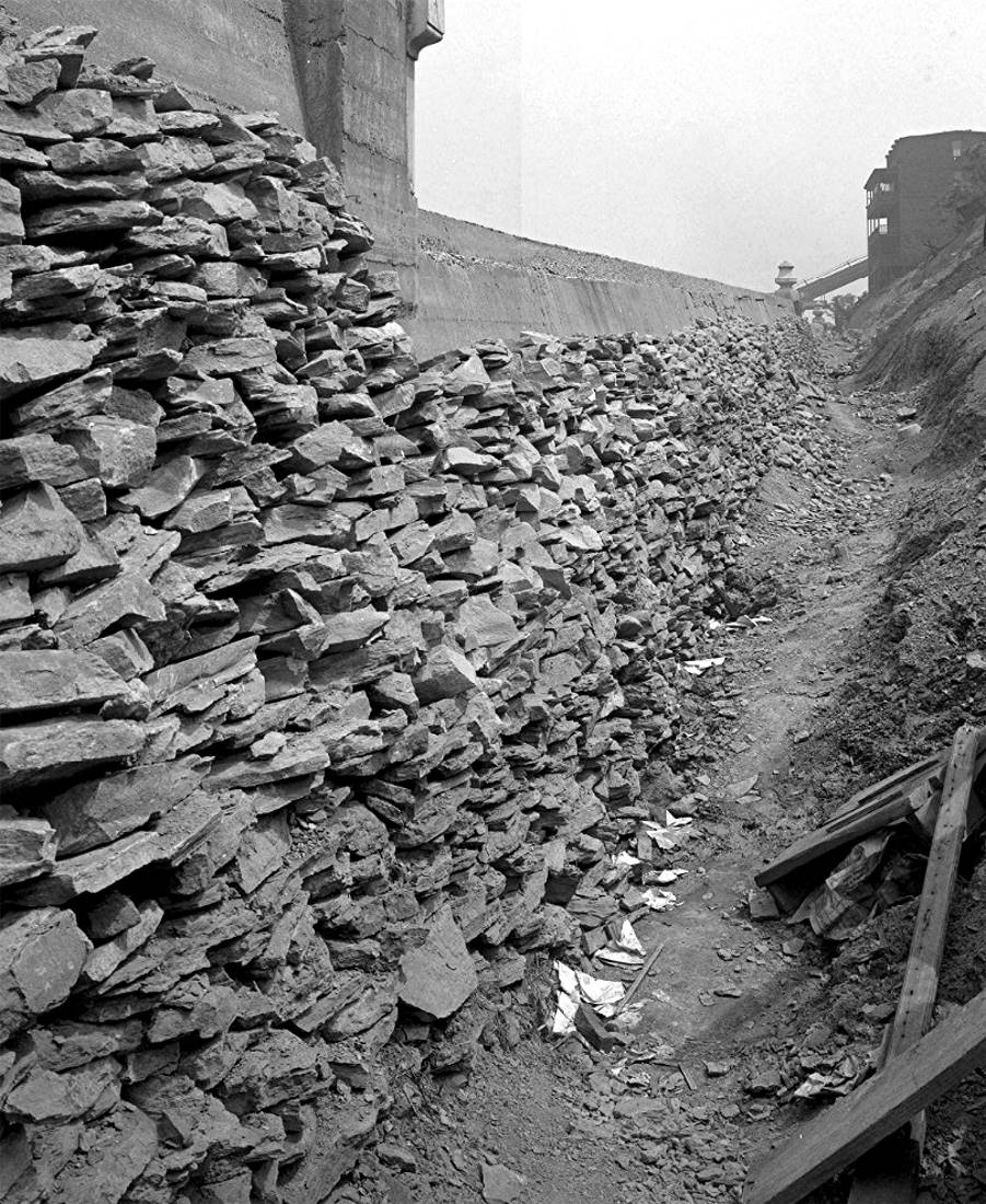
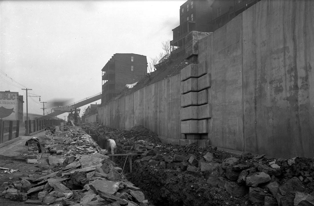
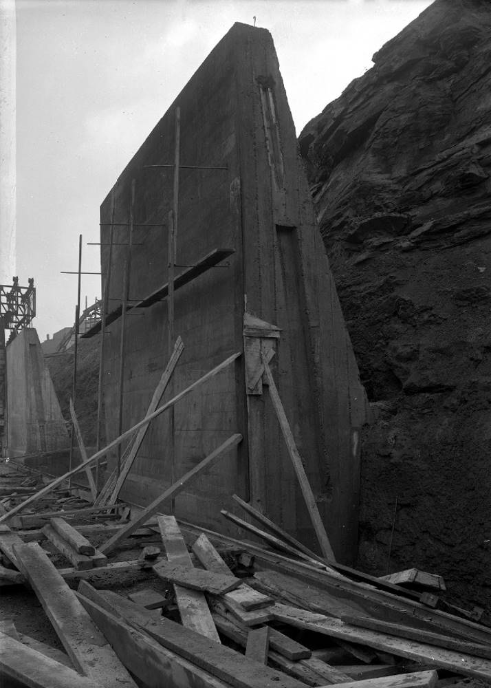
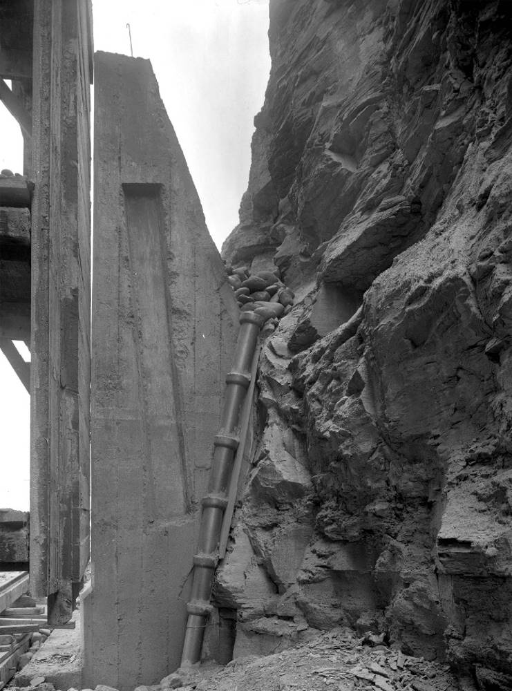
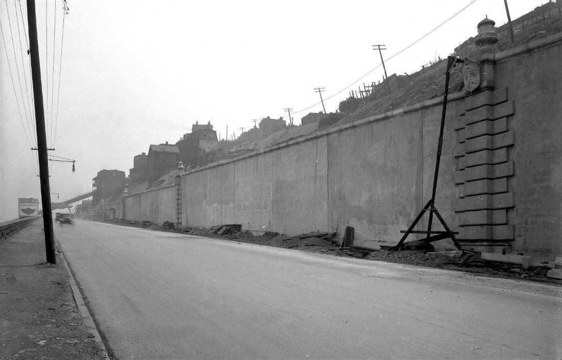
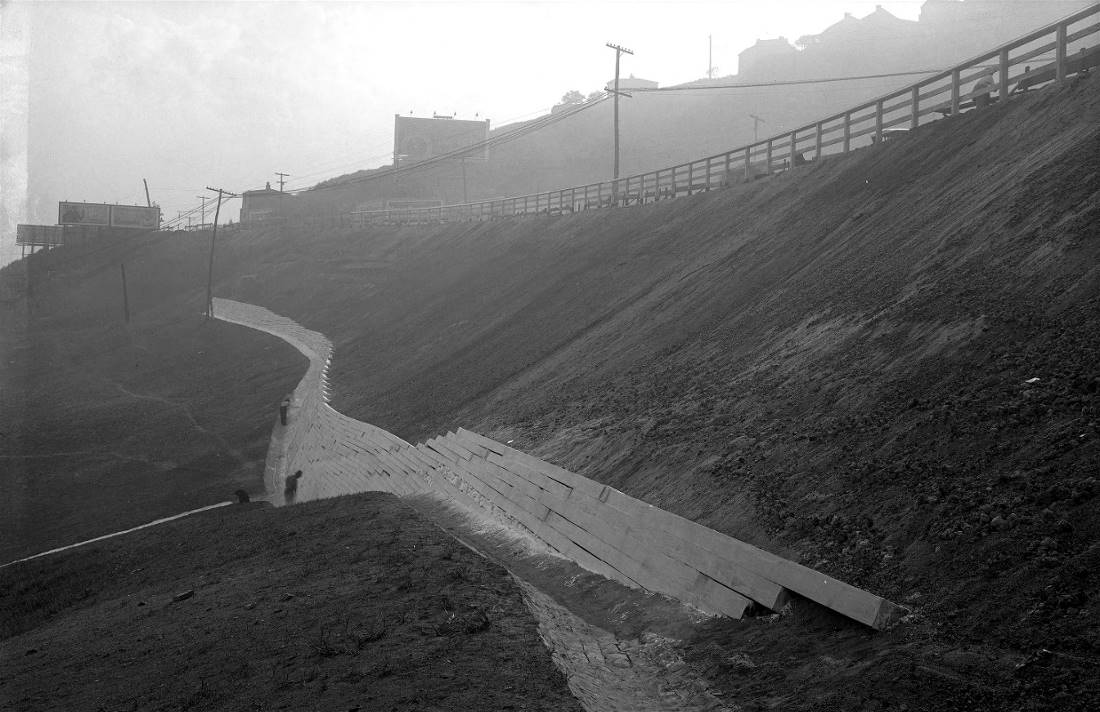
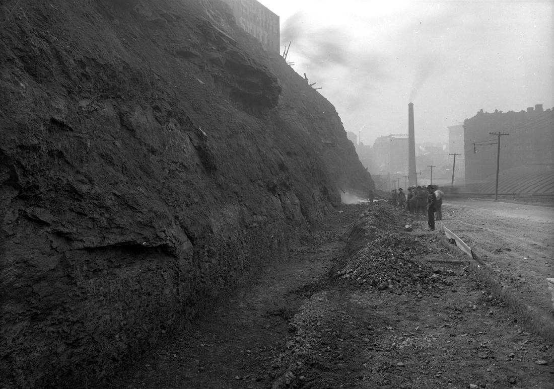
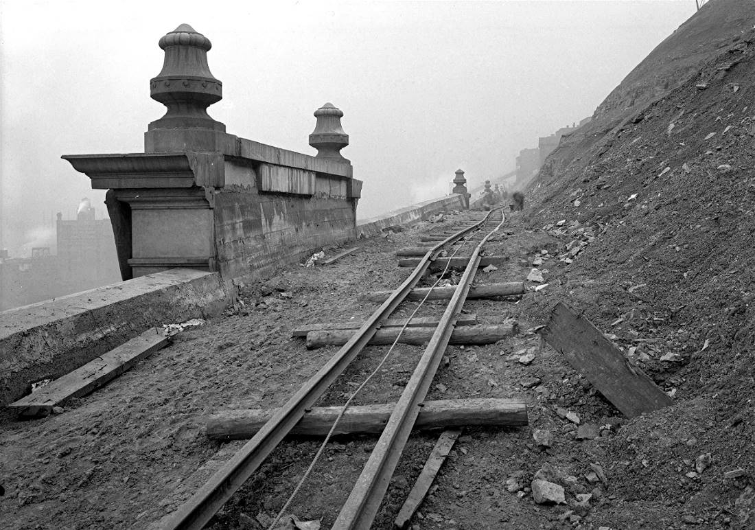
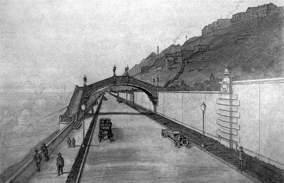
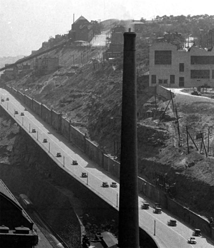
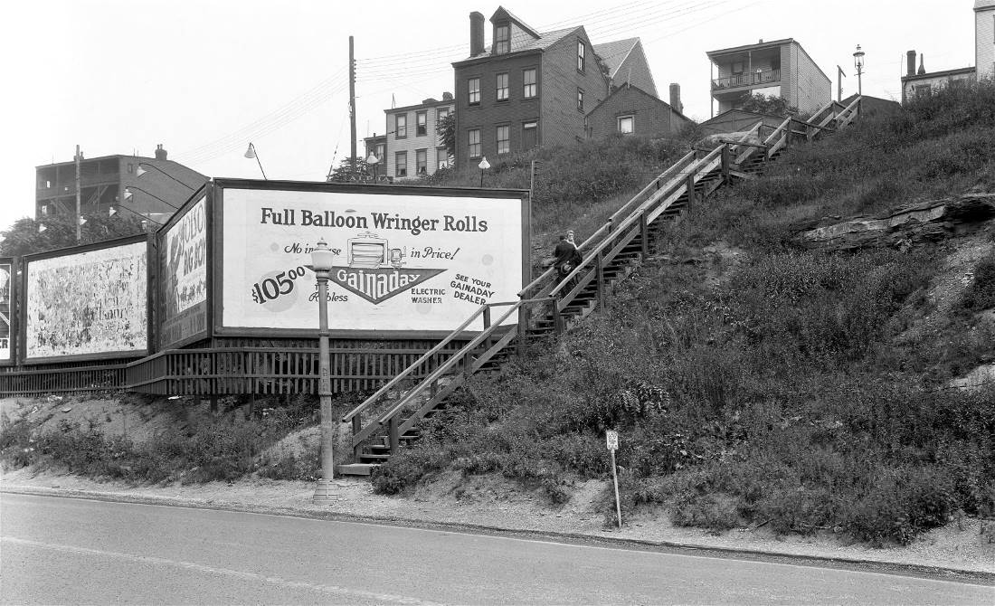
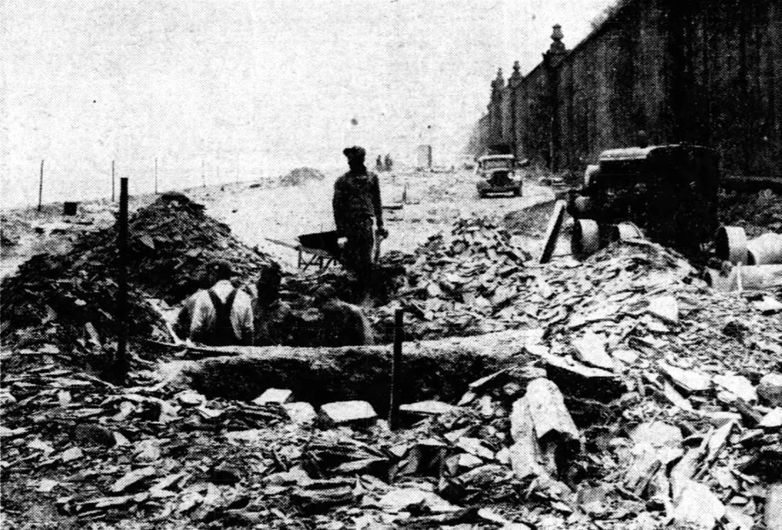
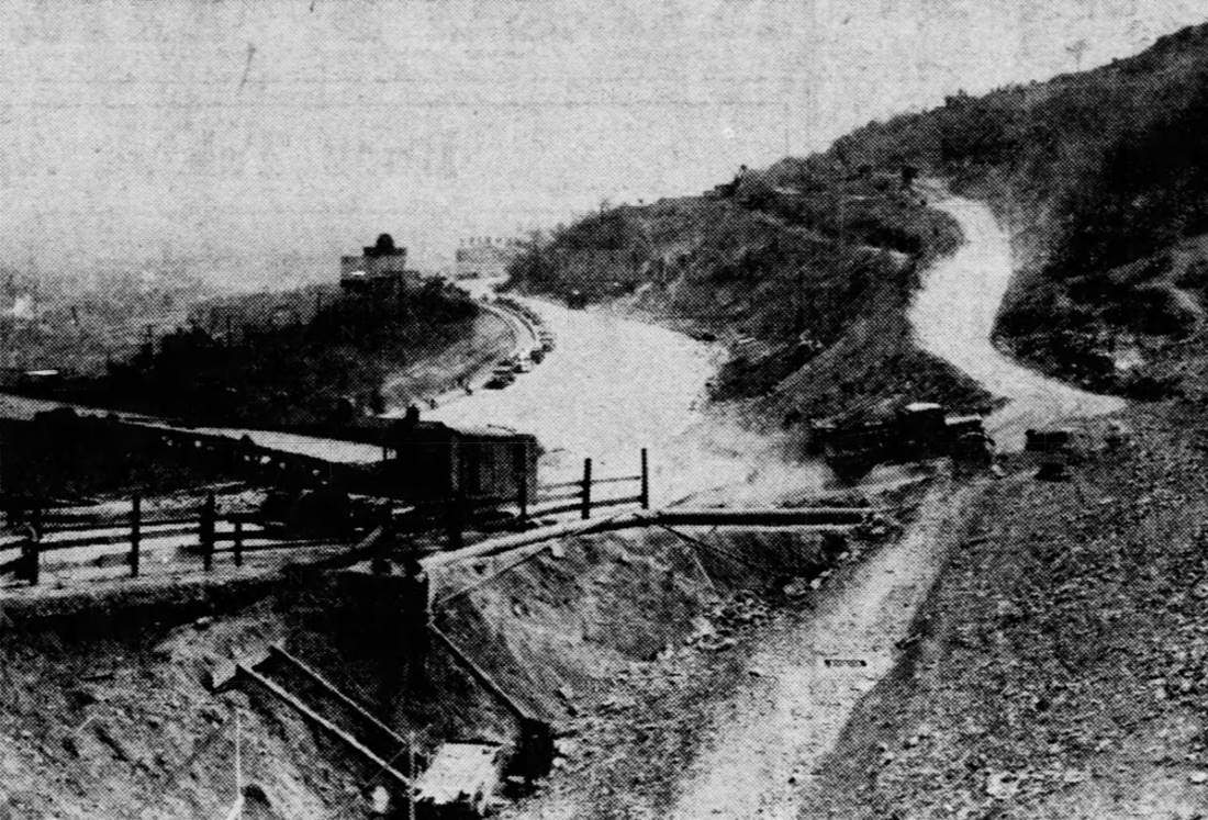
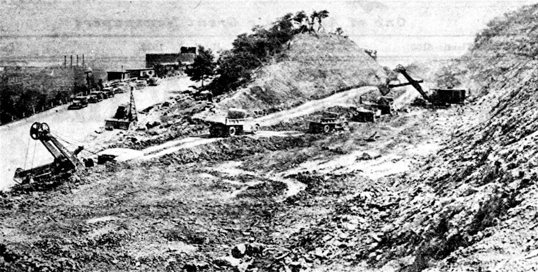
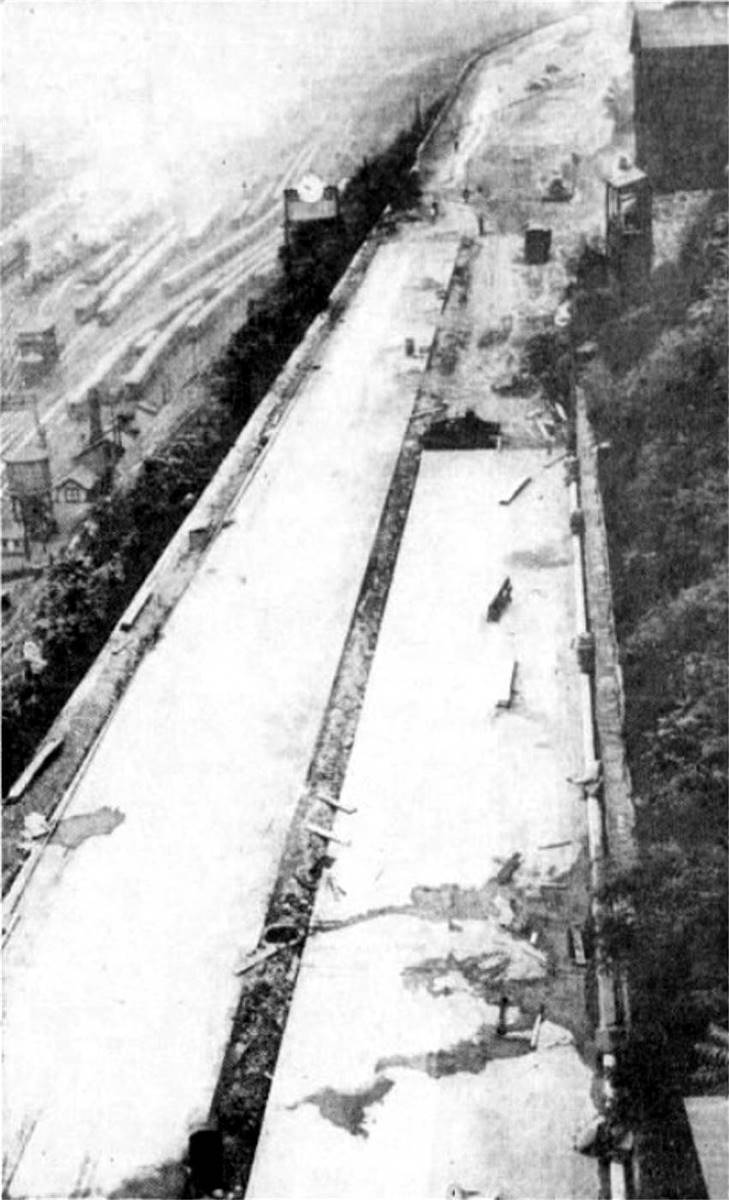
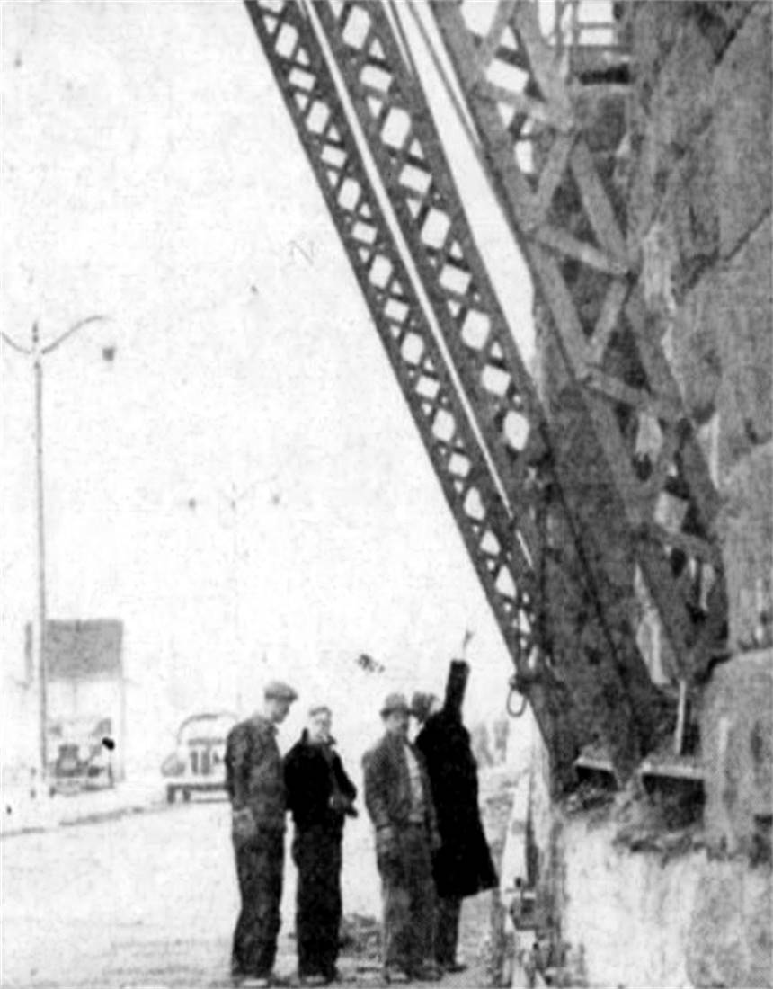
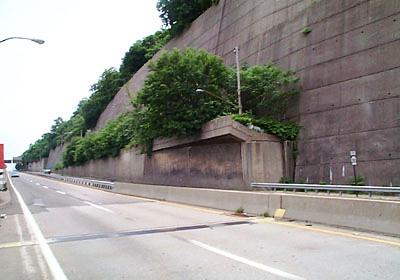
The course of the roadway began at Seventh Avenue with a new section built to Farber Street. It went uphill along a former Pittsburgh and East End Railway trail, which was on the hillside above the Pennsylvania Railroad yards and below the Bedford Basin. This section required a massive and dangerous cut, and the earth proved unstable and prone to landslides. A massive retaining wall was eventually built along the hill below the roadway, extending all the way up the grade. The wall proved a formidable undertaking that required the building of an incline to transport the quarried blocks from the rail yard below. Engineers required blocks that were extra large and thick to hold back the forces of nature. This required the further installation of a small guage railway to move the blocks from the incline. Construction of the roadway took nearly two years and was beset with delays. Lawsuits against the contractor file by the County, State, and Pennsylvania Railroad over the costs relating to the persistent landslides and the increased cost of the resulting construction of the retaining walls dragged on for months.
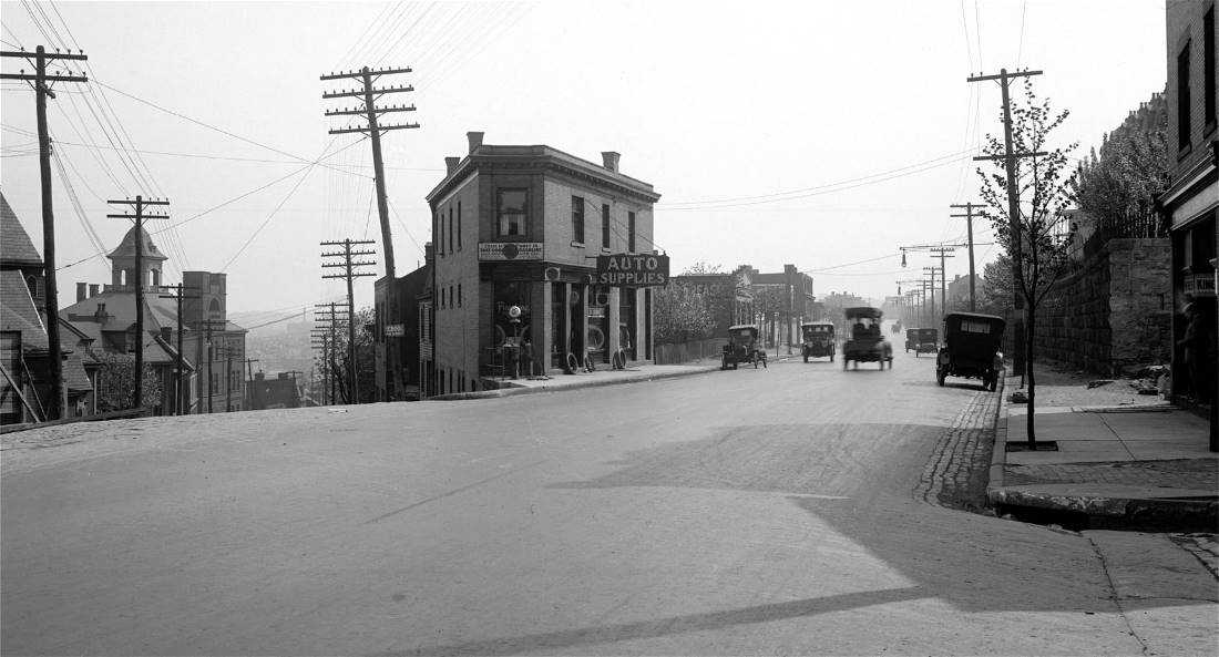
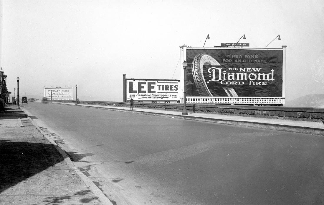
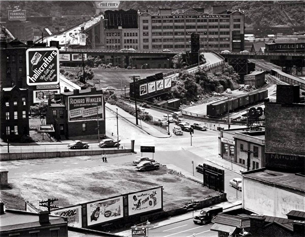
Originally estimated to cost $1 million, the final bill was adjudicated to be $1.5 million. The long-awaited boulevard was completed and opened to traffic on March 31, 1901. Aside from the travel benefits and ease of access to the rural wonders of Oakland and Schenley Park, users commented on the spectacular views of the Strip District, Allegheny River and the lands along the north shore. Grant Boulevard, as it was known at the time, was a major success. It led to the rapid development of the Schenley Farms area. Residents flocked to see the attractions in Oakland and traffic congestion soon became a problem. Determined efforts by the Pittsburgh Railways Company to install trolley lines along the boulevard soon began. In 1904, a decision against the transit company was handed down in court and the scenic drive remained an open roadway. Then, in 1912, the roadway was extended to Webster Avenue in downtown due to the removal of The Hump at Grant Street.
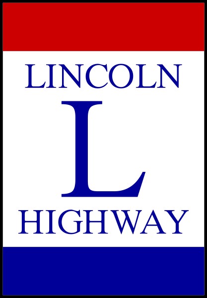
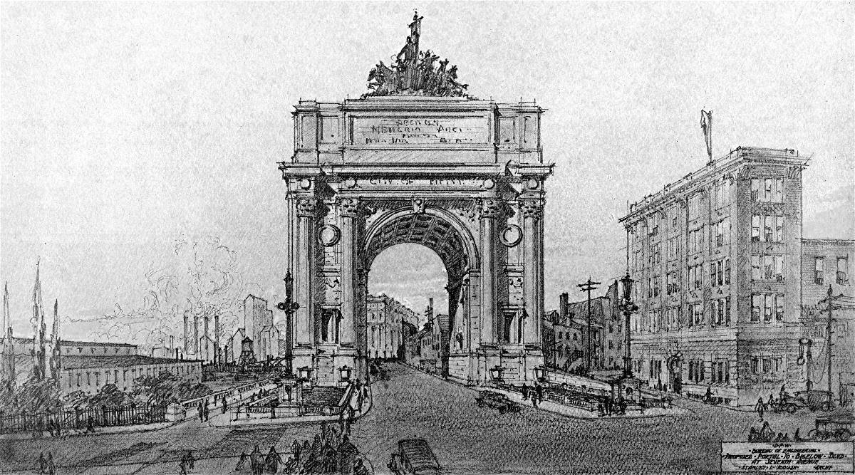
The success of Grant Boulevard led the City Planning Commission, in 1913, to recommend the construction of Monongahela Boulevard, better known as the Boulevard of the Allies, to increase vehicular capacity to the eastern communities. Beginning in 1915, Grant Boulevard was designated as US Route 22/US Route 30 and became part of the national Lincoln Highway. In 1916, the roadway was renamed Bigelow Boulevard after the death of Edward Manning Bigelow. The US Route 22/30 designation was switched to the Boulevard of the Allies in 1926.
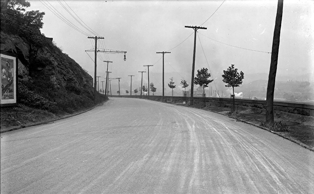
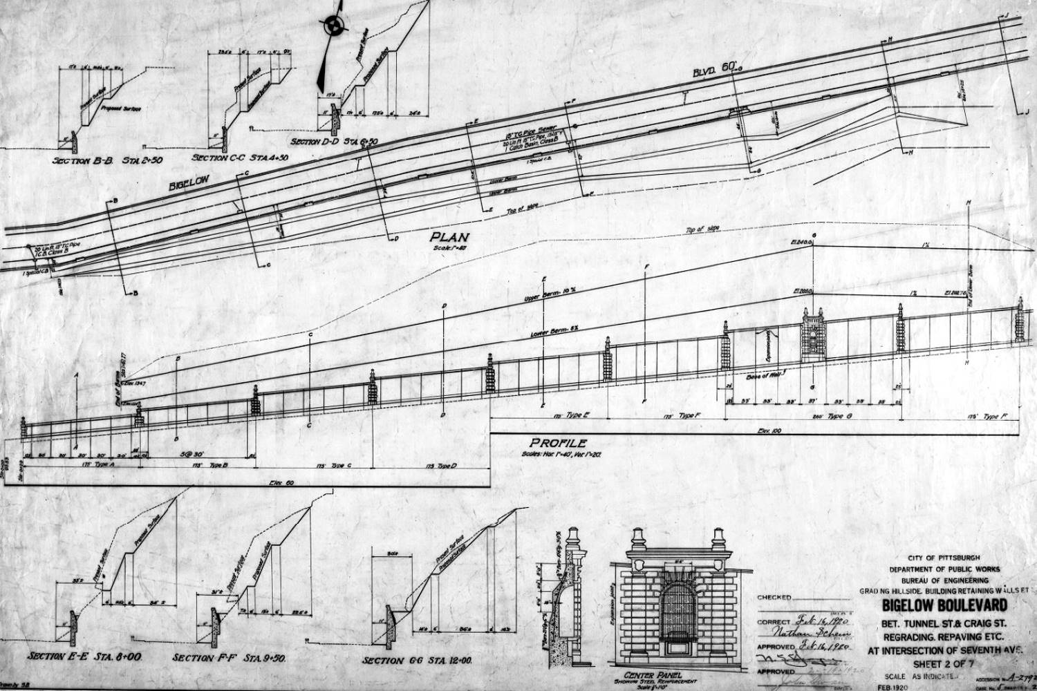
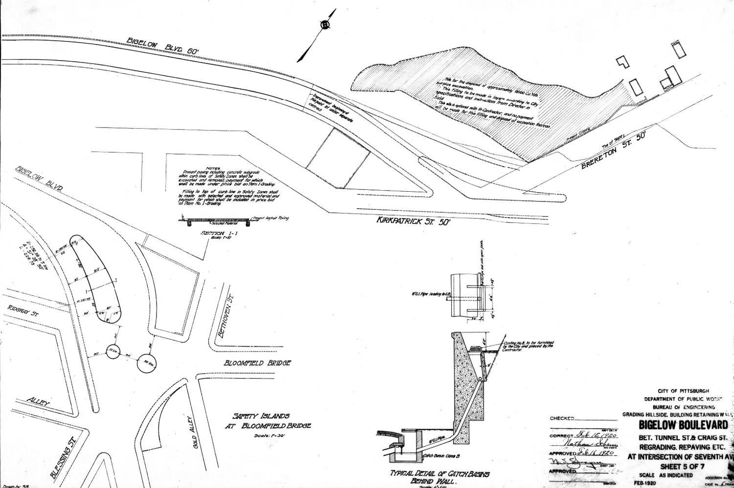
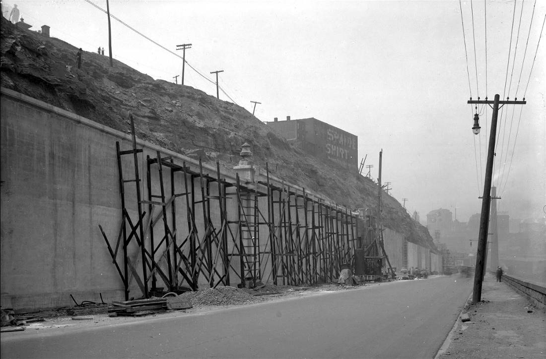
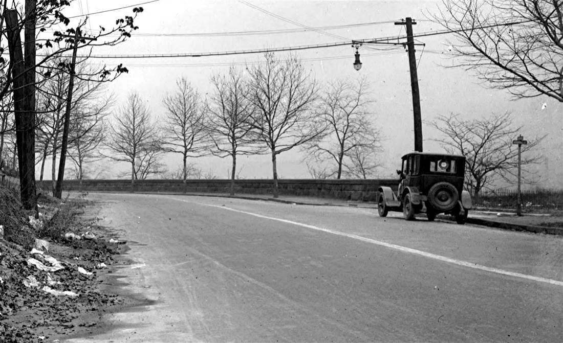
Repeated landslides caused problems with both vehicular traffic and with the Pennsylvania Railroad line that ran along the base of Bedford Hill. Engineers were unable to stop the persistent deterioration of the hillside. In November 1920, a disastrous landslide prompted the city to begin restoration efforts along the roadway. Retaining walls were built both above and below the boulevard.
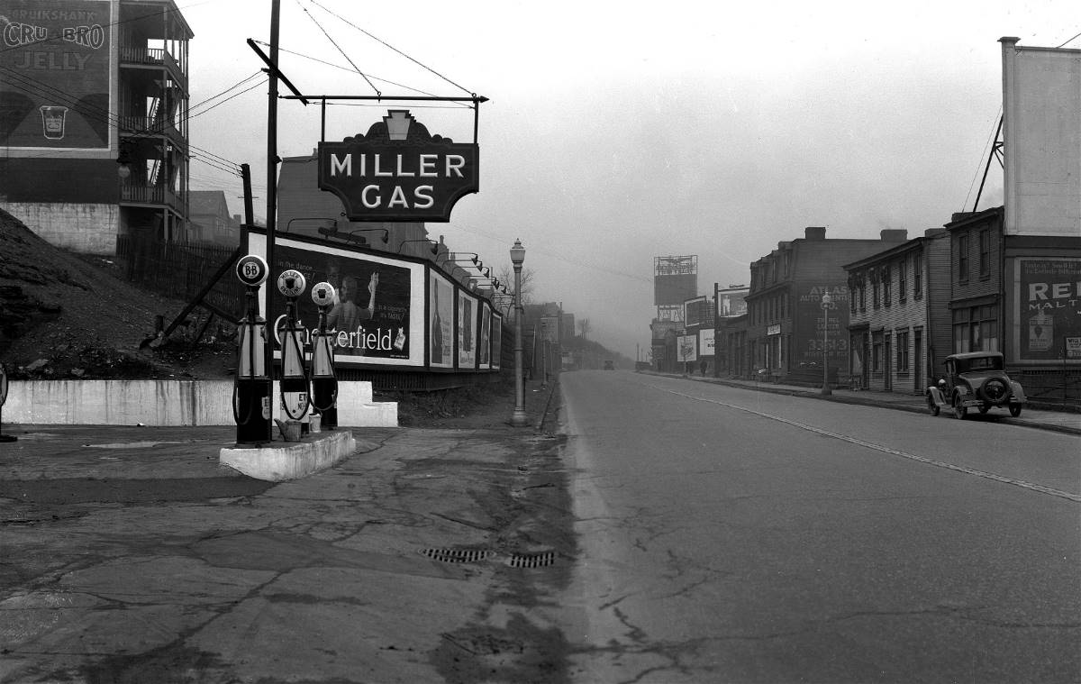
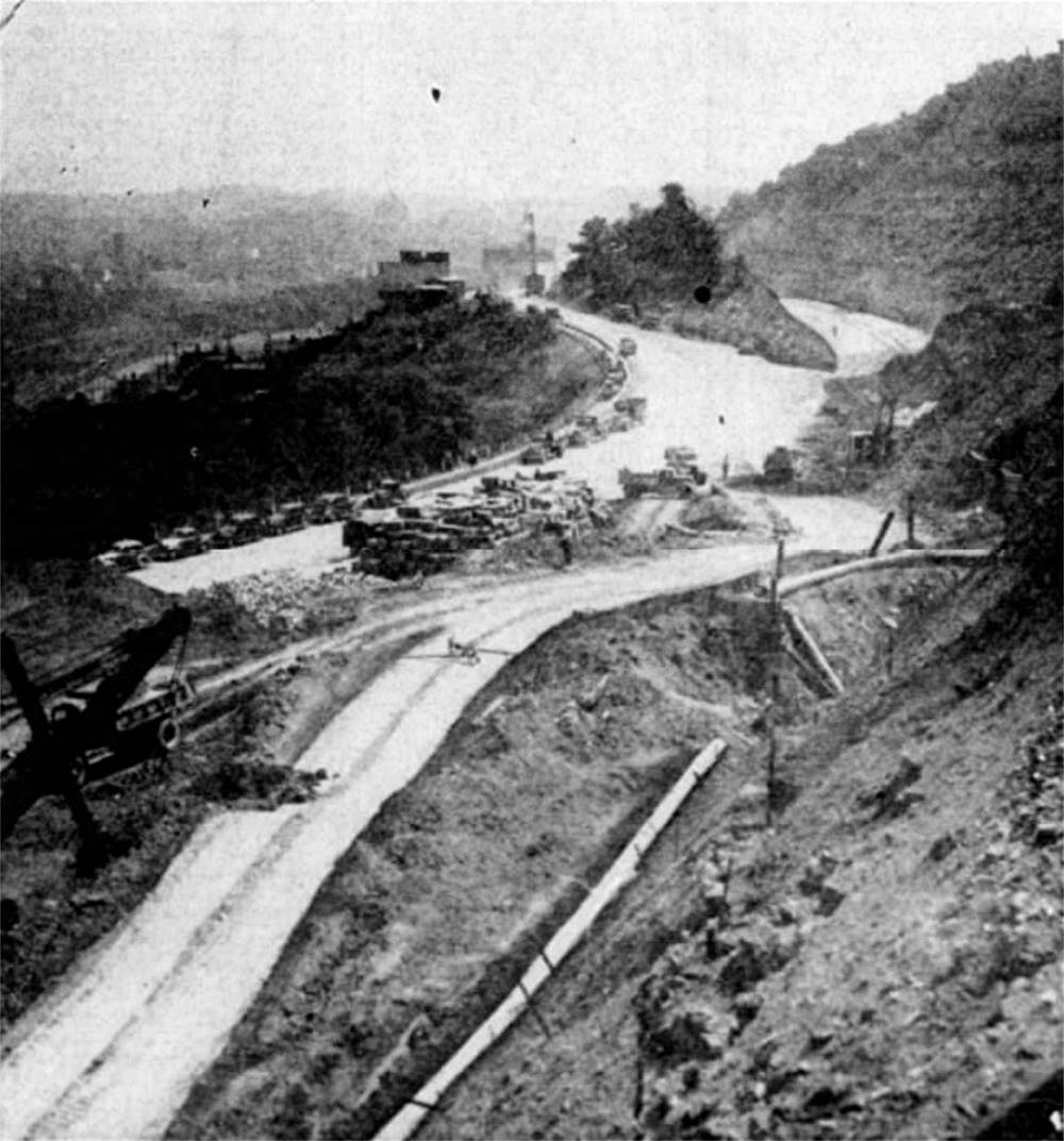
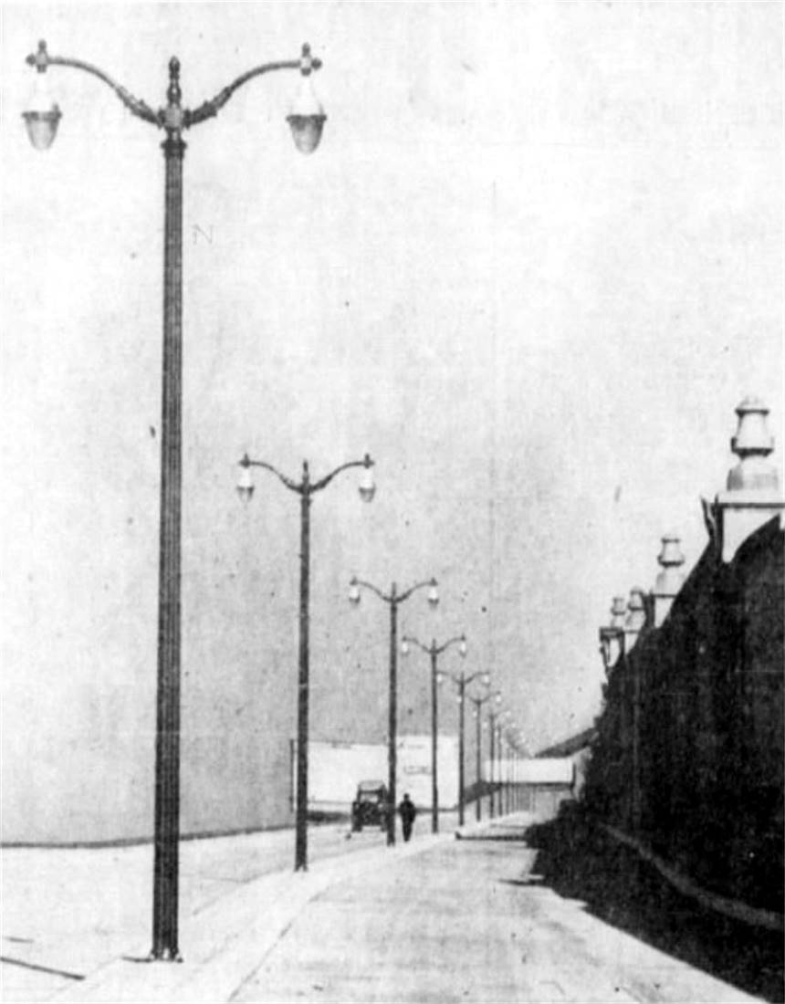
By 1936, the roadway had again deteriorated to the point where motorists refered to it as "no man's land." A major renovation project began. A concrete surface was laid and new lighting installed. The scenic Bedford Hill overlook park was constructed alongside the boulevard. The grand reopening was in December 1939.
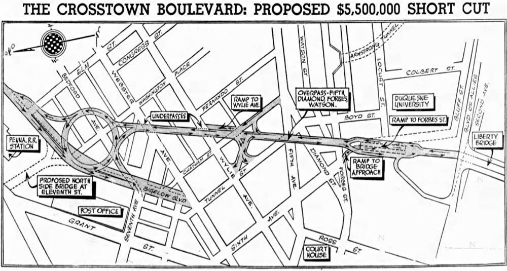
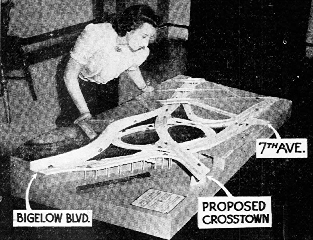
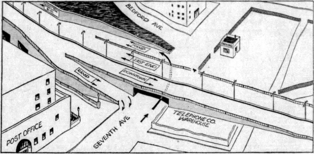
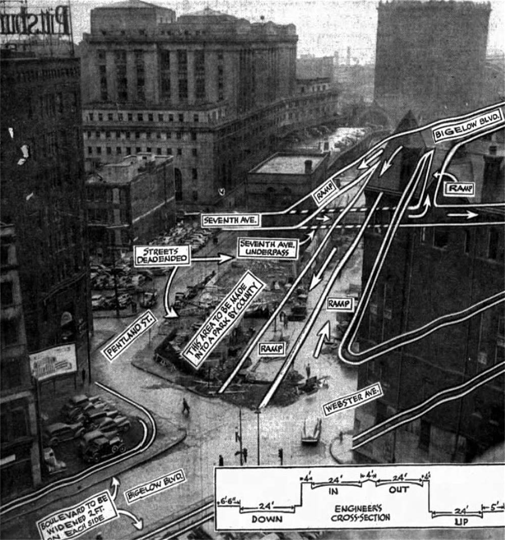
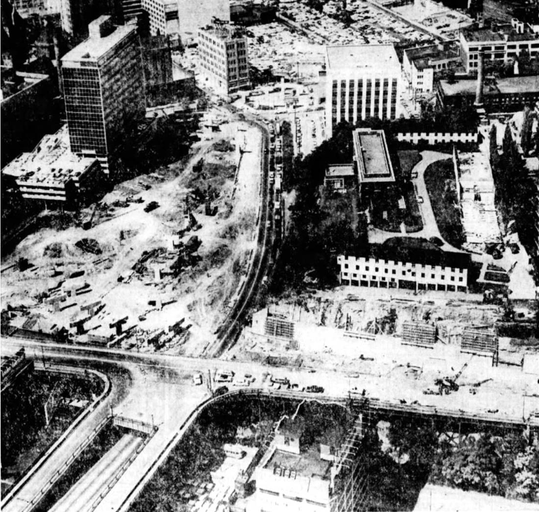
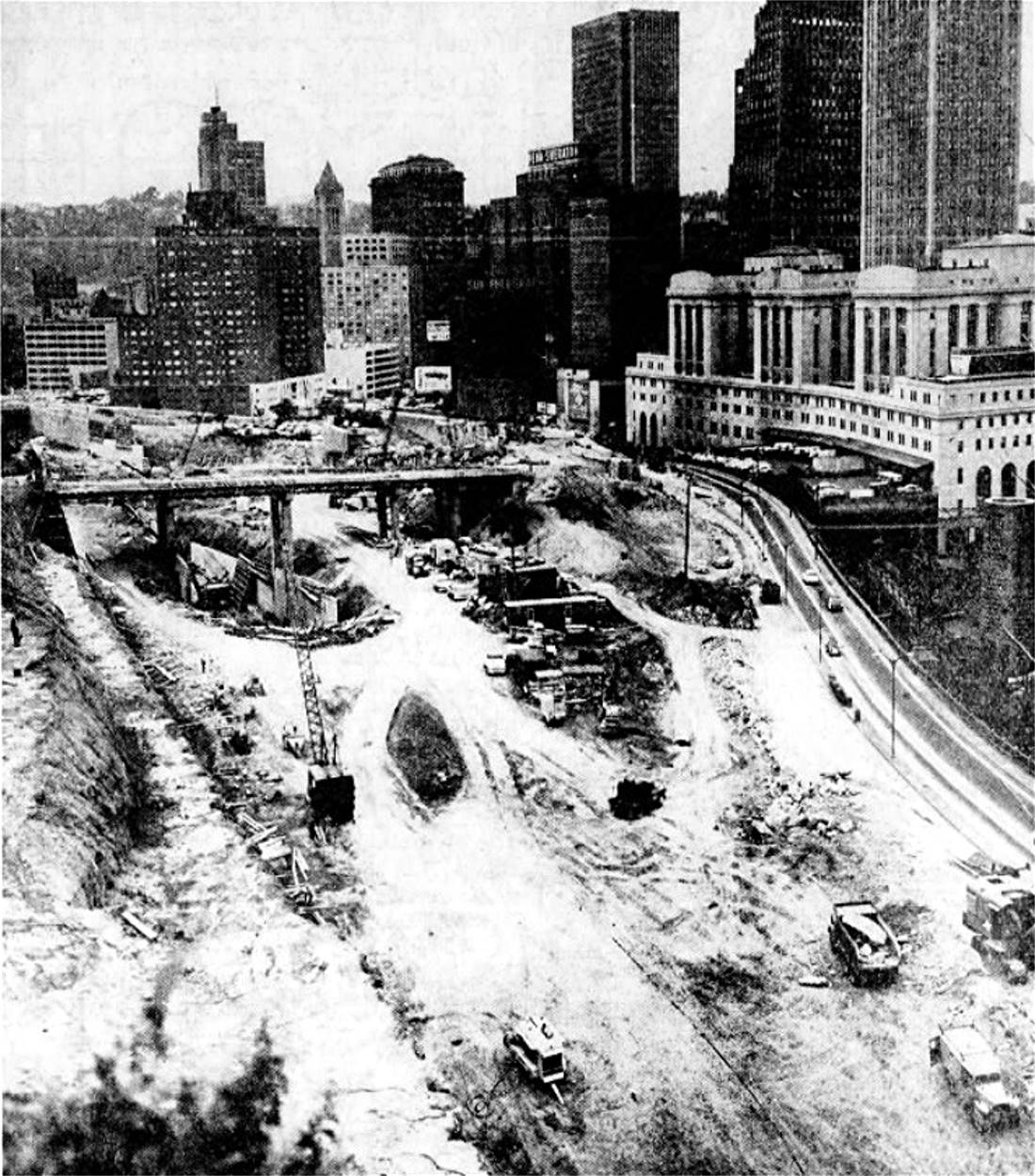
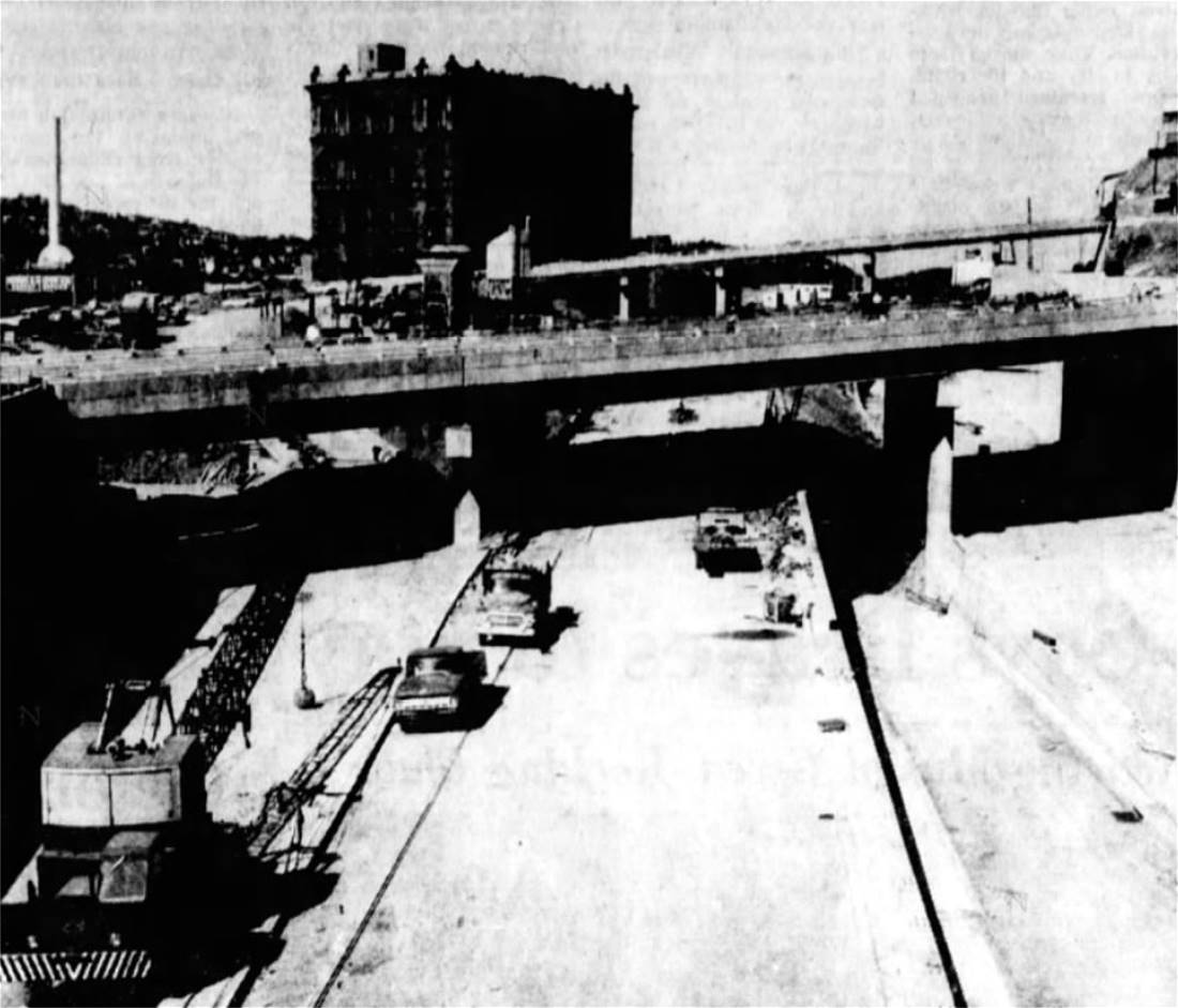
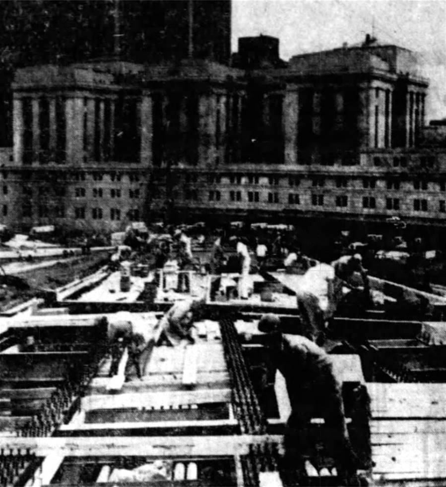
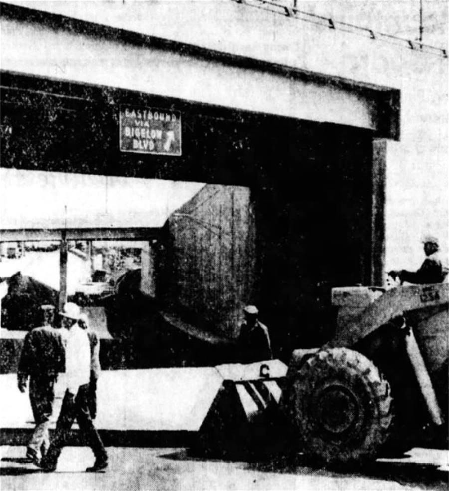
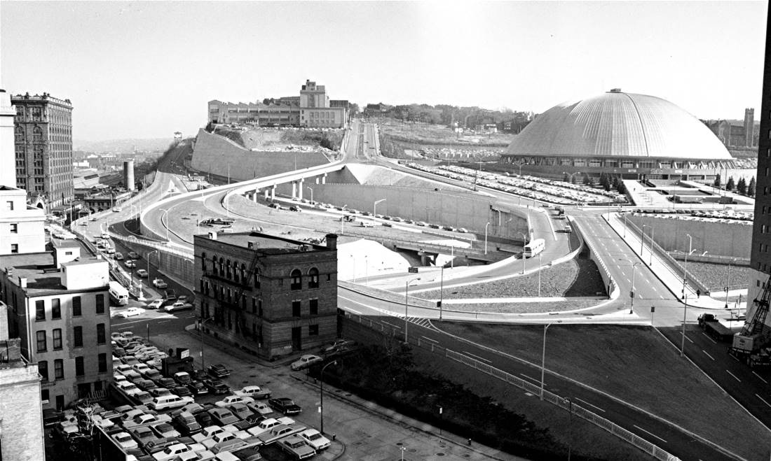
In the two decades that followed, the majority of the roadway remained basically the same, with occasional improvements. More dramatic changes have occurred twice. As the 1950s drew to a close, the construction of Crosstown Boulevard forever alter the downtown end of the boulevard.
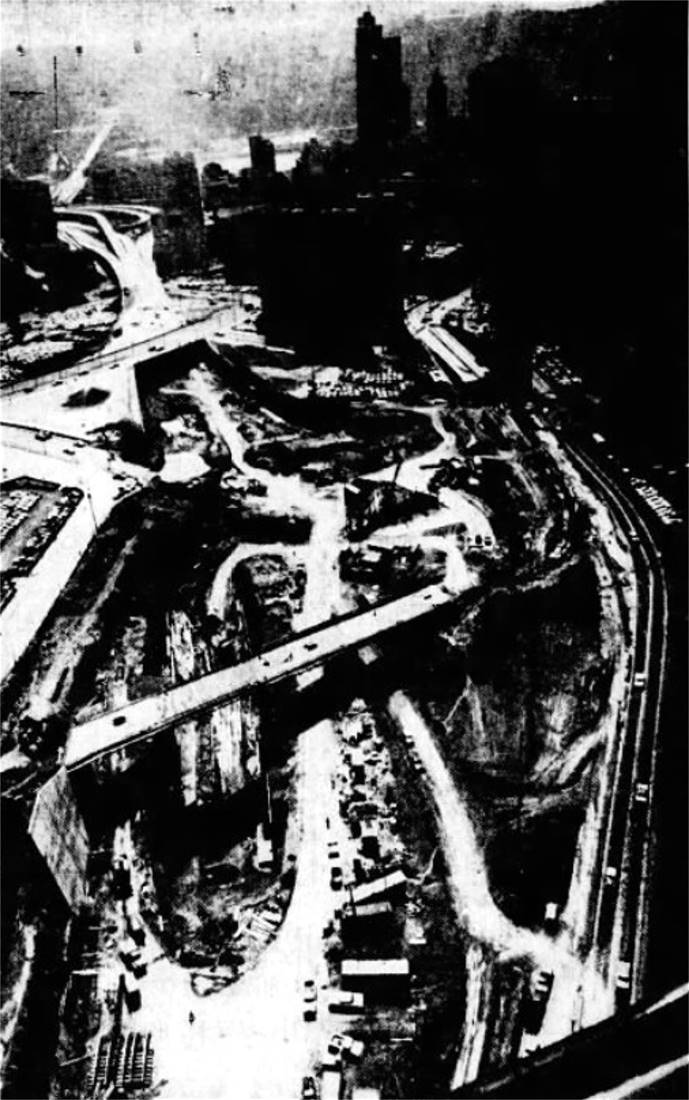
The bridge carrying Bigelow Boulevard over the expressway to Seventh Avenue was built in 1960. The rest of the Crosstown bridges and ramps were finished in 1962. Then, in 1986, new traffic patterns were installed at the Bloomfield Bridge intersection and the offramp from the Veteran's Bridge was built.
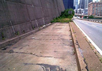
Among the interesting sites motorists encounter as they drive along Bigelow Boulevard is a partially completed ramp known as the "Ghost Ramp." Original plans for the Crosstown/Bigelow interchange included preliminary work on entrance and exit ramps that would connect Bigelow Boulevard to the I-579 expressway, which was still in the planning stages. The original design for the highway included a full interchange at Bigelow. Years later, when the Veteran's Bridge and I-579 were completed, the proposed ramp was not used. The mysterious Ghost Ramp remains as part of the retaining wall.
Today, over a century since it was first opened to traffic, Bigelow Boulevard is still one of the most traveled roads in the City of Pittsburgh. The scenic roadway provides commuters with easy access between the eastern communities and the city center. |