|
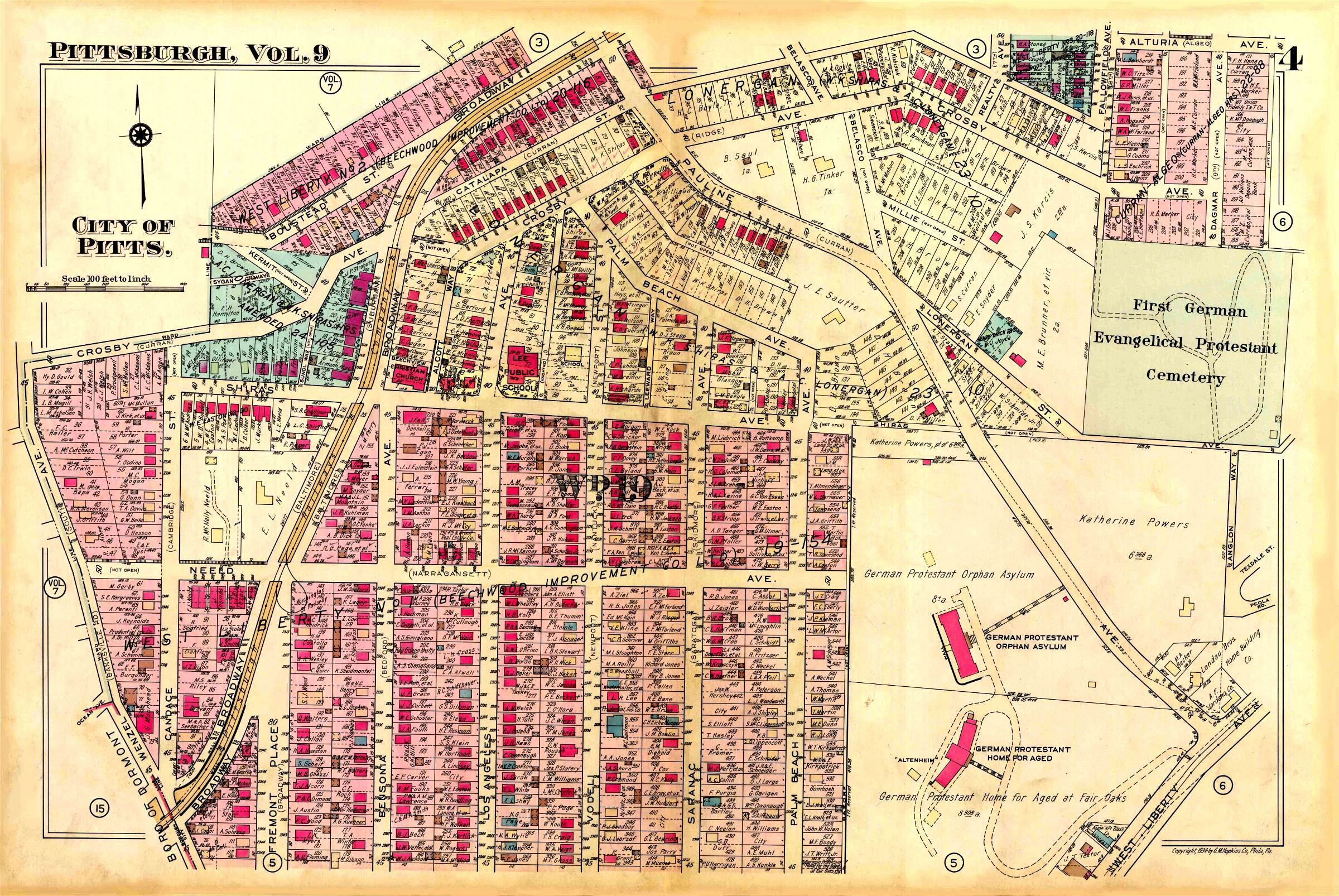
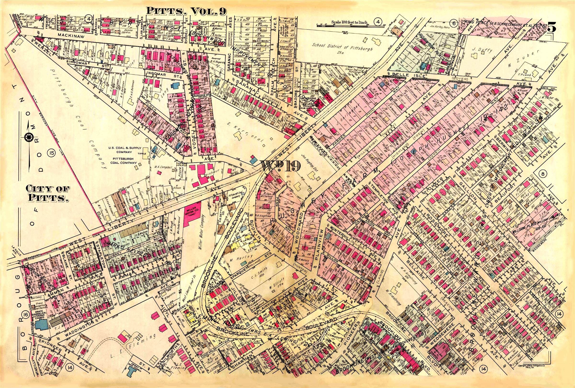
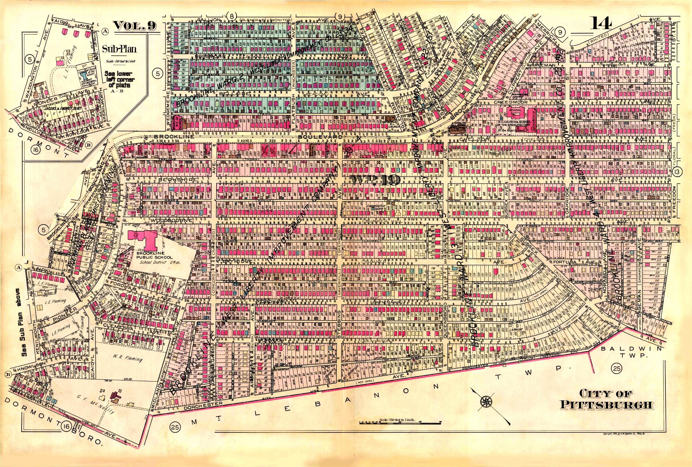
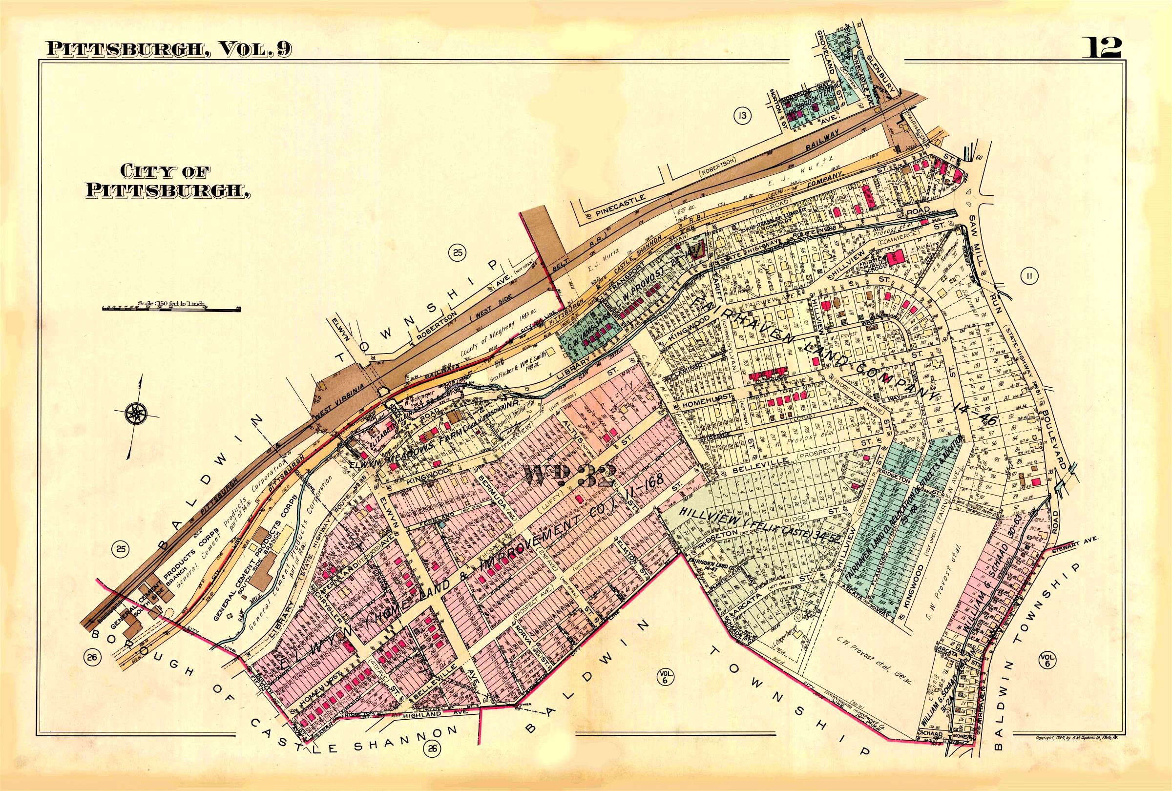
The following map sections make up a detailed look at the Brookline community and the perimeter areas in 1940. The individual sections below make up the numbered plates on the index map above. The original map was drawn in 1934 and revised in 1940. The map is a part of the The Hopkins Map Collection, located in the University of Pittsburgh's online Digital Library.
|
||||||||||||||