|
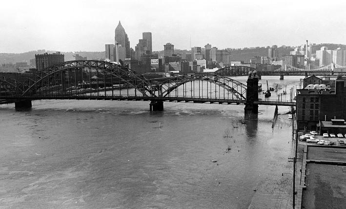
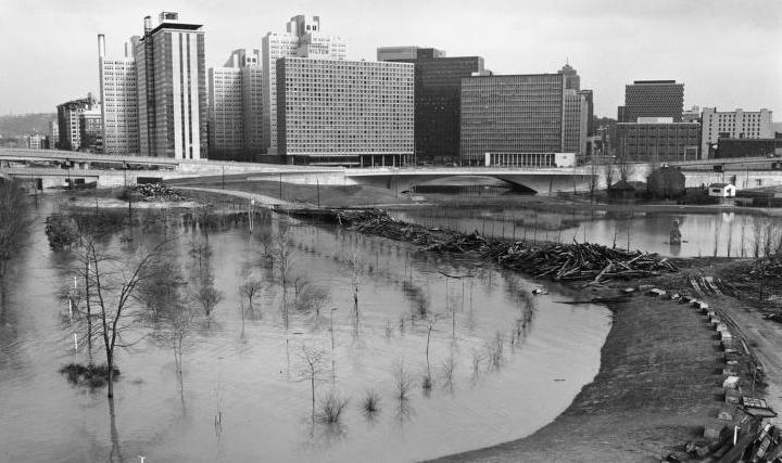
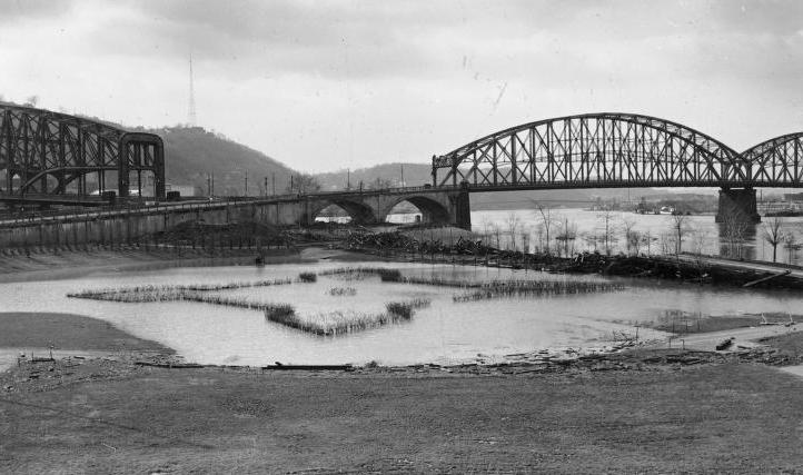
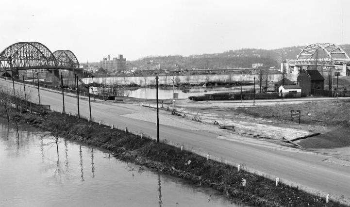
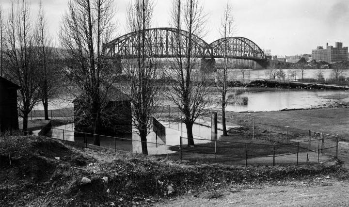
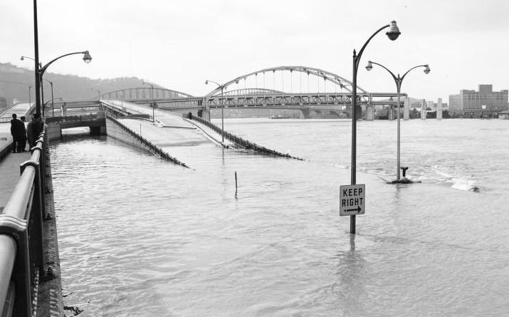
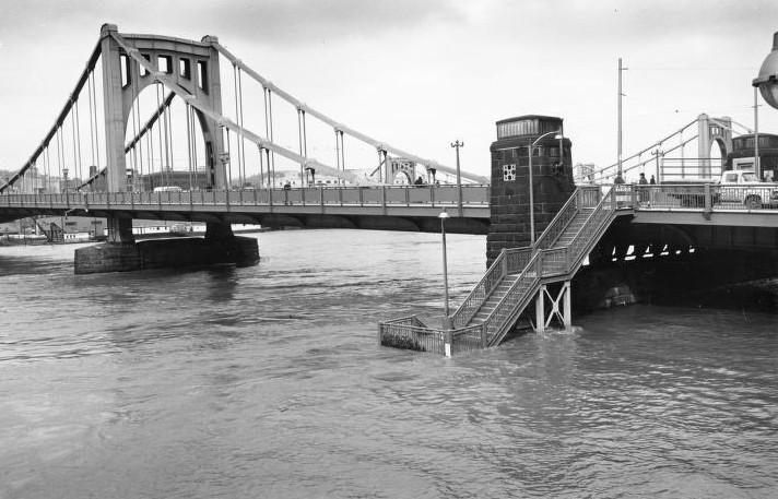
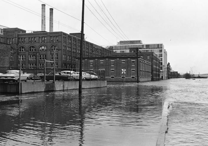
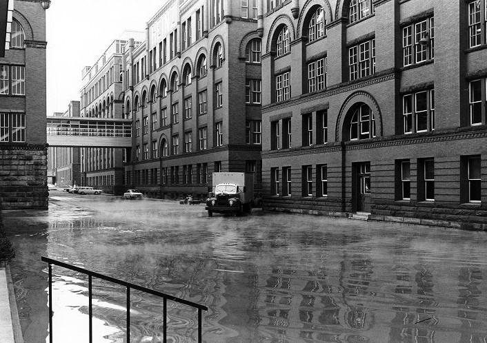
Point State Park is inundated with flood waters on March 11, 1964 as record rainfall caused widespread flooding in Western Pennsylvania and along the Ohio River basin. The waters of the Allegheny River crested at 31'6" in the Pittsburgh region. This was the worst flood to hit the Pittsburgh area since Hurricane Hazel caused the rivers to crest at 32'4" in 1954. The waters of the Ohio River crested at 47 feet. Areas hit hard included the Point and the lower North Side along River Avenue to Federal Street. Several businesses were forced to move merchandise to higher levels. The Heinz factory closed for three days. Several boats were sunk down river from the West End Bridge, Approximately 300 people statewide were forced to evacuate their homes as a result of the flood. The severity of the flood prompted President Lyndon Johnson to conducted aerial surveys of the damage from his private jet. The Governor of Pennsylvania, William Scranton, declared a state of emergency and Pittsburgh was designated a disaster area. Floods remained an annual threat until the completion of the Kinzua flood control reservoirs on the upper Allegheny River in 1965. The photos below show some of the damage done to the Point and the Heinz factory on the North Side. Click on images for larger photos.
|