|

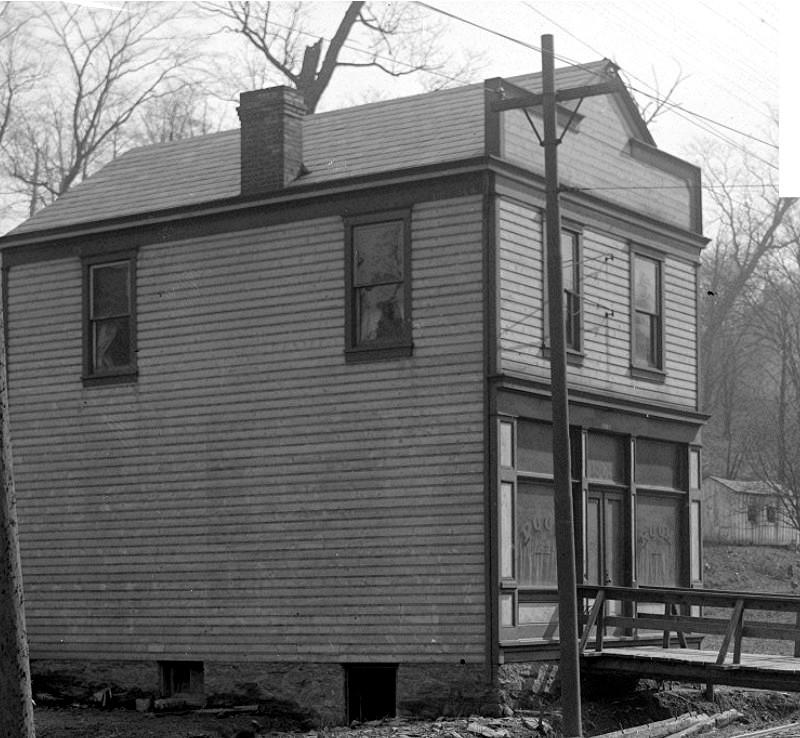
William G. Dooley's Central Meat Market
at the corner of Stetson and West Liberty Avenue in March 1912.
West Liberty Avenue was the central
roadway through the borough of West Liberty (which comprised mostly the
present-day Beechview and Brookline communities). Once known as Plummers
Run (due to the creek that ran down the valley), development along
West Liberty Avenue began in earnest after the opening of the Mount
Washington Transit Tunnel, which brought streetcar service and rapid
residential development to the southern suburbs of Pittsburgh. This
random collection of photos give a glimpse of what West Liberty Avenue
looked like from 1903 through 1913.

Click on images
for larger pictures
<><><><> <><><><>
<><><><> <><><><>
<><><><> <><><><>

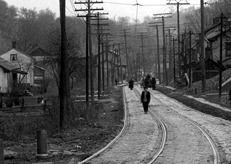
May 10, 1903 - A Pittsburgh Railways traction car brings
investors and home buyers to West Liberty Avenue at Cape May,
part of the Beechwood Improvement Company's West Liberty Plan #3. The photo
appears to have been
taken from the roof of the two-story building that stood along West Liberty
Avenue
at this intersection. That building was the original West Liberty Schoolhouse.

A trolley car passes homes along West Liberty
Avenue, just to the north of Brookside Avenue (circa 1903).
Laid down in 1901, at the time of this photo these tracks were part of the Pittsburgh
to Charleroi
Railway. By October of 1905 the line along West Liberty Avenue would be
double-tracked.
<><><><> <><><><>
<><><><> <><><><>
<><><><> <><><><>
 
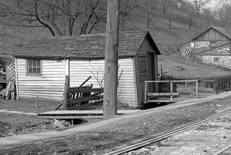
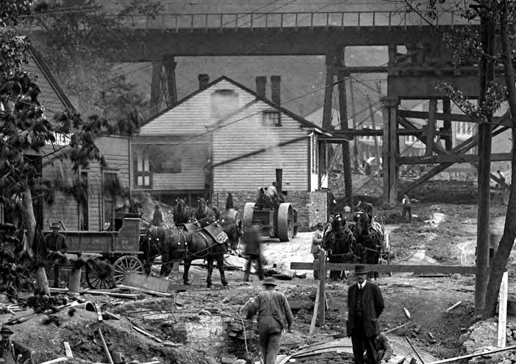
The Pittsburgh Coal Company power plant at
the Brookline Junction (left), and Kerr's blacksmith shop, in 1909.
The Brookline Junction (left), at the corner
of West Liberty Avenue and Brookline Boulevard in 1909, and a
billboard near Cape May advertising available lots in the newly
developing Brookline neighborhood in 1910.
<><><><> <><><><>
<><><><> <><><><>
<><><><> <><><><>
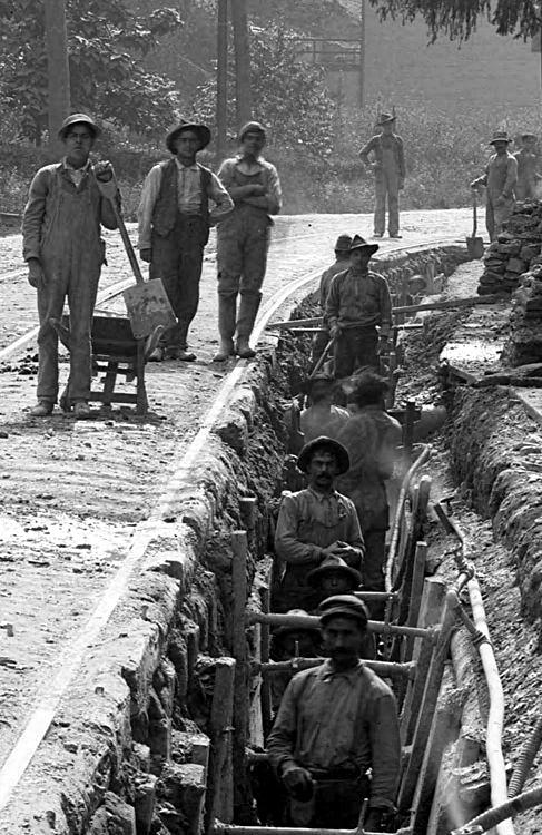
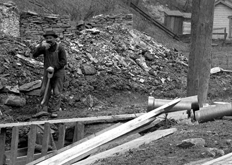
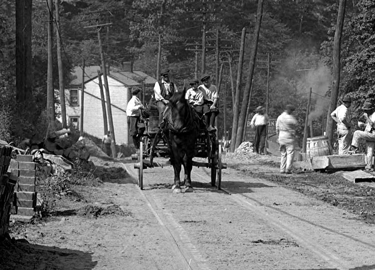
Many of these photos show construction
workers along different points of West Liberty Avenue when the initial city
sewer lines were being laid in 1910. The men are hard-working craftsmen and
laborers that were the backbone of the Pittsburgh "Melting Pot" culture. Without
the benefit of modern machinery, these men used the tools available and played
a major part in helping to build the infrastructure essential to the development
of the community of Brookline.
Workers laying a sewer line south of
Pauline Avenue (left), and north of Ray Avenue, in 1910.
 
Workers laying a sewer line north of Ray
Avenue in 1910. The Capital Avenue intersection is visible in the left photo.
<><><><> <><><><>
<><><><> <><><><>
<><><><> <><><><>
Along West Liberty Avenue
there were several areas that were more developed than others. One of these
places was the junction with Warrington Avenue, near the present-day
Liberty Tunnels. This was a crossing point for most traffic from Fairhaven and
West Liberty heading towards Pittsburgh. It was also a hub for the suppliers and
contractors that helped build the developing community of Brookline. Along with
hotels, general stores and pubs, the intersection had two lumber suppliers,
building contractors, a blacksmith and a wagon repair shop.
 
An ad for the Gazette Times on a fence (left),
and a building contractor's garage at the Warrington Junction, in 1912.
 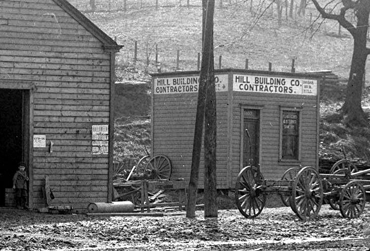
Ads along the side of Shaffner's wagon
repair shop (left), and the Hill Building Company office, in 1912.
 
Peter Shaffner stands in front of his home
at the corner of West Liberty Avenue and Pioneer Avenue (left),
and Shaffner's Horseshoeing and Wagon Works, next to the family home, in
1912. The Shaffner family
once owned much of the terrain near the intersection of Warrington and West
Liberty Avenue
and sold the land that would one day be the South Portal of the
Liberty Tunnels.
<><><><> <><><><>
<><><><> <><><><>
<><><><> <><><><>
As residential development moved south
from Pittsburgh, commercial development soon followed. By 1912, there were
many businesses located between Warrington Avenue and the city line in Dormont.
These establishments, which included markets, bars, hotels, restaurants,
liquor stores, poolrooms and clothing stores, were usually situated near the
major intersections and car stops along the broad avenue.
 
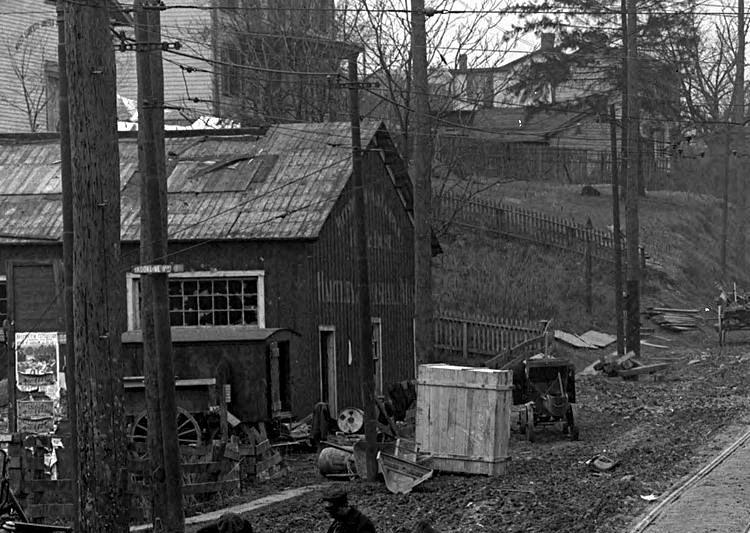
Kerr's Horseshoeing and Wagon Building (left),
located at the intersection of West Liberty Avenue and Wenzell,
and J. Claude Groceries, located between Belle Isle Avenue and Pauline,
in 1912.
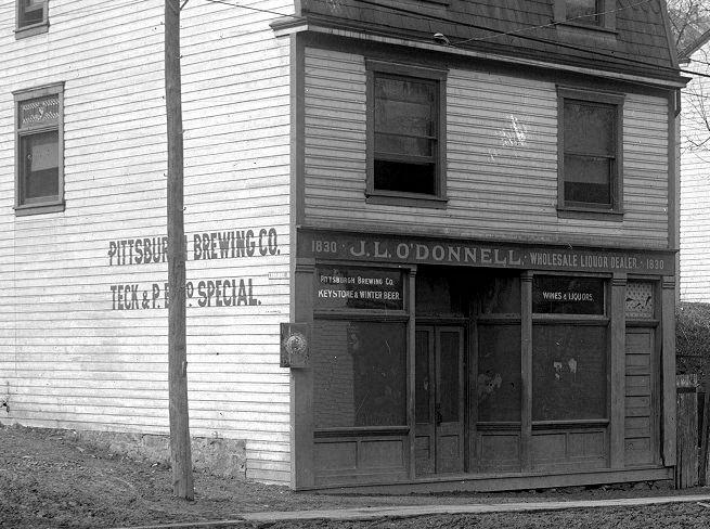 
J.L O'Donnell's wholesale liquor store (left),
and another store across from Capital Avenue, in 1912.
The billboard advertises lots in Beechview's Curran-Alego housing plan.
A Pool Room near the intersection with Capital
Avenue (left), and a small market near Brookside Avenue, in 1912.
The Pool Room was located at the site of the present-day West Liberty Auto
Glass.
 
A Stableing barn across from Capital Avenue
(left), and looking south towards the intersection with Curran Hill, in 1912.
 
J.E. Sill Roofing and Repairing, located
north of Brookside across from the present-day Matthews Bronze (left),
and a General Store owned by Estella Flanders, across from the Ray Avenue
steps, in 1912.
<><><><> <><><><>
<><><><> <><><><>
<><><><> <><><><>
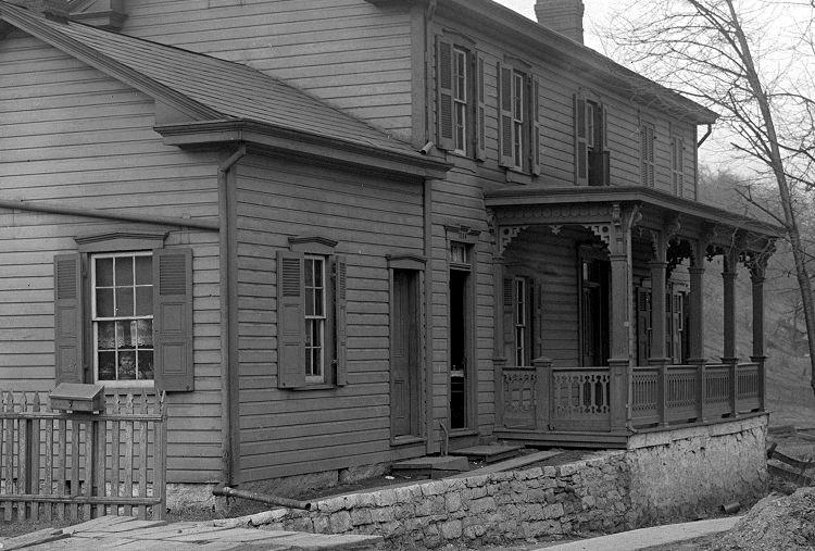
In addition to the many
commercial establishments, by 1912 there were several homes along West Liberty
Avenue. Many of these dated back to the mid-1800s and were the family residences
of some of the more prominent landowners of the time, like the Shaffners, Flanders,
Beltzhoovers, Wenzells, Kerrs and Knowlsons. In some places West Liberty Avenue
resembled an average residential street. Many of the homes shown here were
torn down during the expansion of West Liberty Avenue in 1915, and most of the
others were bought out, and the hillsides cut back, during later commercial
expansion. Only a few of these vintage homes remain.
 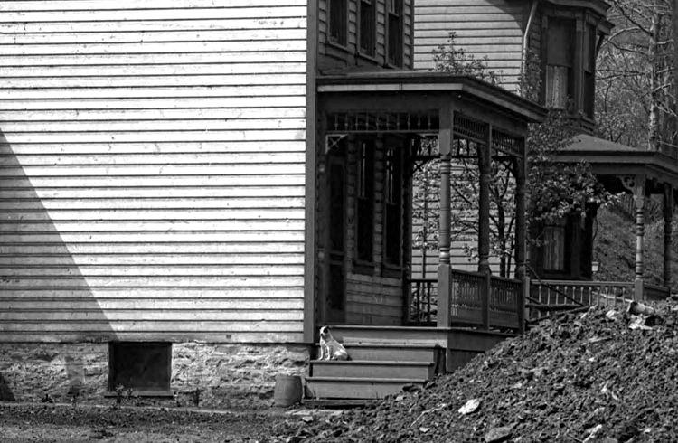
The side porch (left), and a dog on the
front porch, of a home north of Cape May in 1910.
Ground-level and hillside homes north of
Ray Avenue (left), and wagons parked at a store north of Brookside, in 1910.
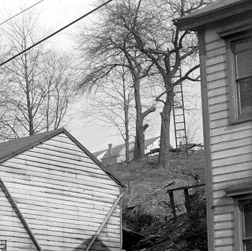 
A ladder rests against a tree (left)
above West Liberty Avenue, and a nearby home
on the hillside across from Pauline Avenue, in 1912.
 
A Brookline home between Belle Isle Avenue
and the Brookline Junction (left), and the Beinhauer estate and
Livery Stables at Wenzell Avenue, in 1912. The family residence also served
as the Mortuary until 1921.
 
Before modern indoor plumbing became commonplace,
the outdoor well pump and the outhouse
were essential amenities for all of the homes along West Liberty Avenue.
Homes along Woodward Avenue above Stetson
Street (left), and a multiple-family dwelling across the street, in 1912.
 
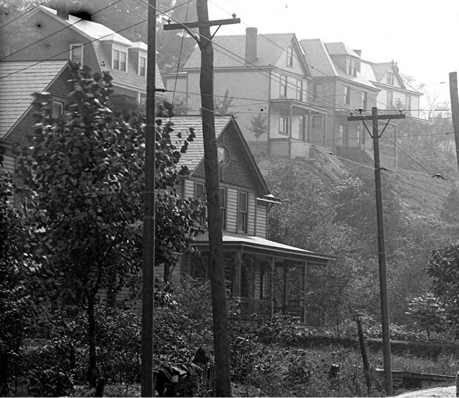
Homes along the Beechview side of West Liberty
Avenue, looking north towards Capital Avenue (left),
and the home of Jacob Beltzhoover, across the street at the bend leading to
Capital, in 1912.
 
Homes on the Beechview side of West Liberty,
heading north towards Capital (left), and south towards Saranac, in 1912.
 
Another home belonging to the Flanders family
(left), north of Pauline Avenue,
and the Knowlston residence, south of Pauline, in 1912.
A small contracting office north of Pauline (left),
and homes just north of the city line, near Dormont, in 1912.
 
Looking south towards homes near Cape May (left),
and looking north from Sauter Place towards Pioneer Avenue, in 1912.
<><><><> <><><><>
<><><><> <><><><>
<><><><> <><><><>
Back in the early 1900s,
seeing a photographer was a novelty. There was a lot of equipment involved in
the craft, and oftentimes residents would peer out the windows to see the
process unfold. Little did they know that 100 years later, we would be viewing
them with curiosity, wondering what life was like a century ago in
Brookline.
 
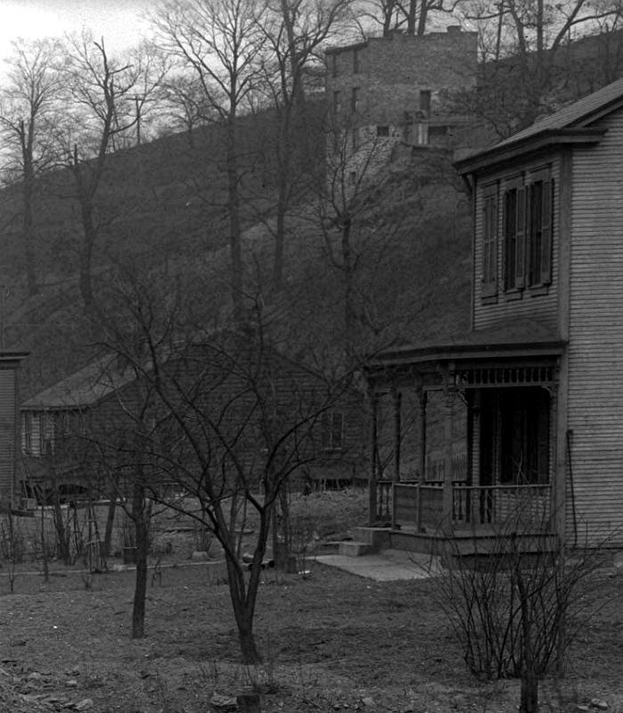
A home north of Pioneer Avenue, at the Sauter
Place intersection (left) and a curious onlooker in 1912.
This home stands where the present-day Matthews Bronze facility is located.
 
Homes along West Liberty Avenue near Cape May
(left), and a young boy in the window with a dog on the porch, in 1912.
A stately home at the corner of Pauline
Avenue (left) with a young boy peering through the window in 1912.
<><><><> <><><><>
<><><><> <><><><>
<><><><> <><><><>
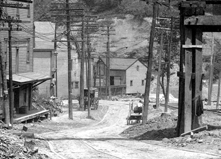
Many of these photos above were taken in
preparation for a construction project along West Liberty Avenue that would take
place in 1915. The roadway would be widened and paved, and the streetcar line
upgraded. The city of Pittsburgh was embarking on a major road building phase
and within ten years most of the roads in Brookline and the surrounding
communities would be paved in either brick or belgian block. The look of
the Brookline and Beechview communities would rapidly change from the rural
atmosphere pictured here to a more modern urban residential and commercial
district.
Beinhauer's Funeral Home and Livery Stables
(left), and the intersection of Wenzell and West Liberty Avenue, in 1913.
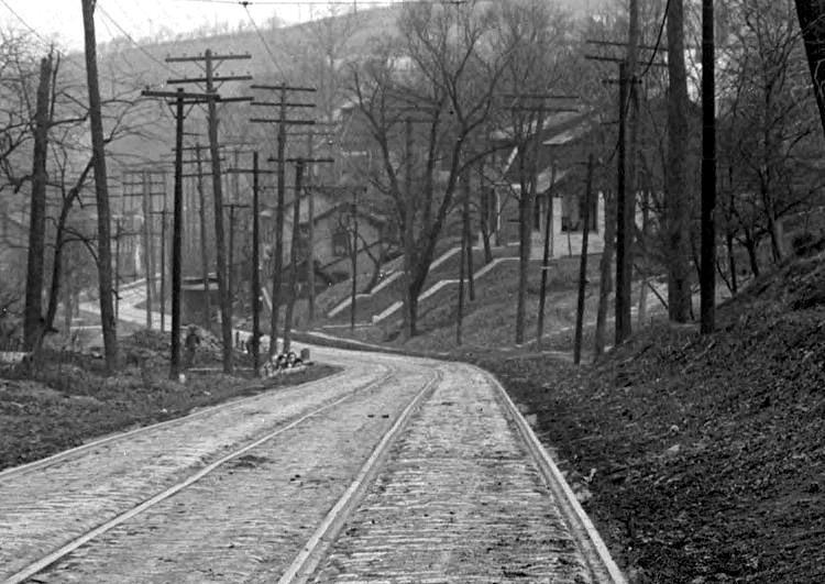
Other than the block roadway along the line of the streetcar
tracks, all local roads were dirt roadways at this time.
 
Mensinger's Stone Quarry was located along
the hillside near the junction of West Liberty Avenue and Warrington.
Shown in 1913, the quarry stood above Saw Mill Run Creek near where the Liberty
Tunnels would be cut in 1922.
<><><><> <><><><>
<><><><> <><><><>
<><><><> <><><><>
March 1915
Looking north from the city line near
Stapleton Street (left), and homes on the Beechview side.
West Liberty Elementary School, on Pioneer Avenue, is visible at the
top of the left photo.
 
Homes along the Brookline side near
Stapleton Avenue and the city line.
Looking north from the city line at Beechview
homes along West Liberty Avenue and Wenzell Avenue (left), and looking
south from the Brookline Junction. The building in the forefront is
Beinhauer's Funeral Home and family residence.
 
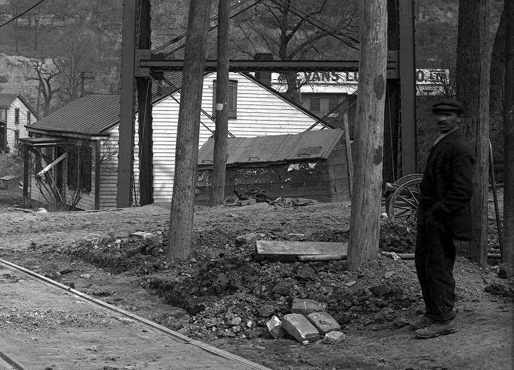
Looking north from the city line towards the
Brookline Junction (left) and surveyors working at the junction.
 
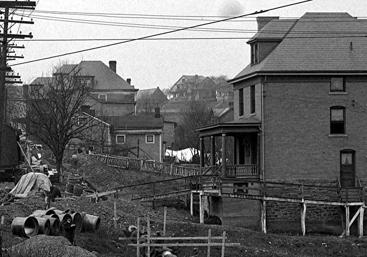
Looking south from the Brookline Junction
towards Dormont (left) and two boys sitting on a stack of wood, watching the
construction of the West Liberty Avenue sewer line. By 1915 the junction
had become a busy traffic intersection.
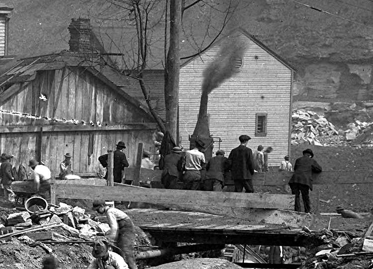
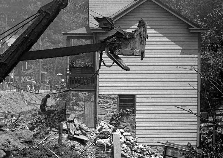
The Pittsburgh Coal Company power plant at
the Brookline Junction (left) and a trolley approaching Belle Isle Avenue. The
power plant was no longer in operation and would be demolished to make room
for the wide intersection at the junction.
A load of pipes sit at the intersection with
Saranac Avenue (left) and workers across from Belle Isle Avenue.
The men on the right are standing by the entrance to the present-day Wendy's
restaurant.
 
A billboard advertising new seven-room homes in
Robinson Place (left) and a home near Belle Isle Avenue.
Homes between Saranac Avenue and Pauline Avenue
(left) and a view of the roadway approaching Pauline.
 
A home at the intersection with Pauline Avenue
(left) and a view of the roadway approaching Ray Avenue.
 
Pedestrian traffic near Flander's General Store
(left), and a laundry (right), at the intersection with Ray Avenue.

Beechview homes north of Ray Avenue near the
bend leading to Capital Avenue.
 
Looking north towards the intersection with
Capital Avenue (left) and the Beltzhoover home at the bend leading to
Capital. The Beltzhoover residence was one of the many homes set
to be demolished during the reconstruction.
 
The Car Stop at the intersection with Capital
Avenue (left) and the walking board sidewalk across from Stetson Street.
Wagon and trolley traffic approaching
the intersection with Stetson Street. The streetcar is at the Stetson Car Stop.
 
Looking south at homes near Stetson Street (left)
and a view of the roadway looking south towards Capital Avenue.

Beechview homes along the hillside across
from Stetson Street.
 
A view from Stetson Street to Cape May Avenue
(left) and Bupp Contractor and Builder across from Cape May.
 
Two views towards Brookside, one from Cape May
northwards (left) and the other from Sauter Place southwards.
 
Homes above West Liberty Avenue at Brookside
(left) and a view from Brookside north towards Sauter Place.
Travelers passing Sauter Place (left) and
Pioneer Avenue (right) heading towards Warrington Avenue.
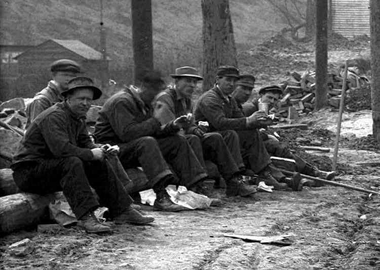 
Workers rest near Pioneer Avenue (left) and
a view south towards Pioneer from Warrington Avenue.
A man stands at the Pioneer Avenue intersection
(left) and a view from Pioneer to Warrington Avenue.
Wagons loaded with construction materials near
Warrington Avenue.
 
Two views of a home that stood at the intersection
of West Liberty Avenue and Warrington Avenue. This home stood
in the path of the proposed new sewer line and would have to be moved in the
upcoming months.
<><><><> <><><><>
<><><><> <><><><>
<><><><> <><><><>
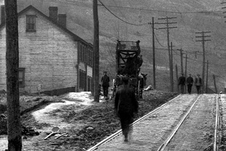
April 1915
 
Workers near the Brookline Junction. The photo on
the left shows the Knowlson Methodist Church, the oldest in Brookline.
 
Sewer line work near Belle Isle
Avenue.

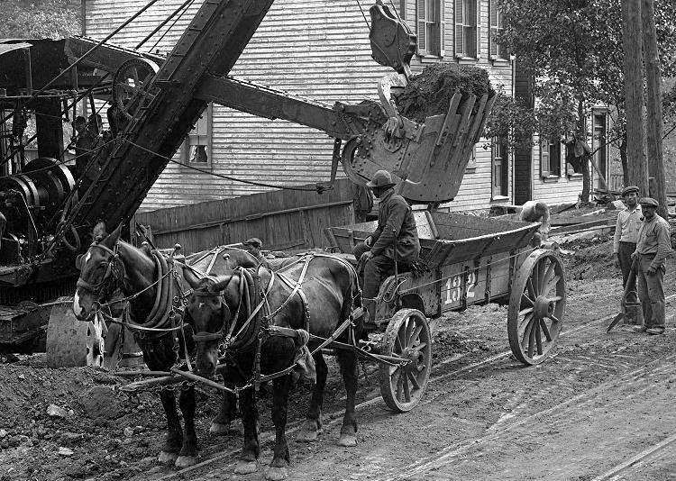
One of the big Marion Steam Shovels
of Booth and Flinn Construction working near Belle Isle Avenue.
 
Sewer work near Brookside Avenue. The billboard
advertises "Beautiful Homes" in Brookline, only eight minutes away.
 
Workers in a sewer trench near Brookside
Avenue (left) and a home between Brookside and Sauter Place.
A home nestled next to the Pioneer Avenue
hillside, north of Brookside Avenue near the Sauter Place plan.
The hillside home is along the lower end of Pioneer Avenue and is still
standing today.
 
A wagon stands alone across from Sauter Place
(left) and the sewer trench running under the porch of the Shaffner home.
The Shaffner home near Pioneer Avenue (left)
and the West Liberty Hotel at the intersection with Warrington Avenue.
 
Work on the new sewer line near the intersection
with Warrington Avenue. In the path of the line is the Warrington home
that needs to be moved out of the way to get to Saw Mill Run creek. The
home was put on bricks and moved to the right.
Work on the new sewer line near the intersection
with Warrington Avenue.
 
A view of the sewer line looking towards Pioneer
Avenue (left); The home that stood in the path of the sewer was moved.
<><><><> <><><><>
<><><><> <><><><>
<><><><> <><><><>
May 1915
 
The old Knowlson Methodist Church (left) and
the Oyer home near the Brookline Junction.
The new sewer line near Cape May (left)
and ongoing trench work near Sauter Place.
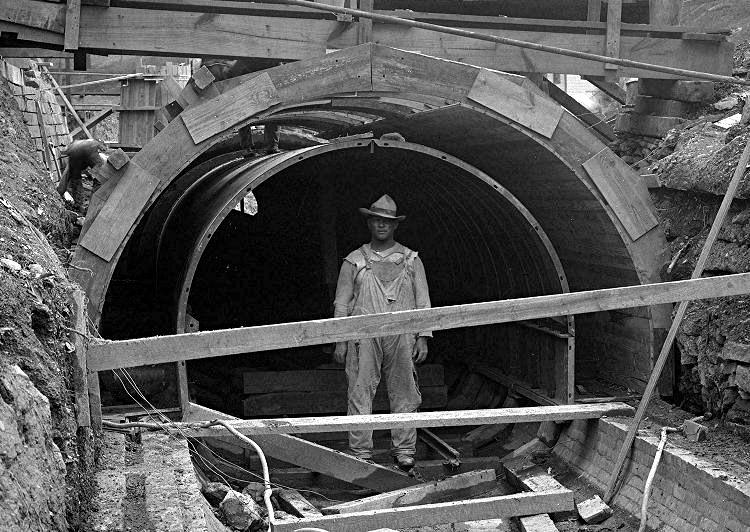
Trench work near Sauter Place (left) and
an engineer stands in the new sewer line north of Pioneer Avenue.
A home in the Sauter Place plan, just
under the Pioneer Avenue hillside.
 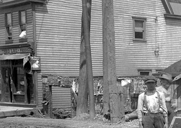
Engineers stand in the new sewer line (left)
and Theo Lau's produce store at Warrington Avenue.
 
The sewer line stretches from Pioneer Avenue
to Warrington (left) and the wagon works at the intersection.
A staging area next to the Shaffner home (left)
and the sewer line approaches Saw Mill Run Creek.
 
The Green and Evans Lumber Company at the
intersection with Warrington Avenue (left) and the end of the sewer line.
The hillside in the distance, once a quarry, will be the spot where the
Liberty Tunnels are cut.
<><><><> <><><><>
<><><><> <><><><>
<><><><> <><><><>
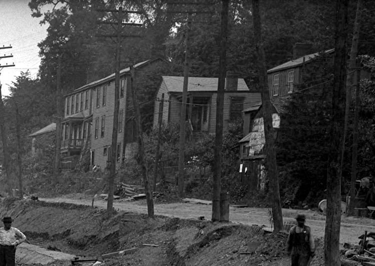
July 1915
 
Construction work at the Brookline
Junction.
 
A view from the Brookline Junction towards
Dormont (left) and Kerr's Practical Horseshoeing and Wagon Building.
Work on the sewer line near Pauline Avenue
(left) and north of Stetson Street.
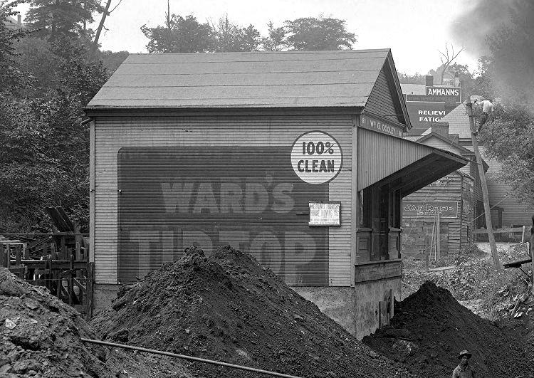 
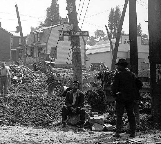
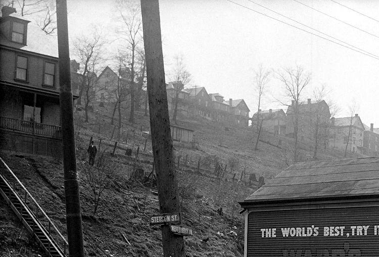
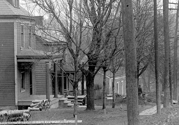
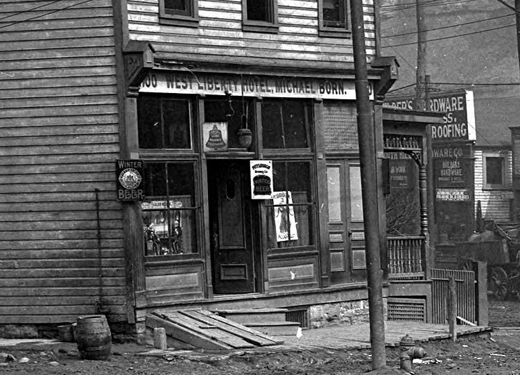
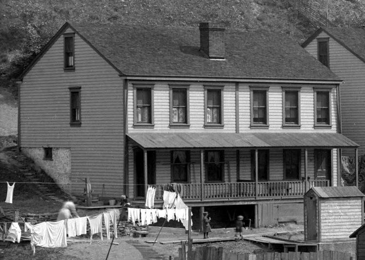
Dooley's Meat Market at Stetson Street (left)
and homes north of Stetson on the Beechview side.
 
Homes (left) and sewer line work (right)
between Stetson Street and Cape May Avenue.
A view from Pioneer Avenue towards the
intersection with Warrington Avenue.
 
A brick layer sits on a pile of bricks near
Cape May Avenue (left) and workers near Brookside Avenue.
 
Construction workers near Brookside Avenue
(left) and Sauter Place.
 
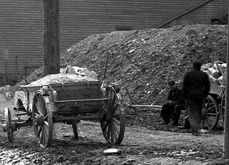
Wagons await a load of gravel near
Sauter Place.
 
The railroad tressel (left) and
the Shaffner home (right) at Pioneer Avenue.
 
A special trolley car towing construction
materials and a Kaufmann's Delivery wagon (left) and
Elijah Lee's Horseshoeing and Wagon Building near the intersection with
Warrington Avenue.
A man sits near an outhouse (left) and a boy
stands at the end of the sewer line, near Warrington Avenue.
<><><><> <><><><>
<><><><> <><><><>
<><><><> <><><><>
August 1915
 
A view from the city line towards the
Brookline Junction, showing West Liberty Avenue homes.
 
A view from the Brookline Junction towards Dormont
(left) and a South Hills Ice Company wagon being repaired at Kerr's.
 
It's a busy construction and traffic
day from Belle Isle Avenue through to Pauline Avenue.
 
Workers toil on the streetcar tracks (left) and
the home at the intersection with Pauline Avenue.
 
Roadwork from Pauline Avenue north towards
Capital Avenue (left) and a laundry located at Ray Avenue.
Work on a gas line near Capital Avenue (left)
and traffic passing Stetson Street.
A view looking north from Stetson towards Cape
May (left) and the reverse angle, from Cape May south towards Stetson.
 
A view looking north from Brookside Avenue to
Sauter Place (left) and a home at the intersection with Sauter Place.
 
Trench work continues south of Pioneer Avenue
(left) and a view of the Pioneer Avenue intersection, looking north.
 
Two views of the Pioneer Avenue intersection,
looking north towards Warrington (left) and south from Warrington.
<><><><> <><><><>
<><><><> <><><><>
<><><><> <><><><>

A view looking south towards the Brookside
Avenue intersection in April, 1915.

From Sauter Place looking north towards Pioneer
Avenue, which can be seen heading up the hill from left to right, in 1912.
Also visible are the West Side Belt Railway line and a home on Richter Street,
on the other side of the tracks. In
the early days, Pioneer Avenue did not turn left towards West Liberty, but
ran straight over the tracks and
on to Saw Mill Run. When the railroad was upgraded, the
roadway was diverted to West Liberty Avenue.
|